A nice & cooler fall day for Friday
SUMMARY: Friday & the weekend will be looking pretty good for the most part. Our quiet, early fall weather pattern will continue for at least the next week. The only chance for some rain will come in the form of some isolated showers Sunday with a weak front crossing the area.
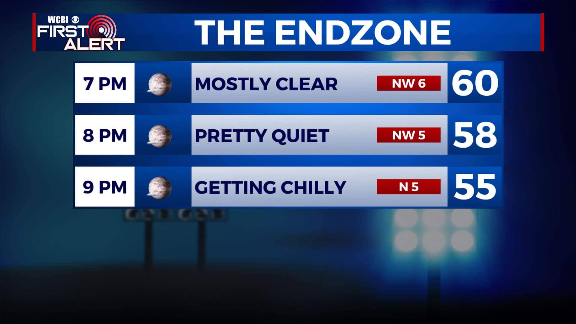
FRIDAY: We’re waking up this Friday morning to clear skies & temperatures in the 40s. It will be mostly sunny and seasonably cool this afternoon. Highs in the upper 60s to near 70. Winds NW 5-10 mph. High school football weather will be picture perfect with clear skies tonight, but you’ll need to pack a jacket. Temperatures will be quickly falling from the 60s into the 50s after sunset.
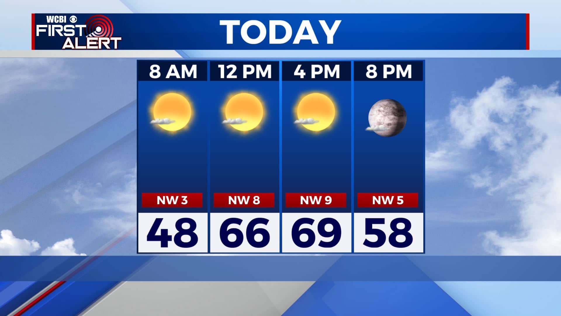
FRIDAY NIGHT: Clear skies, quiet, and remaining a but chilly. Overnight lows in the mid to low 40s.
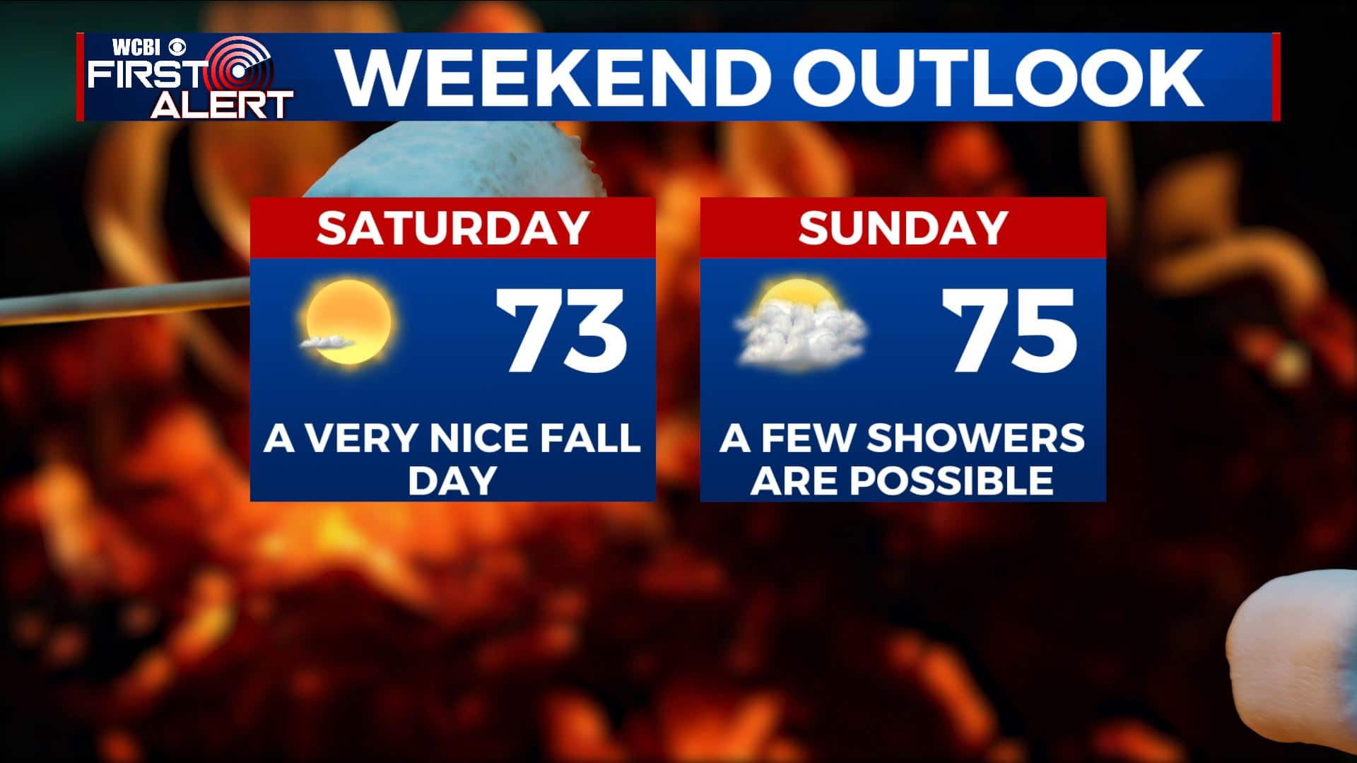
SATURDAY: Staying mostly sunny and pleasant. Highs back up in the lower 70s. No issues are expected for the college football games in Starkville and Tuscaloosa.
SATURDAY NIGHT: Partly cloudy. Overnight lows near 50 degrees.
SUNDAY: A mix of sun & clouds. A few showers are possible. Highs in the mid 70s.
NEXT WEEK: Mostly sunny skies to start off the new workweek. Plan on mild days with highs in the 70s and low 80s. Cool nights with overnight lows in the 50s continue.
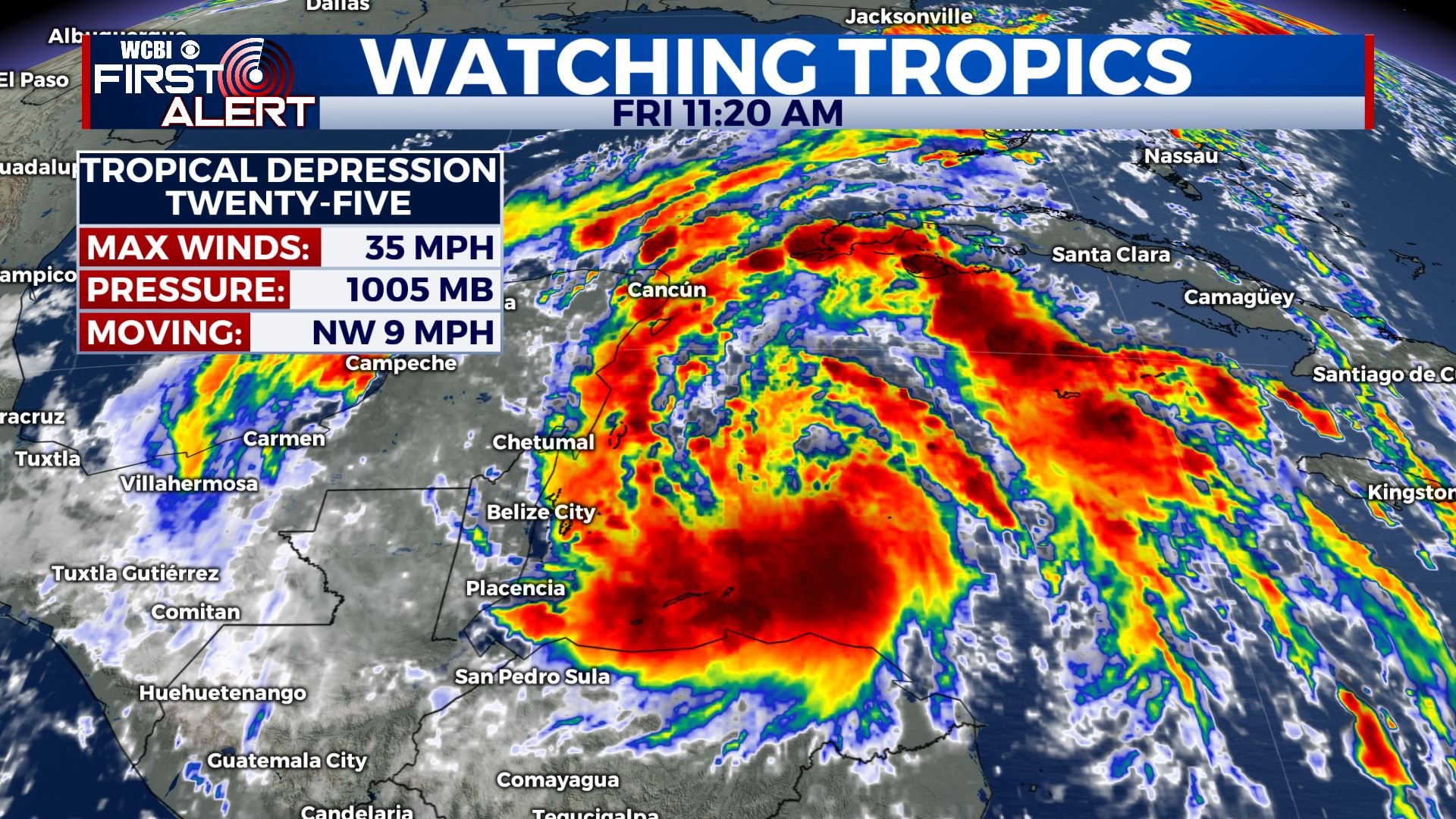
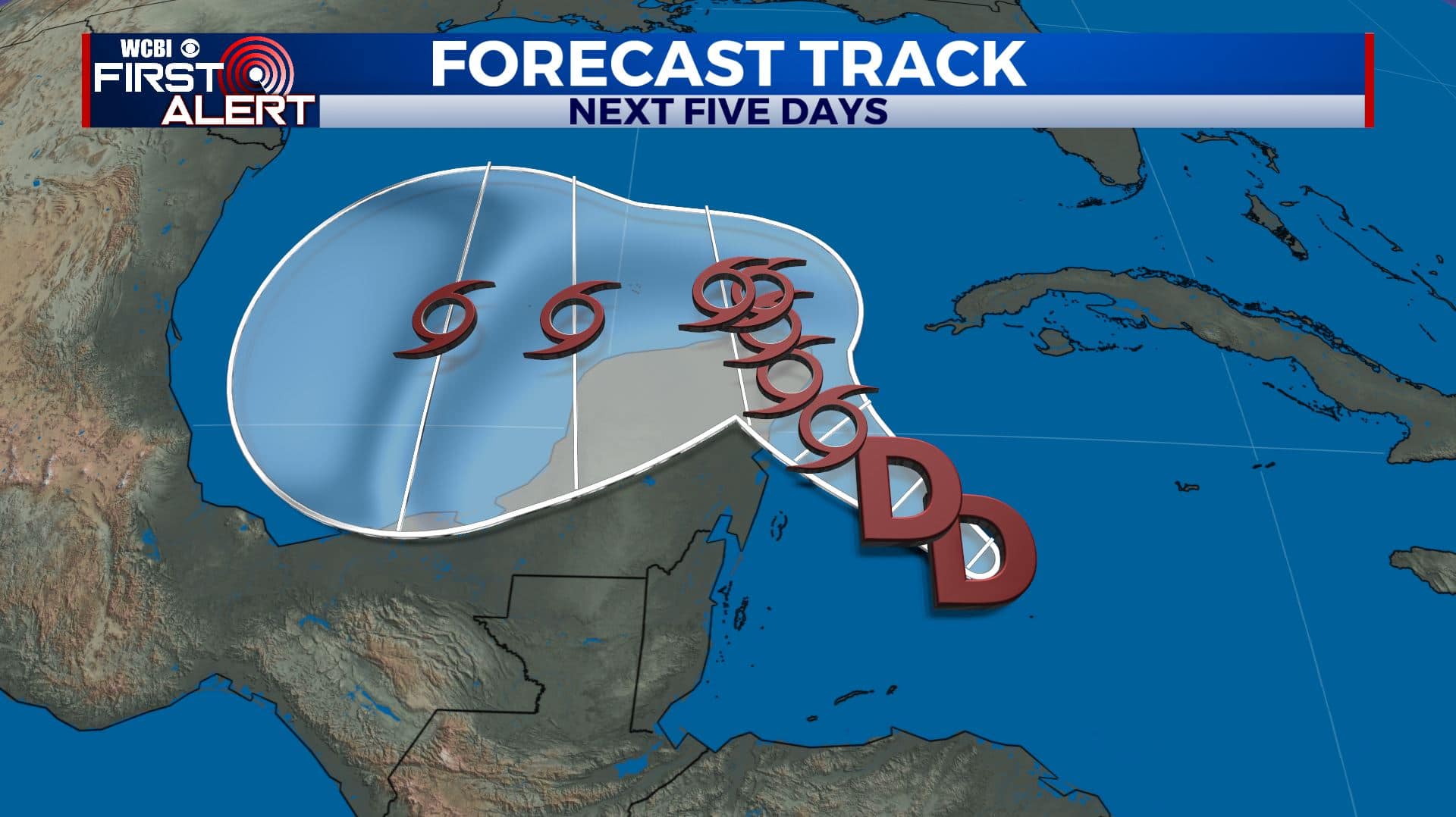
TROPICS: Tropical Update: Tropical Depression #25 Forms Over the northwest Caribbean. Most likely will become #Gamma and affect the Yucatan Peninsula. No immediate threat for the U.S. as of right now.
Stay connected with @WCBIWEATHER on Facebook, Twitter, Instagram, and the WCBI News App


Leave a Reply