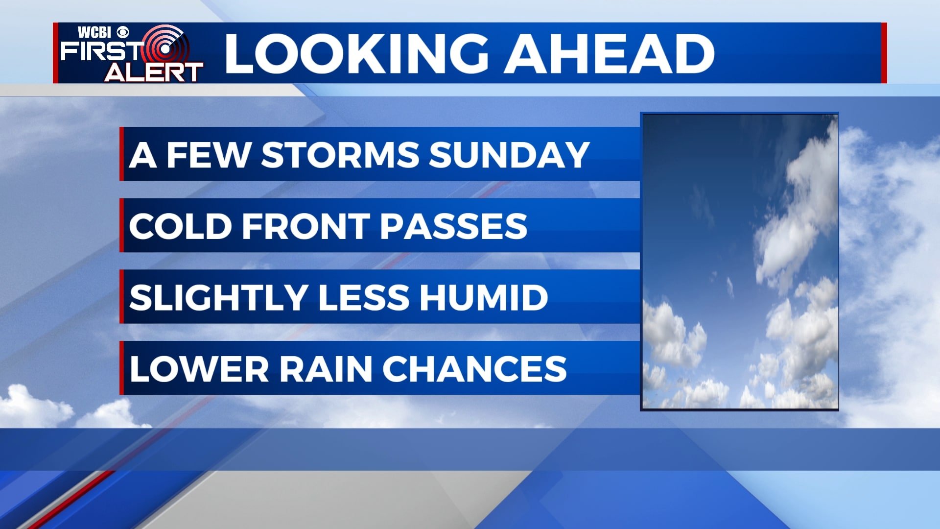
A few storms Sunday, drier next week
A few showers and storms will be possible through the day on Sunday as a cold front passes, but it won’t be an all-day washout. Rain chances diminish through the week as drier air filters in. However, more pop-up storms will be possible by the end of the week and next weekend.
SATURDAY NIGHT: Mostly clear and just a touch cooler. Temperatures will fall to the upper 60s with a light northwesterly wind.
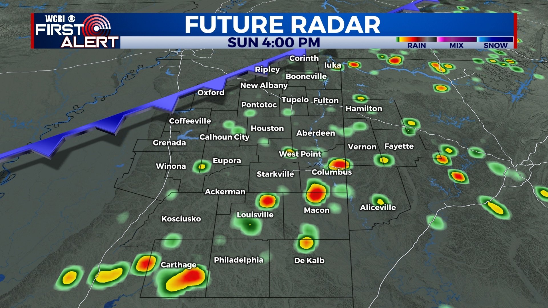
SUNDAY: A few isolated showers are possible early Sunday morning between 5am and 9am, but more pop-up storms will be possible through the afternoon. There will still be some sunshine through the day, but keep the umbrella nearby just in case. Temperatures will remain hot and humid with highs in the low 90s.
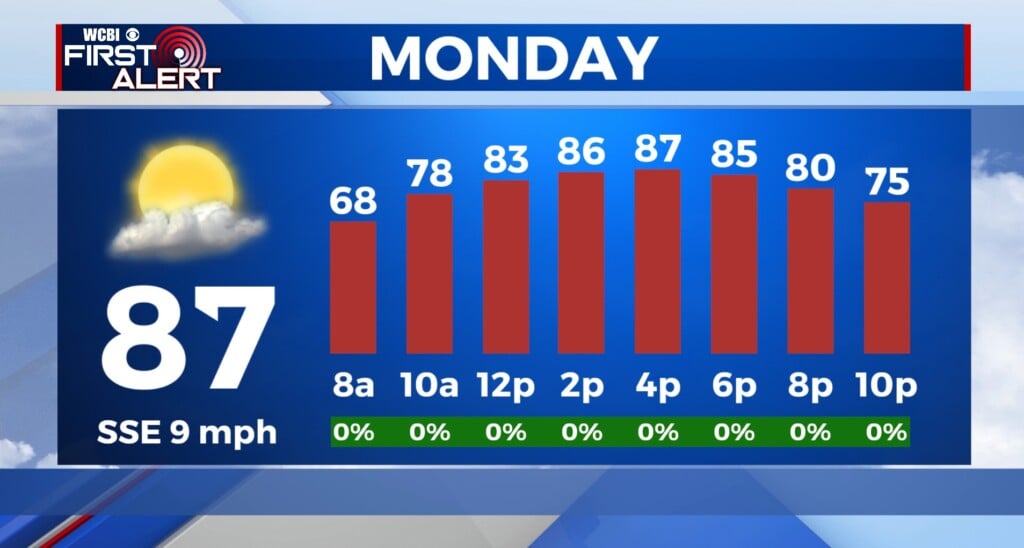
MONDAY-WEDNESDAY: Drier weather will return to the area for the first half of next week under mostly sunny to partly cloudy skies. A very brief shower is still possible, but most of us won’t see rain. Highs will be in the low 90s with lower humidity helping to knock the heat index down just a bit. Morning lows will also be just a little cooler as temperatures bottom out in the mid to upper 60s.
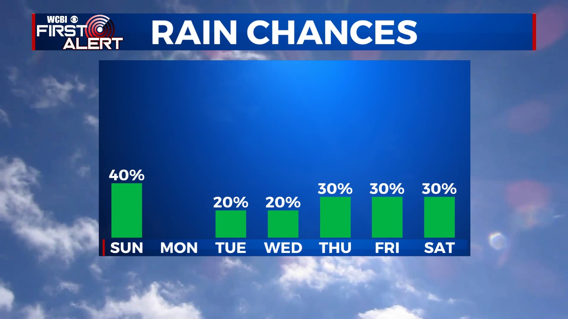
THURSDAY-SATURDAY: Chances for pop-up storms make a comeback for the second half of the week and the weekend with daily chances for a few downpours each afternoon. We’re not expecting widespread rain and any shower will be brief, but just keep it in mind. Heat and humidity will also return with highs back in the low and mid 90s and heat index values closer to 100. Morning lows will be in the upper 60s.


Leave a Reply