A few more systems on the way
SUMMARY: A few more weather makers are on the way over the next week but they won’t bring us too many issues. Our area looks to remain in a zone between winter weather and severe weather. Seasonably cool air will continue into early next week.
MONDAY NIGHT: Clouds & stars. Lows in the upper 20s. Northerly winds 2-7 mph.
TUESDAY: A mix of clouds & sun. Dry during the daylight hours with rain developing during the evening. Highs in the low 50s. Easterly winds 4-10 mph.
TUESDAY NIGHT: Areas of rain. Lows around 40.
WEDNESDAY: Morning rain then turning mostly cloudy. Highs in the 40s. Northwesterly winds around 10 mph. Total rainfall in the 1/4″ to 1/2″ range.
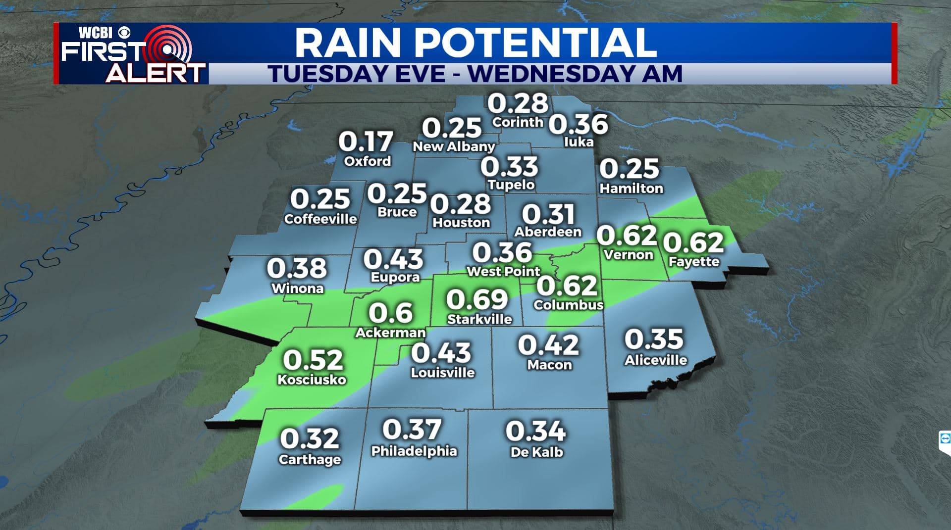
Rain potential
WEDNESDAY NIGHT: Partly to mostly cloudy. Lows in the upper 20s.
THURSDAY: Turning mostly sunny. Highs in the upper 40s.
THURSDAY NIGHT: Clear and cold. Lows in the mid 20s.
FRIDAY: Mostly sunny. Highs in the 50s.
WEEKEND: Mostly cloudy with rain developing Saturday afternoon and evening. Highs in the 50s. Mostly cloudy skies continue Sunday along with highs in the 50s.
Follow @WCBIWEATHER on Facebook, Twitter, Instagram, and the WCBI News App


Leave a Reply