A cloudy end to the week
COLUMBUS, Mississippi (WCBI) – What a difference Thursday’s forecast has been to the past several months. Heavy cloud coverage, scattered showers, and “fall-like” temperatures that peaked in the middle 70s. Temperatures look to heat back up, as the rain chance increases for the weekend.
THURSDAY NIGHT: Humidity staying a little bit lower tonight. Slightly drier air will have conditions tonight feeling “cool” and calm. Overnight low temperatures will be back in the middle 60s. Cloud coverage will be going from mostly cloudy to mostly clear by early Friday morning.
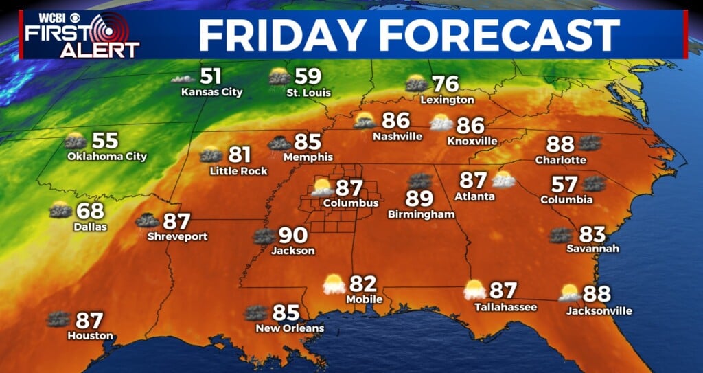
FRIDAY: End of the week! High temperatures are expected to make way back into the middle 80s. Most of the morning, sky conditions will be mainly clear. By the afternoon, we will be returning to a partly cloudy sky. The rain chance is light, around 20%, during the afternoon. Not looking too bad for high school football games! Low temperatures will maintain in the middle 60s.

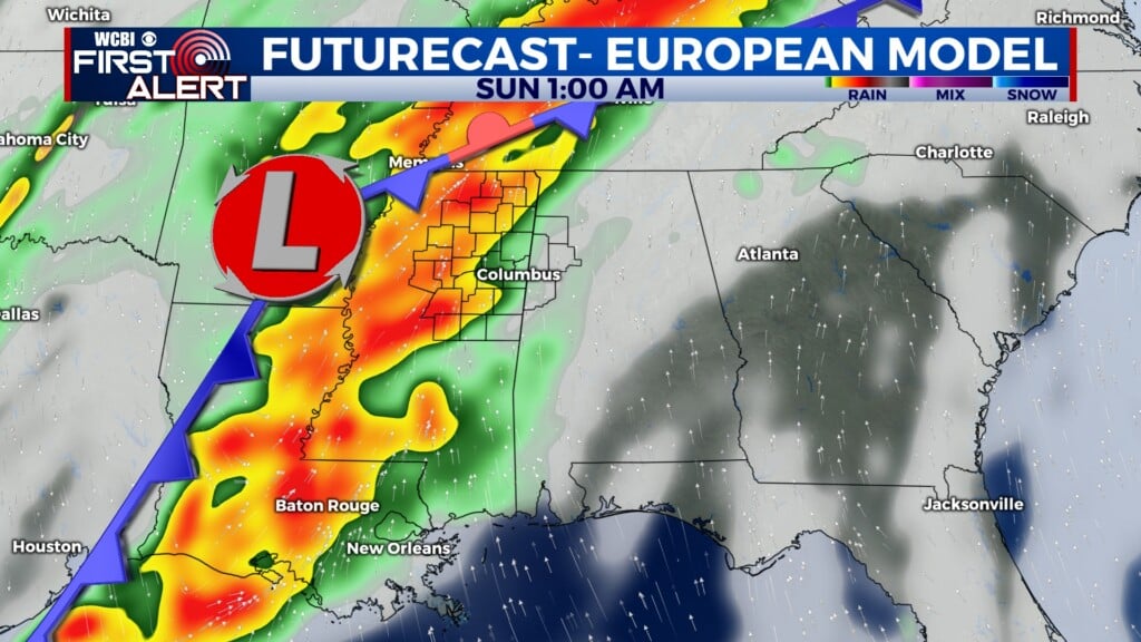
SATURDAY: Slightly warmer for the beginning of the weekend. High temperatures will be in the middle to upper 80s. Cloud coverage does make a return, but staying scattered enough to build that heat in during the afternoon. Rain chance increases for Saturday afternoon through evening. It is going to be scattered with a chance of a few quick downpours. MSU (or visiting LSU fans) be prepared with rain gear, or at least a poncho for that 11AM kickoff. Ole Miss (and Georgia Tech fans) look to be mostly in the clear by their 6:30PM kickoff.