More Storms Possible Through Midweek
SUNDAY: Additional showers and storms are likely out ahead of a cold front that’ll be pushing through the area. Highs should be in the low 80s. The chance of rain is 60%. Showers and storms will end by the evening from north to south.
MONDAY: A few lingering showers are possible south of US 82 but we’re taking the rain chance down to 10%. Expect highs in the upper 70s and low 80s with partly cloudy skies. Showers and storms will pick up late Monday Night into Tuesday.
TUESDAY: Showers and thunderstorms are again possible across the twin states as our next storm system moves through. Look for highs near 80 with partly cloudy skies.
WEDNESDAY: Much cooler and air may return and it could support a few more scattered showers and thunderstorms. Temperatures will only make it into the low 70s.
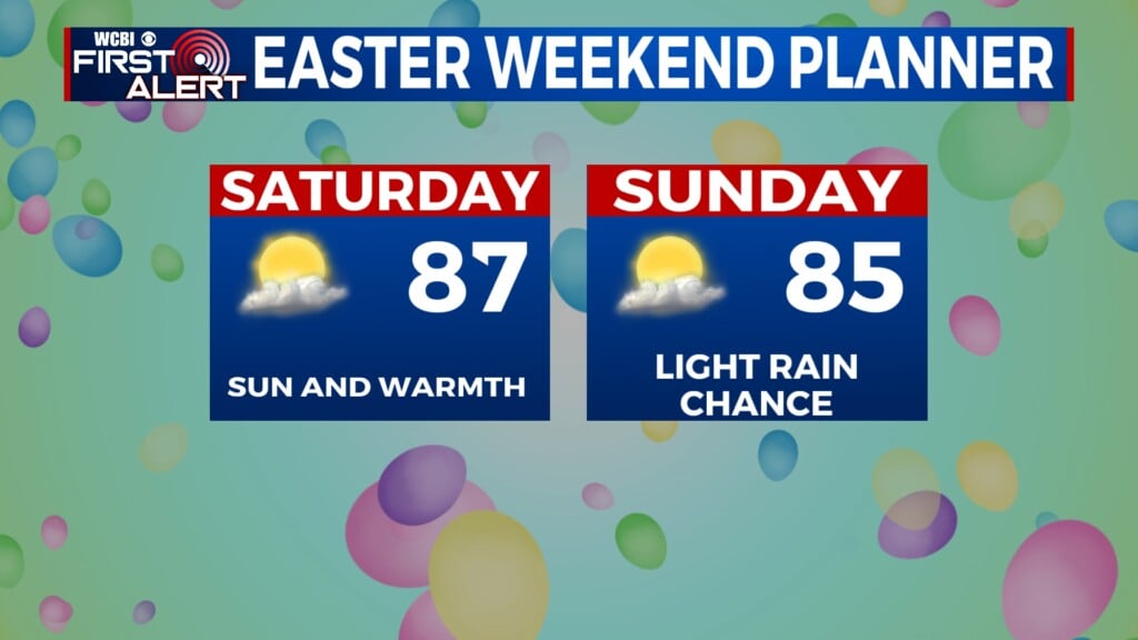
THURSDAY – SATURDAY: We’re looking to keep plenty of sunshine with temperatures rising into the mid to upper 80s by the weekend. Thankfully moisture doesn’t look like it will return, so it will be a comfortable few days. Lows will stay in the 50s.
FOLLOW @WCBIWEATHER ON FACEBOOK, INSTAGRAM AND TWITTER.


Leave a Reply