Severe weather Saturday, plummeting temps and snow Sunday
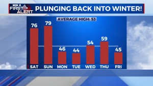
SUMMARY: a VERY busy forecast for us here in northern MS to kick off 2022. We’ll see very warm temps continuing into Saturday, with a major severe weather risk during the afternoon and evening hours Saturday. A powerful arctic cold front then moves through during the overnight hours into Sunday, with a period of snow and plunging temps Sunday afternoon! Temps will stay cold for Monday and Tuesday with very cold nights. We moderate a bit mid-week, but this is short lived as another powerful arctic front will move through on Friday bringing much colder temps.
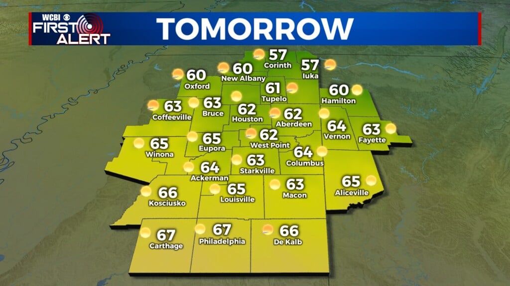
FRIDAY: Extremely warm once again Friday afternoon, record highs are possible across the area. Expect a mostly cloudy day with a few showers, and breezy winds out of the south. Highs in the mid-upper 70s.
FRIDAY NIGHT: A fairly calm New Year’s night in store, with cloudy skies, a few showers, and very mild temps. Looking good at midnight with temperatures in the upper 60s under cloudy skies. Lows only drop to the mid to upper 60s.
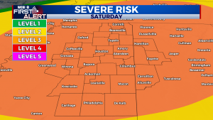
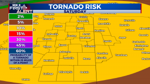
NEW YEAR’S DAY SEVERE THREAT: A substantial January severe weather outbreak is in store for Saturday. The entire viewing area is under a level 3/5 severe risk, and further upgrades are possible. There will be a ton of spin in the atmosphere, so the tornado risk is fairly high. If storms can remain fairly isolated Saturday afternoon and evening then the tornado threat will be higher. If the storms move through as a well-defined squall line, the tornado threat will be a bit lower, but the damaging wind threat will be very high. If we see sunshine during the day that will really help to ramp up the severe weather threat, we’ll also have to watch any individual storms out ahead of the main line for tornadoes. I would seriously consider altering any afternoon and evening plans on New Year’s Day, or at least have a backup plan for what to do should a tornado warning be issued. Have multiple ways to get warnings on Saturday! Storms will begin in the early afternoon, with the highest threat from around 6 to 10 pm. It will be extremely warm, in the upper 70s and low 80s.
SATURDAY NIGHT: Severe storms will continue into the evening hours, but should be out of our hair by Midnight. Temperatures will begin dropping after the cold front moves through, and we’ll wake up to temperatures in the mid 40s.
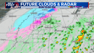
SUNDAY SNOW?!: It seems hard to believe after one of the warmest Decembers on record, but yes, snow is a very real possibility on Sunday. Temperatures will fall throughout the day into the 30s by the afternoon. An area of low pressure will slide by to the southeast, throwing moisture back into the cold air. Rain will transition to snow for almost all of us, from NW to SE. Northern and western areas have the best chance of seeing some flakes at this time. Because the ground will be so warm, accumulation is not expected. However, if snow can fall heavily enough I wouldn’t complete rule out a light dusting in grassy areas and on elevated surfaces. Either way, it will be very COLD! Winds will be gusty from the NW, so it will feel like the 20s by the afternoon. Quite a shock after nearly 80 the day before!
NEXT WORK WEEK: A much, much colder week in store. After a hard freeze in the low to mid 20s Sunday night, highs won’t make it out of the 30s in places on Monday, with low 40s for most of us. The good news is that the sunshine will be out in force on Monday. Another hard freeze for Monday night, with some moderation for Tuesday into the 50s. Sunshine will continue. By Wednesday, the next front will be approaching the area. At this time, it’s looking like there won’t be enough warm air and moisture to bring a severe threat, with only a few showers possible on Wednesday. The front brings dropping temperatures for Thursday, with a high in the 40s and some rain. Thursday night will be VERY cold, with lows around 20- some spots may get into the teens!
Stay weather aware this weekend, and we’ll be sure to have you covered for Saturday’s severe threat on WCBI!
CONNECT WITH @WCBIWEATHER ON TWITTER, FACEBOOK, AND INSTAGRAM
