Very wet pattern returns by the weekend
SUMMARY: Isolated to scattered storms remain in the forecast through Friday. Hot and humid weather will be the main story until the weekend, with feels like temps near or just over 100 degrees. By the weekend, a stalled frontal boundary and several disturbances riding along it will provide the focus for yet another period of very wet weather. Flash flooding could become a concern as we start next week. With lots of cloud cover and rain, highs will be held down into the low to mid 80s Sunday to Wednesday.
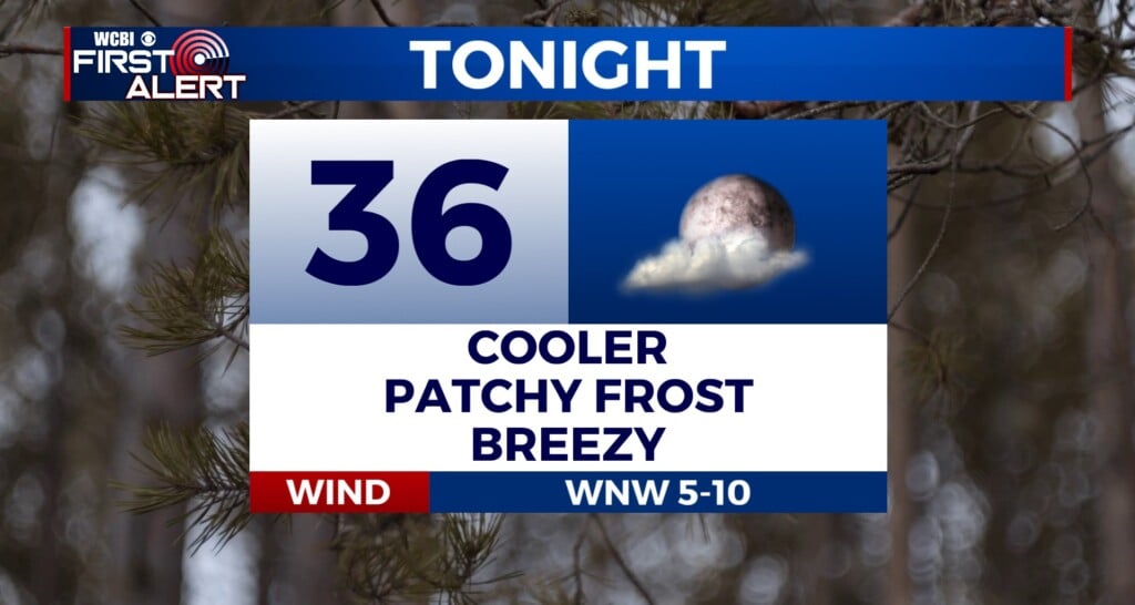
TONIGHT: Any isolated storms will quickly end this evening with the loss of daytime heating. Lows near the 70 degree mark under partly cloudy skies, winds will be calm.
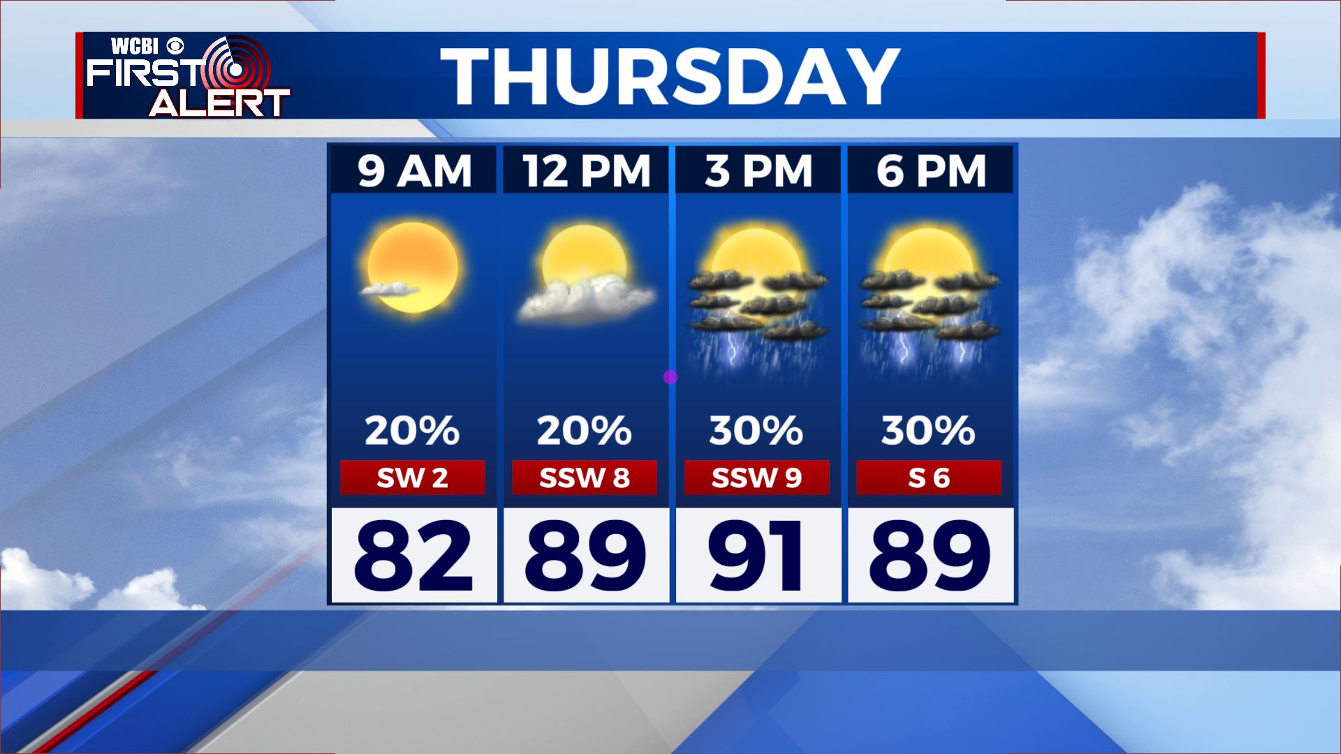
THURSDAY: Isolated to scattered coverage of storms is possible again Thursday afternoon, most of the area will stay dry. Partly cloudy, hot and humid with temps in the low 90s and feels like temps near 100.
THURSDAY NIGHT: Any showers and storms will quickly dissipate after sunset. Mostly clear skies expected with lows in the low 70s and calm winds.
FRIDAY: Rain chances just a hair higher on Friday, with maybe a few more of us getting in on some scattered afternoon storms. Again, the majority stays dry under partly cloudy skies. Highs remain in the low 90s.
SATURDAY TO WEDNESDAY: As a frontal boundary begins to affect the area, rain chances markedly increase for Saturday, with scattered to numerous afternoon showers and storms. Highs will be right around 90 degrees. Sunday looks even wetter, with mostly cloudy skies and several rounds of showers and storms possible through the day. Highs in the mid to upper 80s. Monday looks like it could be a washout, with clouds most of the day and several periods of rain and storms. Highs stay in the low to mid 80s. Tuesday looks very similar, with widespread rain and storms and highs in the low to mid 80s. With days of repeated heavy rainfall, flash flooding is not out of the question across the area as we start next week. Wednesday is looking quite wet as well, with highs staying in the mid 80s. Lows will be near 70 degrees through the entirity of the forecast period.
CONNECT WITH @WCBIWEATHER ON TWITTER, FACEBOOK AND INSTAGRAM


Leave a Reply