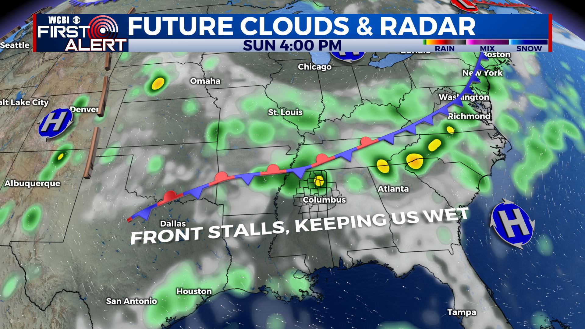
Drier work week, unsettled weather returns by the weekend
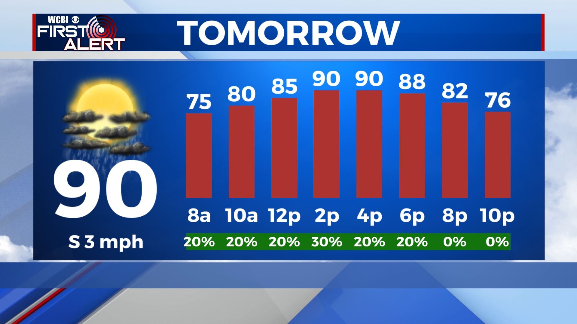
SUMMARY: Shower and storms chances remain isolated through Friday. Highs will top out in the low 90s each day, with lows in the 70s. Many of us will remain dry under partly cloudy skies for much of the day, with only a few of us getting an afternoon or evening storm. By the time we get to Saturday, a cold front will approach the southeast and then stall out to the north of our viewing area, setting the stage for very wet weather beginning Sunday and continuing into the next work week.
TONIGHT: Showers and storms exit stage right as the sun sets, leaving us with partly cloudy skies and a low near 70 degrees. If winds can calm enough and skies clear out, fog could be possible in the morning.
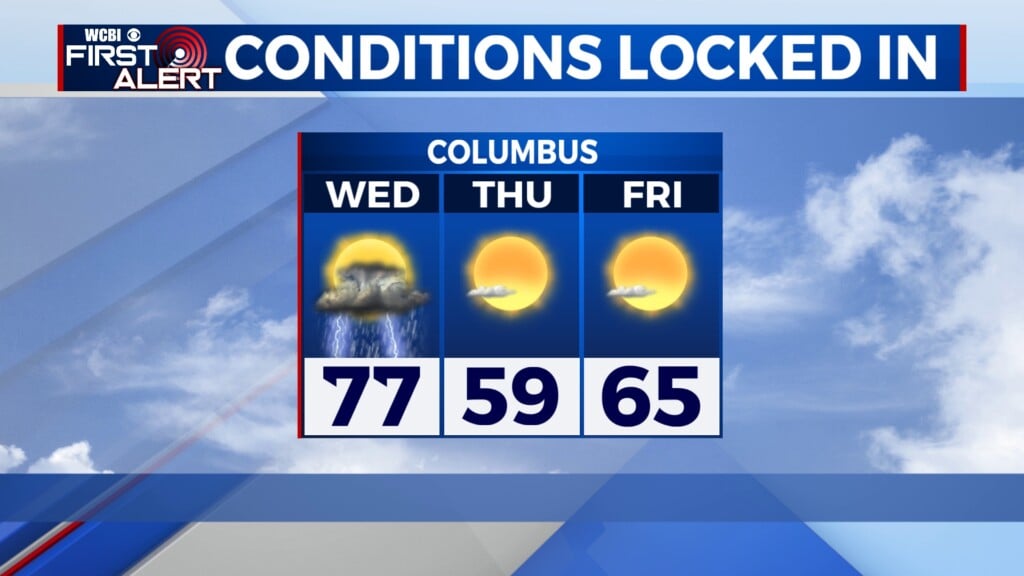
WEDNESDAY: A hot and humid day in store for Wednesday, with partly cloudy skies and highs in the low 90s. Isolated storms will pop up into the afternoon, but coverage should be limited and most of us stay dry.
WEDNESDAY NIGHT: any lingering storms will quickly dissipate into the overnight hours. Partly cloudy skies prevail with lows in the low 70s.
THURSDAY: Thursday looks very similar to Wednesday, with very isolated coverage of afternoon showers and storms. Most of us stay partly cloudy with highs in the low 90s.
FRIDAY TO TUESDAY: Storm chances remain isolated to widely scattered for Friday, but by Saturday storm chances begin to ramp up and more of us will see some rain. Highs in the low 90s Friday, and around 90 Saturday. A cold front will stall out to the north of or right over the viewing area beginning Sunday, with widespread showers and storms throughout the day. Cloud cover drops our highs into the mid 80s on Sunday, and they stay there through Tuesday. Monday and Tuesday look quite wet with several rounds of showers and storms moving through. Lows will be right around the 70 degree mark.
CONNECT WITH @WCBIWEATHER ON TWITTER, FACEBOOK AND INSTAGRAM


Leave a Reply