Great baseball weather through Saturday, storms return by Sunday
SUMMARY: A calm and quiet night across the area, lows in the mid 60s. Friday looks to stay dry, with partly cloudy skies. A slight chance of afternoon storms on Saturday, but most of us will stay dry. Rain and storms return by Sunday, with widespread coverage for Sunday, Monday, and Tuesday. Cloud cover and rain drops highs into the low 80s. Rain and storm chances continue Wednesday and Thursday. Lows remaining in the mid to upper 60s.
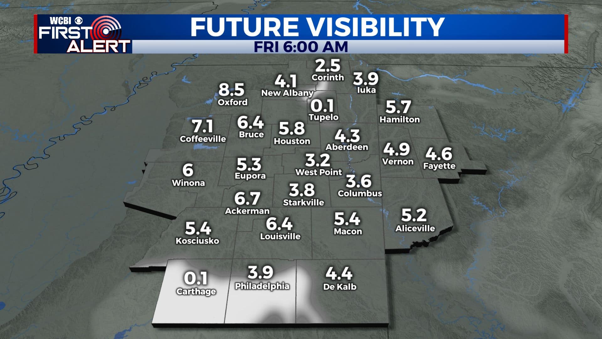
TONIGHT: A calm and quiet night in store for us. With calm winds and high humidity from recent rains, fog is again possible late tonight and into tomorrow morning. Lows in the mid 60s area wide.
TOMORROW: Expect partly cloudy skies and for your Friday. Weather is looking good for the start of the baseball regional in Starkville, if you don’t mind a little heat! We should stay completely dry across the area Friday afternoon. Highs in the mid to upper 80s.
FRIDAY NIGHT: Another calm and seasonable night in store, with partly cloudy to mostly clear skies. Lows will be in the mid 60s.
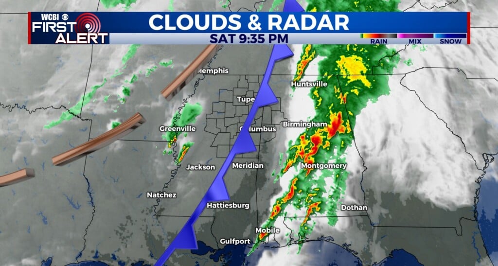
SATURDAY: Weather still looking OK for the baseball regional, but it’ll be a bit hotter. Highs will top out in the upper 80s to near 90, and there will be a chance of an isolated afternoon shower or storm, especially across southern areas.
SUNDAY TO THURSDAY: Rain chances quickly ramp back up for Sunday, with widespread afternoon showers and thunderstorms. Highs in the mid 80s. Rain chances increase even more for Monday, with almost everyone likely getting in on some rain Monday afternoon. The rain and storms will keep our highs down in the low 80s. Unsettled weather continues throughout the week, with daily chances of scattered to widespread afternoon thunderstorms. Rain chances could decrease a bit by late week. Highs staying seasonable in the mid 80s with lows in the mid to upper 60s.
CONNECT WITH @WCBIWEATHER ON TWITTER, FACEBOOK AND INSTAGRAM


Leave a Reply