Some storms through Friday, nice holiday weekend
SUMMARY: Showers will quickly dissipate as the sun sets tonight. Patchy fog possible tomorrow morning, especially in areas that saw rain today. Hot and mainly dry Thursday, with storms returning to the forecast for Friday. The holiday weekend is looking great.
TONIGHT: Clearing skies into the overnight hours, with a low around 66. Some patchy fog is possible late tonight into tomorrow morning, especially in places that saw rain.
THURSDAY: Warm and drier than Wednesday, only a slight chance of an isolated afternoon shower or t-storm. Hot and partly cloudy, highs near 90.
THURSDAY NIGHT: Clouds moving in later in the night as a frontal boundary approaches the region. Should remain dry, with a low in the upper 60s to around 70.
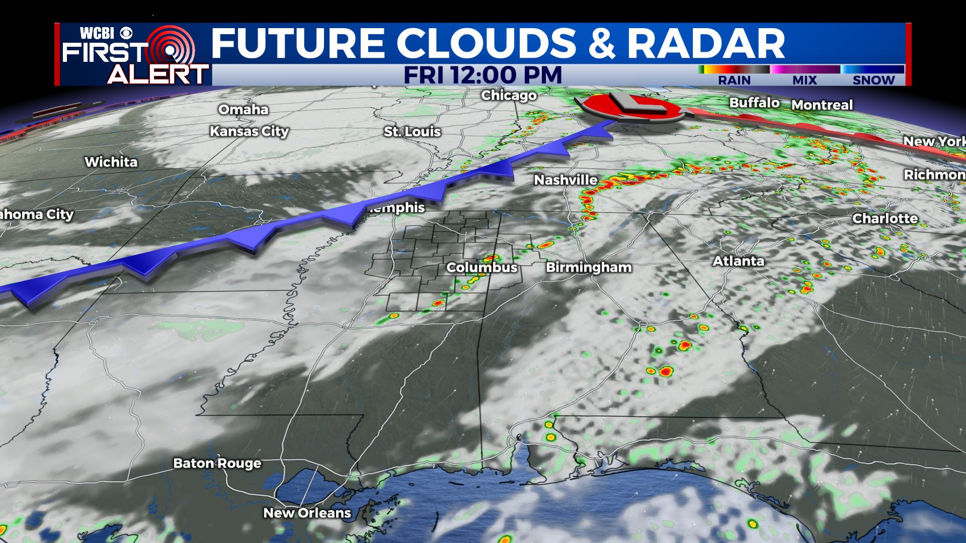
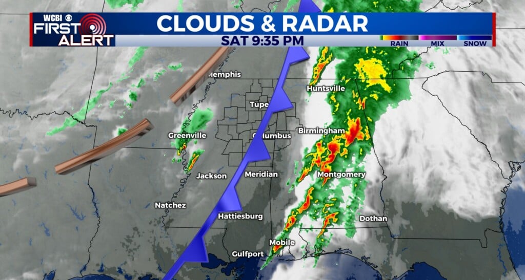
FRIDAY: As a front moves through, we will see showers and storms across the area. They are looking to be more scattered in nature at this time but a few could be on the strong side. Cooler, with a high near 86.
FRIDAY NIGHT: The front will usher in cooler and drier air for Friday night. Lows right around 60.
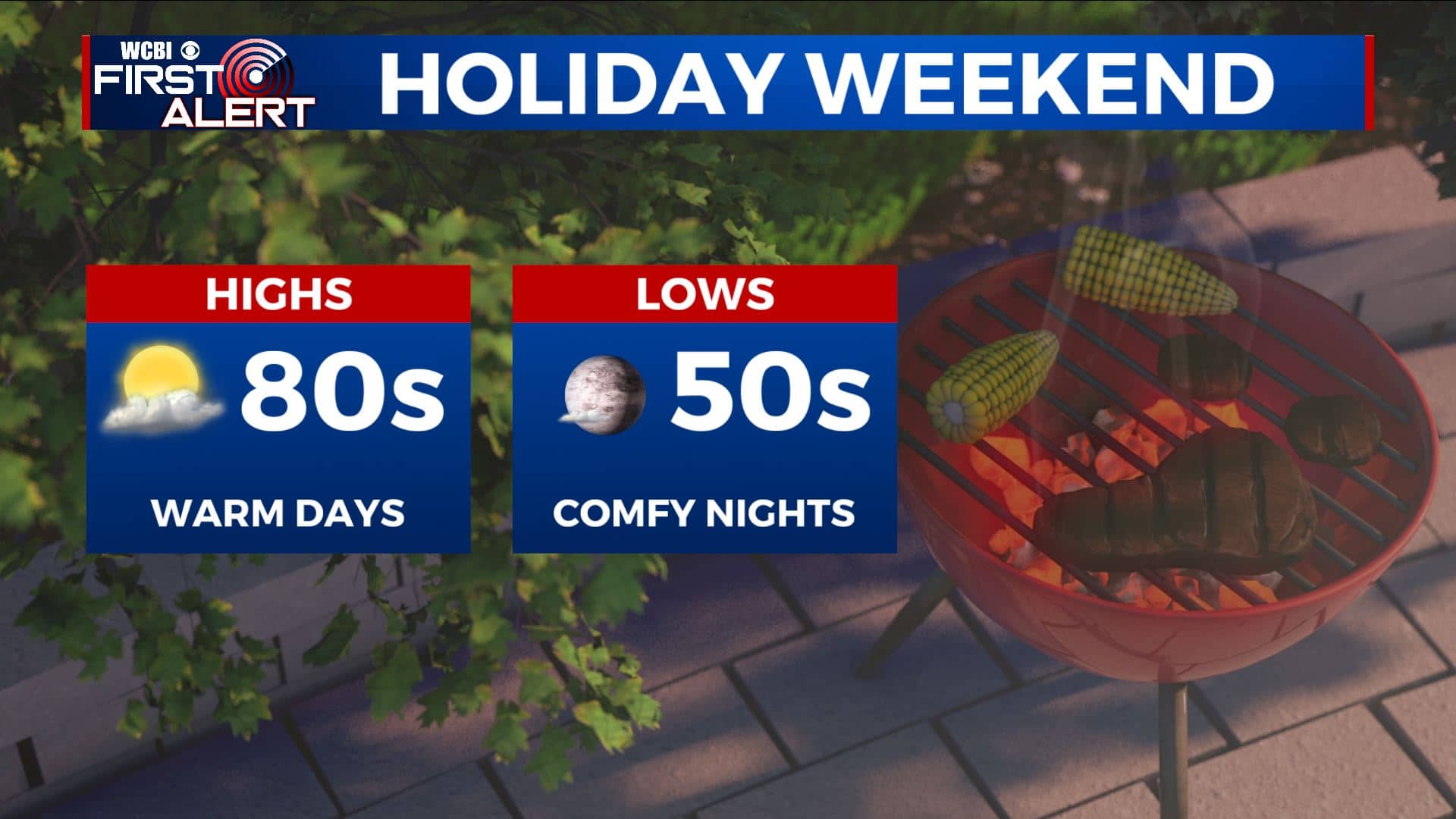
HOLIDAY WEEKEND: Memorial day weekend is looking fantastic. Unseasonably cool for this time of year, with dry air, mostly sunny skies, and highs in the low to mid 80s. Nights will be very comfortable, with lows in the mid 50s. A nice treat in late May!


Leave a Reply