Early summer heat wave coming soon
SUMMARY: Clouds and a few showers will linger into Wednesday. By Thursday and beyond our region will start to dry out and really warm up. Highs should be around 90° all weekend long with low 90s continuing into next week. One saving grace for us is that humidity shouldn’t be TOO harsh but it’s still going to be plenty warm.
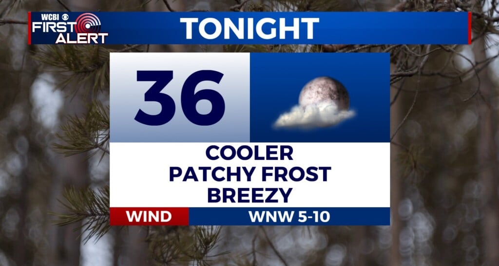
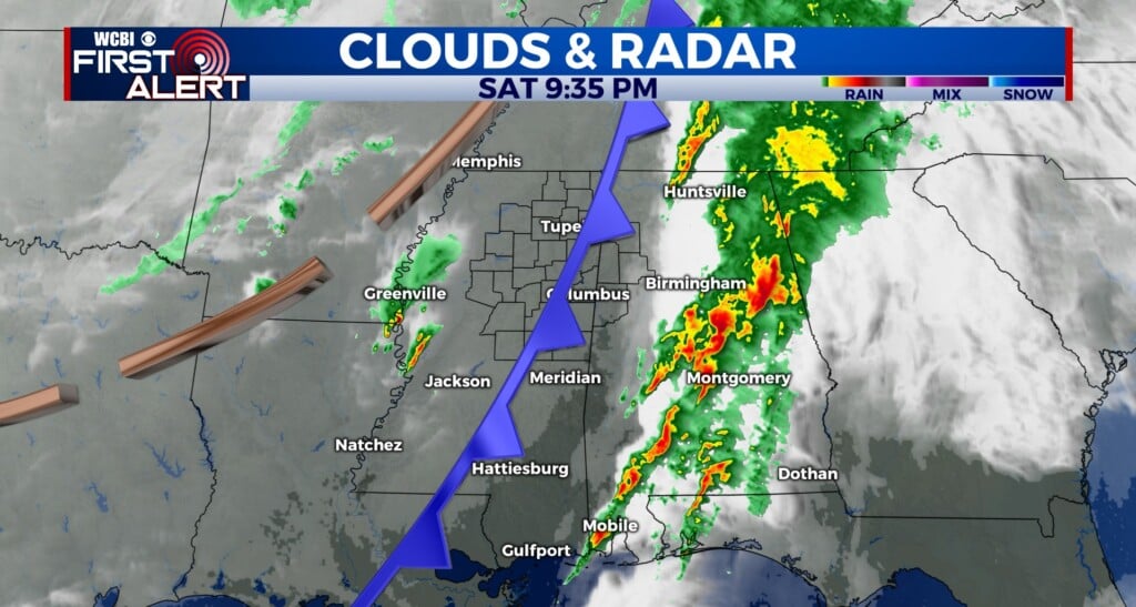
TUESDAY NIGHT: Mostly cloudy with lingering showers possible. Lows in the mid 60s. Winds SE 3-7 mph.
WEDNESDAY: More clouds than sun with showers still a possibility. Highs in the low 80s. Winds SE 10-20 mph.
WEDNESDAY NIGHT: Variably cloudy. Lows in the mid 60s.
THURSDAY: Partly cloudy. Highs in the mid 80s.
THURSDAY NIGHT: Partly cloudy. Lows in the low 60s.
FRIDAY-TUESDAY: Mostly sunny. Warm highs in the upper 80s to lower 90s. Lows in the 60s.
Follow @WCBIWEATHER on Facebook, Twitter, Instagram, and the WCBI News App


Leave a Reply