Nice weather continues, but cooler air is on the way
Our weather pattern will remain pretty nice for the next few days with mostly sunny skies continuing. However, a cold front will move through the area late Tuesday night bringing a few sprinkles and much cooler air in.
MONDAY NIGHT: Clouds will begin to fill in tonight, but no rain is expected. Lows will be in the mid to upper 40s with a generally calm wind.
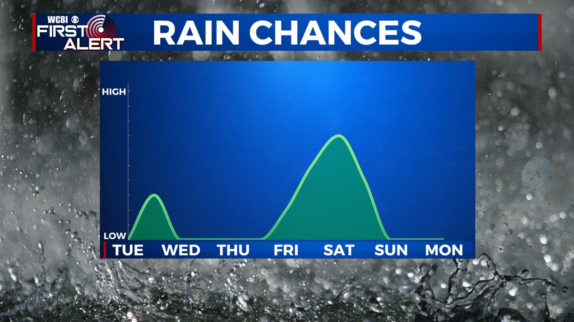
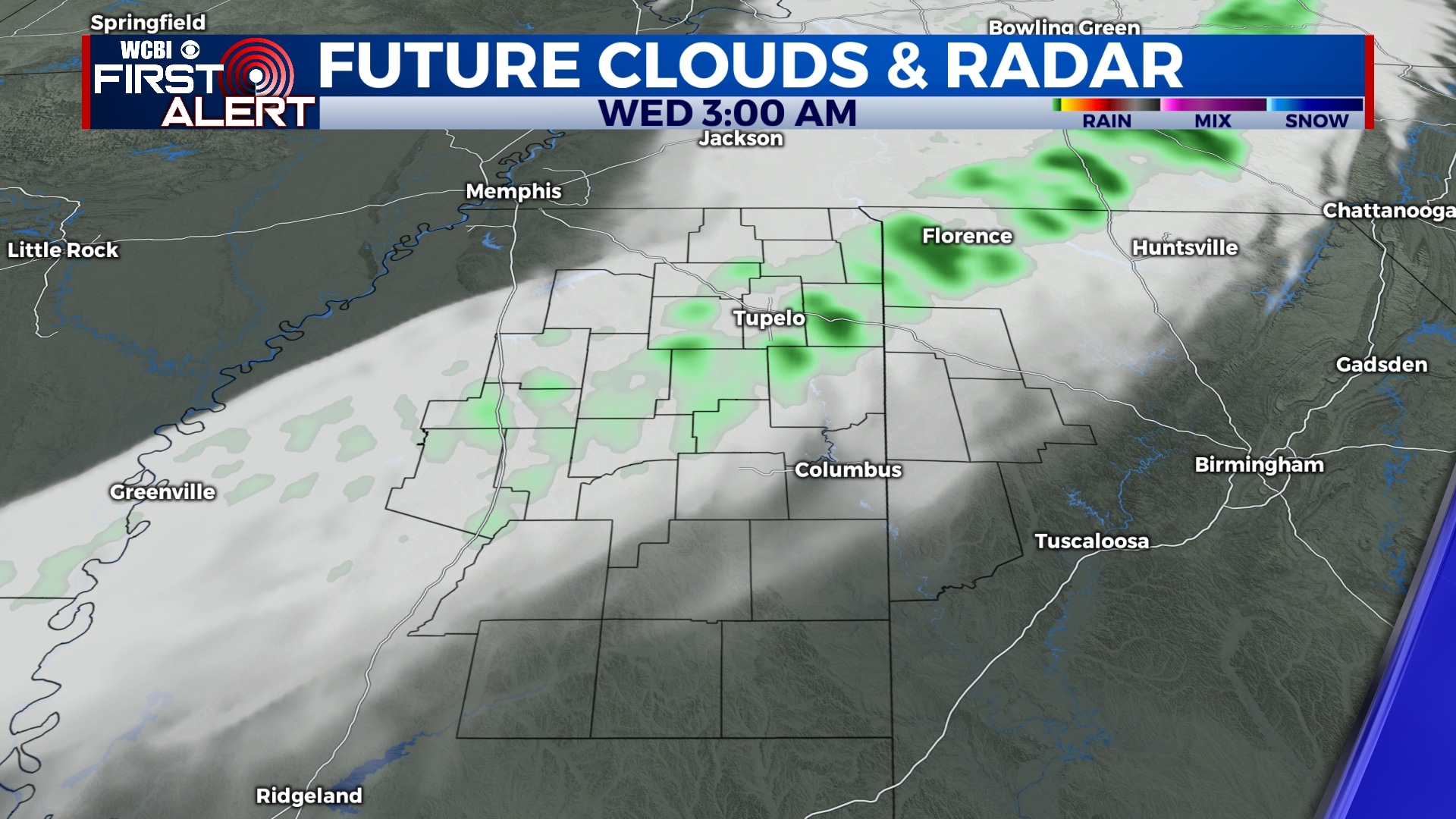
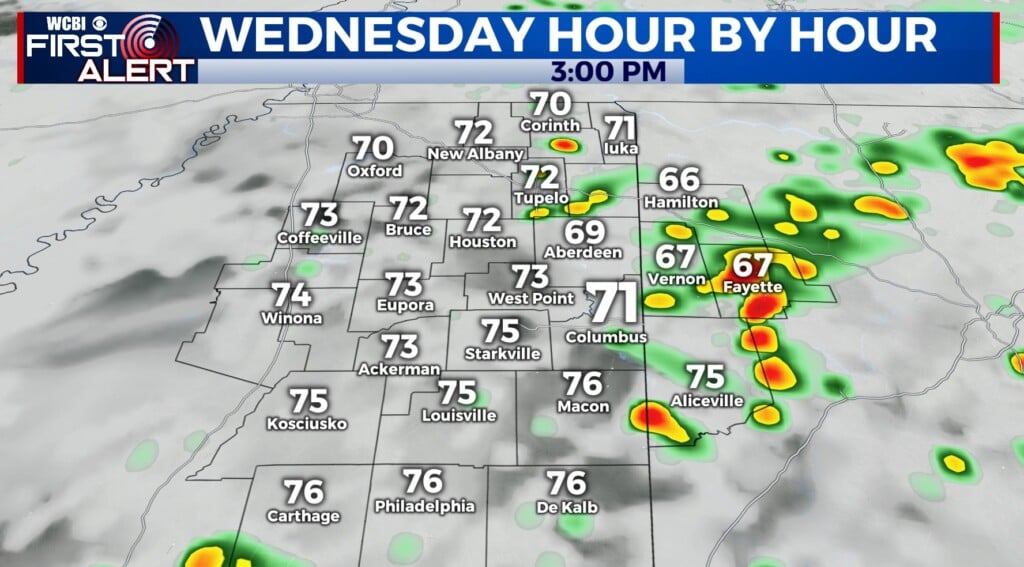
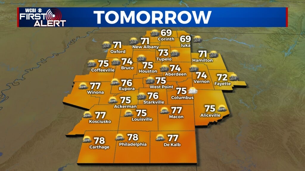
TUESDAY-WEDNESDAY: We’ll see a mix of sun and clouds on Tuesday with highs in the mid 70s. Clouds will build in Tuesday night and we will see some off-and-on rain showers overnight Tuesday into early Wednesday. It appears any rain will be gone by sunrise Wednesday, with sunshine returning through the day. Temperatures will be cooler on Wednesday with morning lows near 40 and highs in the low 60s.
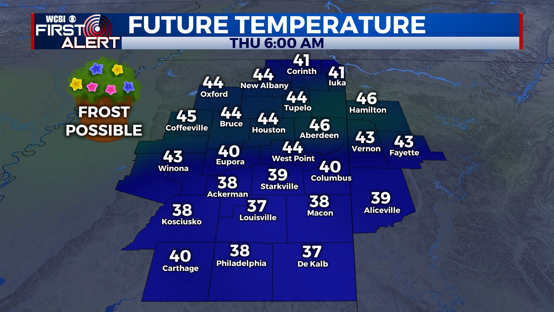
THURSDAY-FRIDAY: Temperatures will remain cool for the second half of the week with lows in the 30s and 40s and highs in the 60s. Some patchy frost is possible Thursday morning, so bring in or cover your plants Wednesday night. Skies will remain mostly sunny to partly cloudy, but rain will develop across the area Friday night after sunset.
SATURDAY: Rain showers are likely through the day on Saturday, but fortunately, it appears the severe weather threat will remain to our south. However, we could see some heavy rain at times with totals near or just over 1 inch. Highs will be in the mid 70s.
SUNDAY-MONDAY: Rain will exit by Sunday morning, leaving us dry for Sunday and Monday. We’ll see a mix of sun and clouds with highs in the 70s and lows in the 50s.
Follow WCBI Weather on Facebook, Twitter, and Instagram
Follow Meteorologist Trevor Birchett on Facebook and Twitter


Leave a Reply