Quiet Monday but some rain chances will return this week
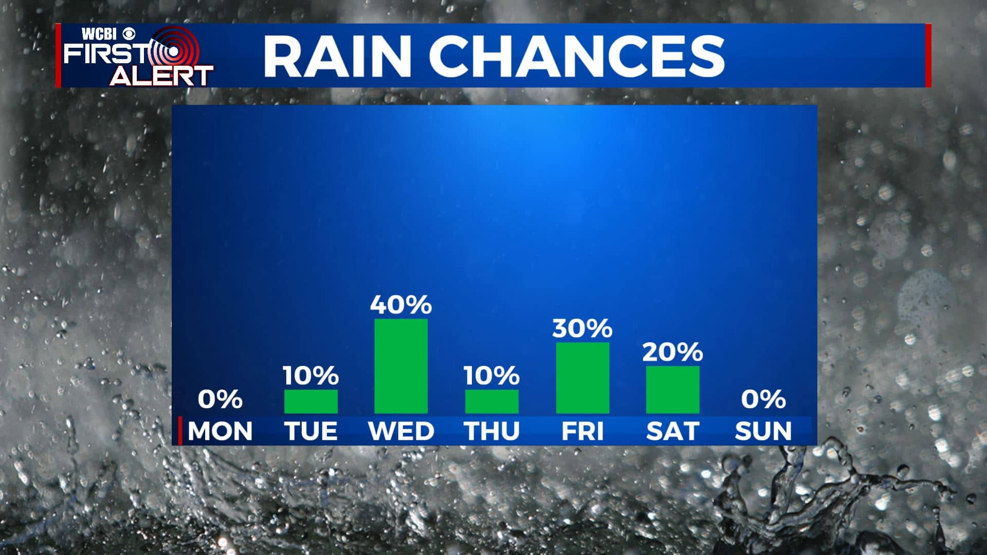
SUMMARY: We’ll have a quiet & warm start to our new workweek on Monday. Another cold front late Tuesday into Wednesday will bring us the return of some showers to the area. The unsettled weather pattern of on & off again rain chances will continue through the weekend. The great news is that our severe weather threat will be low.
RIVER UPDATE: Many rivers in our area are at or above flood stage currently. We expect water levels to remain steady or drop below flood stage by Tuesday area-wide.
MONDAY: After a nice weekend, the sunny skies will continue through much of our Monday, but a few clouds are possible by the afternoon. We’ll be staying dry. Highs will be in the lower to mid 80s. W winds 5-10 mph.
MONDAY NIGHT: Clouds continue to move in during the overnight hours. Overnight lows not as chilly in the mid 50s.
TUESDAY: We’ll have a mix of clouds with some sunshine. A few isolated afternoon showers are possible, but many of us won’t see rain. Highs will be in the upper 70s to near 80.
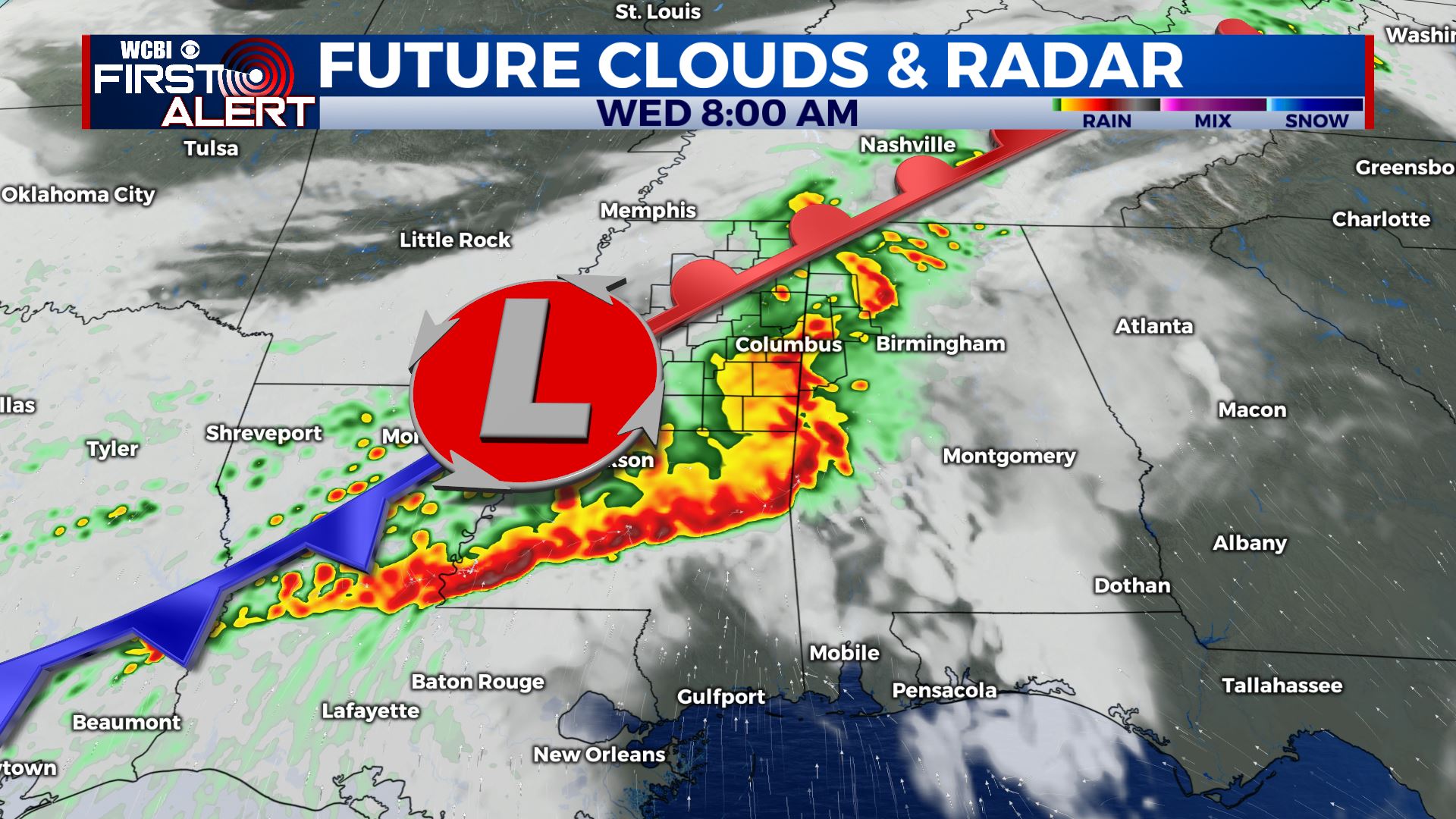
WEDNESDAY: Rain showers will be possible anytime on Wednesday, and a rumble of thunder or two is even possible as our cold front pushes through. Highs will be much cooler in the upper 60s.
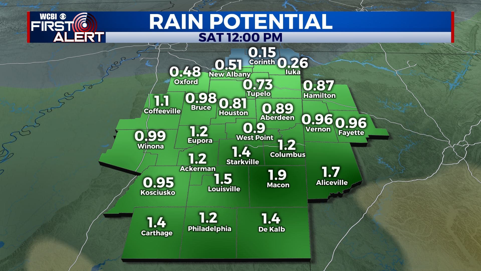
THURSDAY-SUNDAY: Some isolated showers will remain possible for the second half of the workweek and into the weekend. but it won’t be a complete washout. Highs will remain on the cooler side in the mind to upper 60s to near 70 degrees with some lingering clouds.
Stay connected with @WCBIWEATHER on Facebook, Twitter, Instagram, and the WCBI News App.


Leave a Reply