A break for your Thursday before more storms return Friday
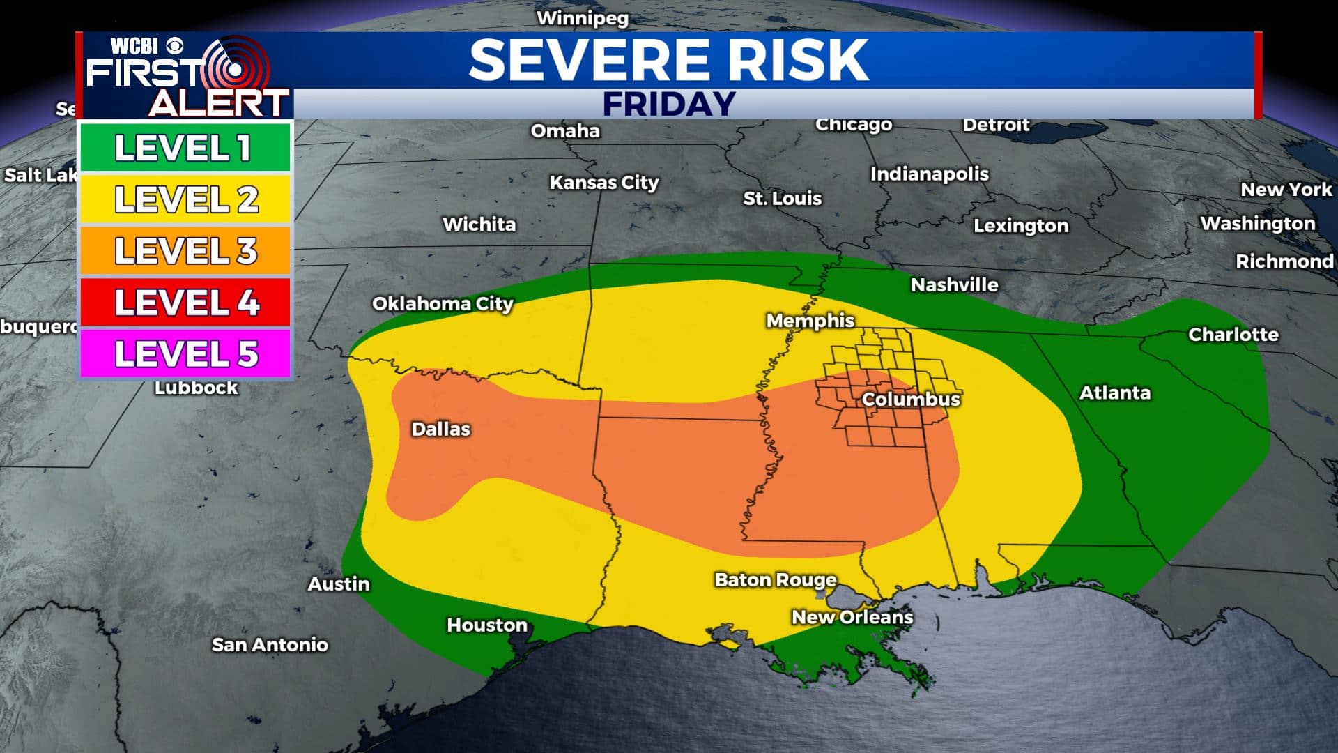
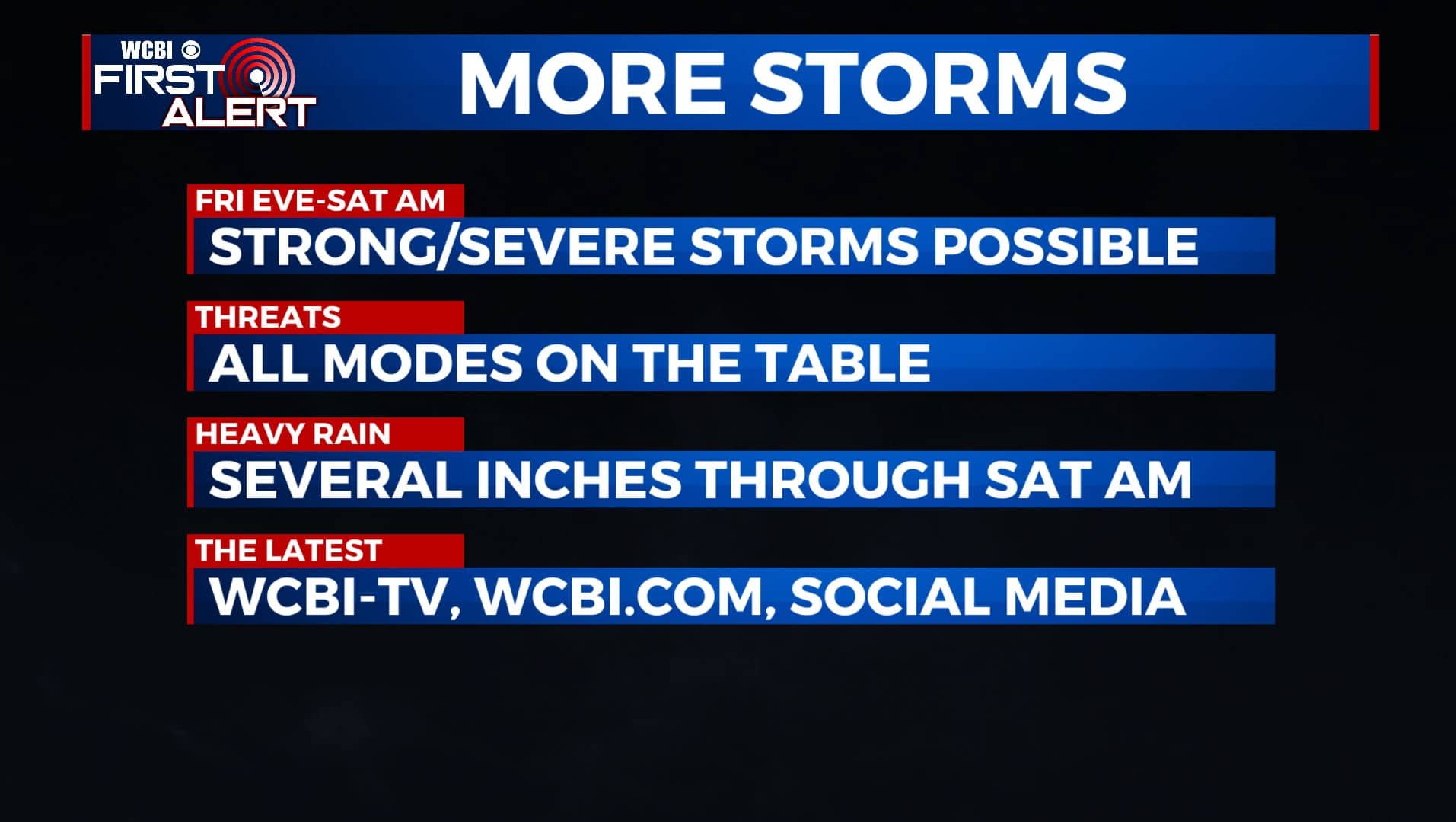
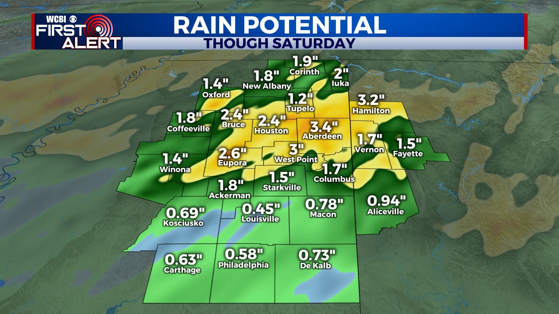
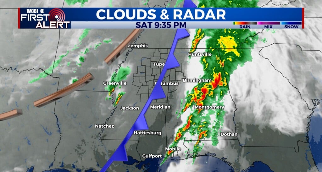
SUMMARY: After a stormy Wednesday night, we’ll dry out on Thursday. Additional rain and storms will return Friday into the start of the weekend. An additional 1-3 inches of rain is possible Friday through Saturday. We are under a Level 2-3 Risk for severe weather Friday night through early Saturday morning. Stay tuned to WCBI for the very latest!
THURSDAY: Morning clouds will give way to more sunshine by the afternoon. Highs look to be around 80. Winds SW 5-15 mph.
THURSDAY NIGHT: Partly cloudy. A stray showers is possible but most spots will not get any rain. Overnight lows in the upper 50s to around 60.
FRIDAY: Chance of scattered showers and storms continue. It should not be an all day rain or anything like that but keep an umbrella on standby. Highs in the lower 80s.
FRIDAY NIGHT-SATURDAY MORNING: Areas of rain and storms are likely. Some strong to severe storms could occur in addition to more heavy rainfall. All modes are possible including damaging winds, large hail and isolated tornadoes are possible. Right now we are under a Level 2-3 Risk. Overnight lows in the low 60s.
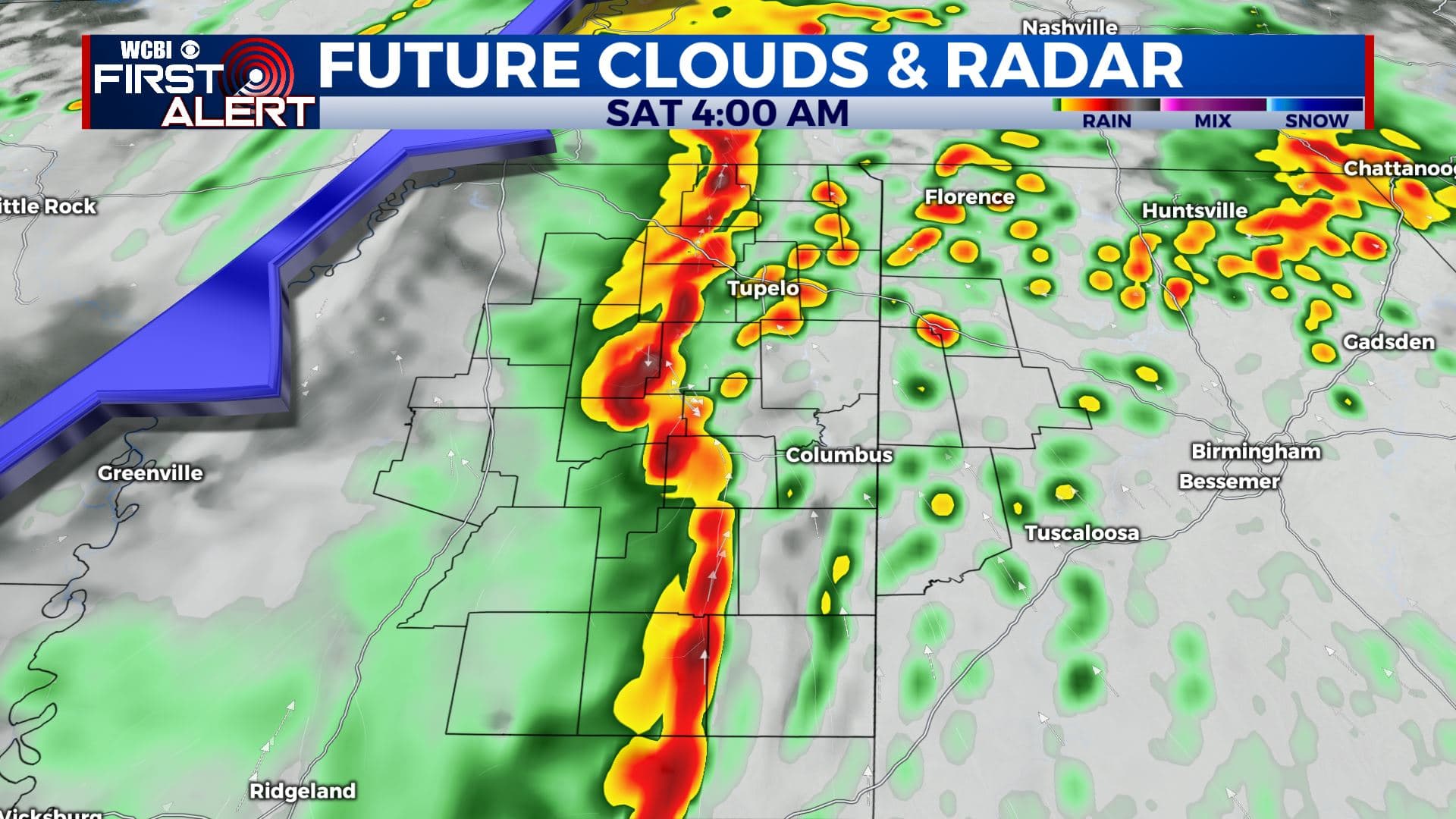
SATURDAY AFTERNOON: Drier & cooler conditions take over. Afternoon highs in the mid 70s.
SATURDAY NIGHT: Partly cloudy and cooler. Lows in the low 50s.
SUNDAY: Mostly sunny skies. Highs in the mid 70s.
MONDAY: A mix of sun and clouds. Highs in the upper 70s.
TUESDAY-WEDNESDAY: More chances of scattered showers and storms return to the forecast. Highs in the lower to mid 70s.
Stay connected with @WCBIWEATHER on Facebook, Twitter, Instagram, and the WCBI News App.


Leave a Reply