Spring weather for two more days before winter returns
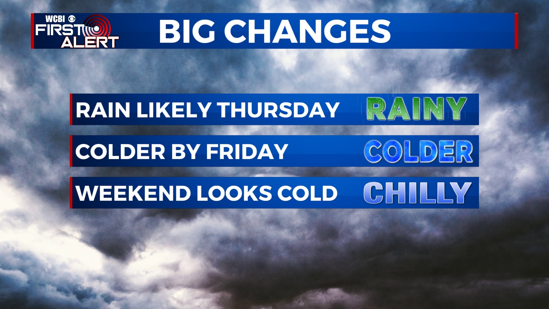
SUMMARY: We’re still dealing with spring-like weather for the next two days then winter will be making its comeback. Widespread rain chances are still likely for our Thursday as a cold front pushes through. Colder air is then expected to gradually move into the region behind the front Friday and it will continue into the weekend. There are still a few uncertainties in the forecast for early next week in terms of some wintry precipitation. We’ll continue to keep you updated as we fine tune it!
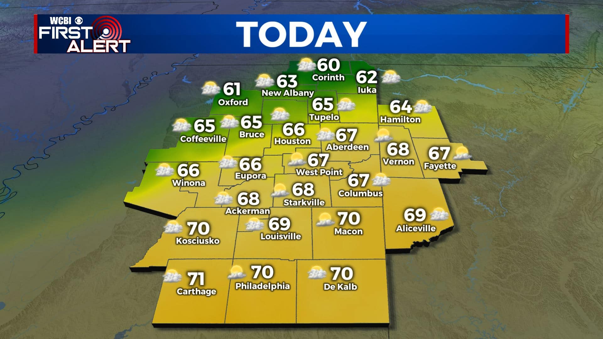
TUESDAY: We have a weak disturbance pushing through our area today, but it’s not going to be a big deal with our weather. We’ll have more cloud cover along with a chance of a stray shower or sprinkle. It’s staying mild, but the cloud cover will play a factor in how high temperatures will climb. Highs in the mid to upper 60s, maybe 70 degrees in our southern counties while our northern counties may top out in the lower to mid 60s. Light winds.
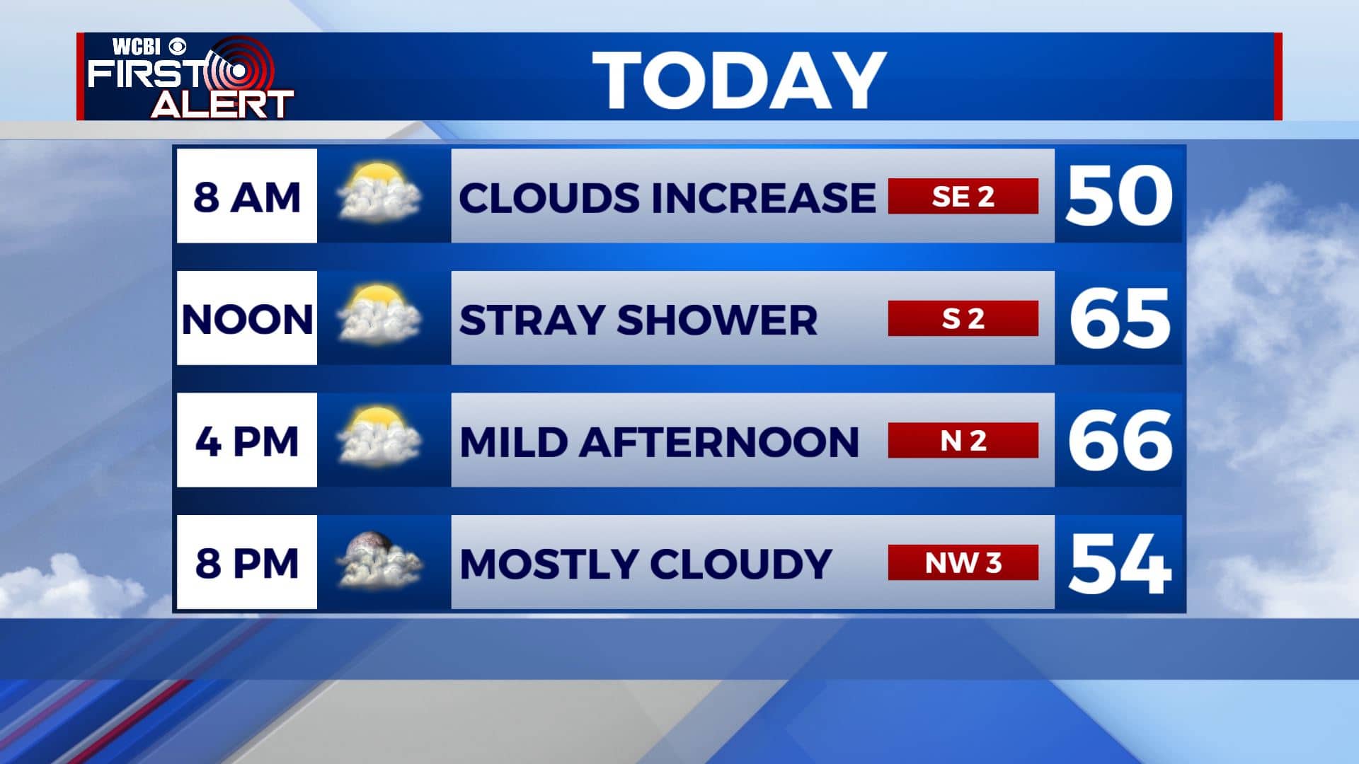
TUESDAY NIGHT: Mostly cloudy. Lows in the mid to upper 40s.
WEDNESDAY: Staying cloudy. Maybe an isolated shower. One more mild day with highs in the upper 60s.
WEDNESDAY NIGHT: Cloudy with areas of rain developing. Lows in the 50s.
THURSDAY: A strong cold front is looking more likely to push through the Deep South as we head into the second half of the workweek. Widespread rain is likely, some of which could be heavy at times. Temperatures will cool down a bit into the 50s through the day with even
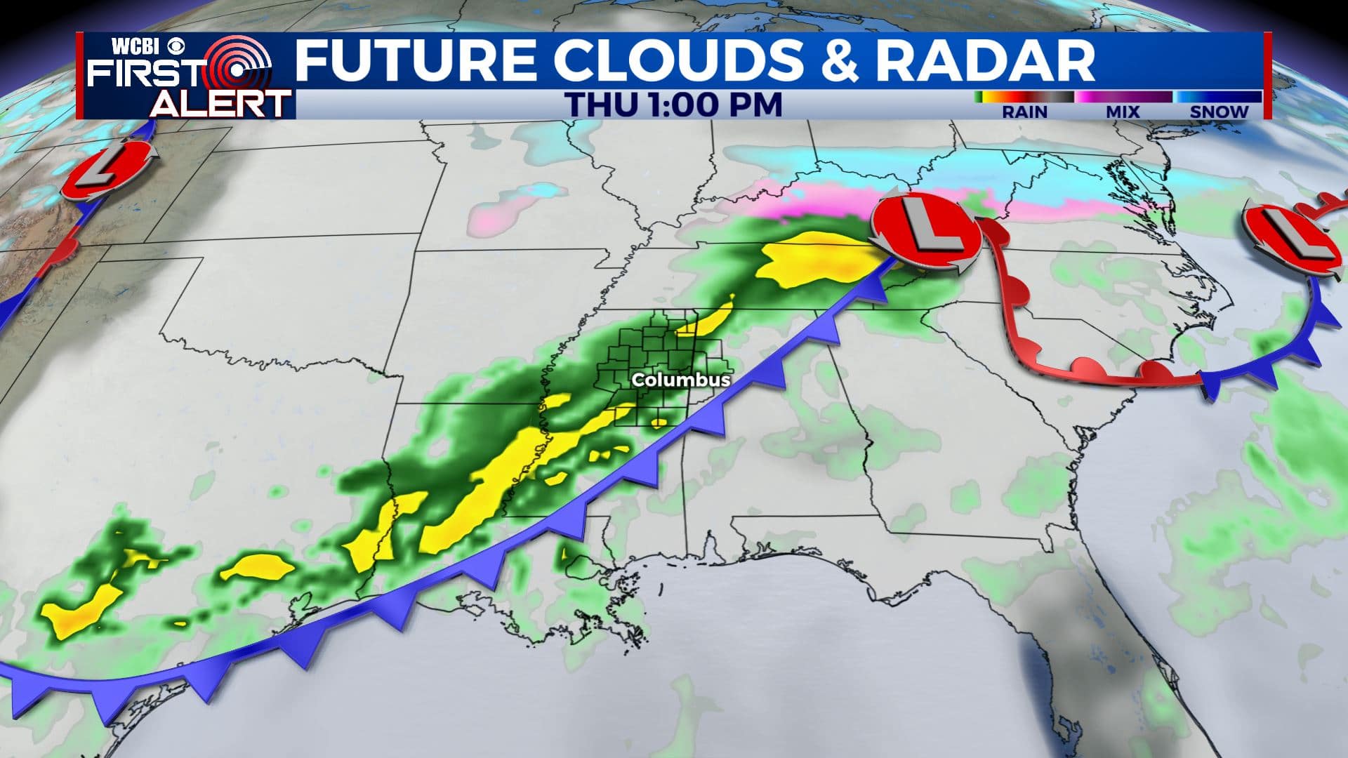
THURSDAY NIGHT: Cloudy skies with colder air moving in as the rain exits. Overnight lows in the 30s.
FRIDAY: Mostly cloudy. Turning colder with highs only in the lower 40s.
FRIDAY NIGHT: Mostly cloudy. Overnight lows in the upper 20s to near 30 degrees.
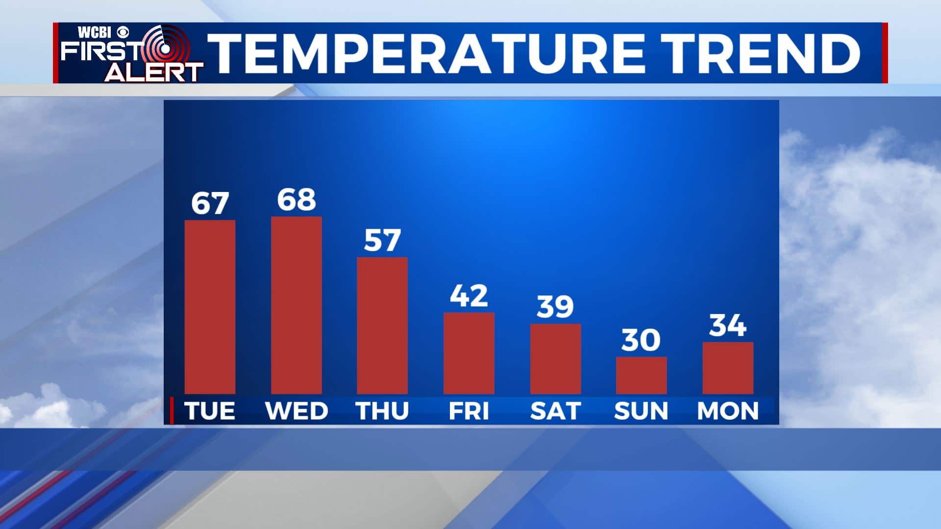
SATURDAY: Mostly cloudy. Chilly highs in the upper 30s to near 40 degrees.
SATURDAY NIGHT: Mostly cloudy. Overnight lows in the lower to mid 20s.
SUNDAY: Mostly cloudy. Cold. Highs may only top out in the lower 30s.
SUNDAY NIGHT: Staying cold. Lows in the 10s.
MONDAY: Mostly cloudy skies. Now there are some models that want to bring in a slight chance of some wintry weather into our region, but it’s not set in stone. Something we’ll continue to keep you updated on. Staying cold with highs in the lower 30s.
Stay connected with @WCBIWEATHER on Facebook, Twitter, Instagram, and the WCBI News App


Leave a Reply