Hot weather continues ahead of Thursday front
COLUMBUS, Mississippi (WCBI) – Temperatures will remain in the upper 80s to near 90 degrees through Wednesday. Rain and storm chances build in Thursday & Friday.
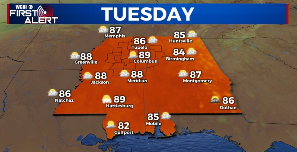
TUESDAY: On the heels of Monday’s 90 degree day, we’ll be close to it again by afternoon. With a mix of sun and clouds, highs will easily reach the upper 80s for most. There is a small risk of a rogue downpour or storm from Iuka to Oxford northward to Tennessee, but all others should stay dry.
TUESDAY NIGHT: Expect scattered clouds through the overnight with lows in the 60s.
WEDNESDAY: Continued heat! Highs will reach the upper 80s with no rain expected.
THU/FRI: Showers and storms are likely at times Thursday. We could see weakening storms early followed by renewed development in the afternoon w/highs knocking back several degrees into the low/mid 80s. Most storms will remain below severe limits, but there is a risk of one or two locally stronger to possibly severe storms. Rain chances will continue into Friday, but the thunder potential is more limited.

WEEKEND: We’ll see gradual clearing Saturday with highs dropping into the 70s. Perhaps the best weather day holds off until Sunday – expect lots of sunshine with highs in the 70s and lows in the 50s!