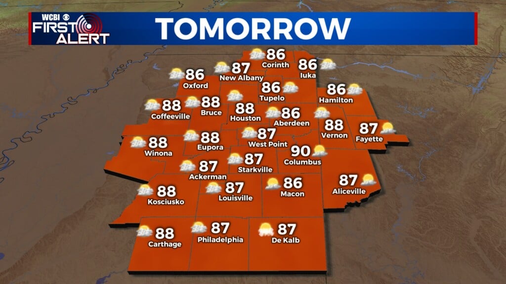
Hot start to the week
COLUMBUS, Mississippi (WCBI) – Expect toasty conditions the first half of the week, with a rainy end. Next rain and storm chance on Thursday.
MONDAY NIGHT: Mild and humid for our Monday night. Lows tonight will eventually fall into the middle 60s. A few clouds will be working their way in from the West.
TUE/WED: Warm, if not hot conditions, will be sticking around the next few days. High temperatures will be in the middle 80s to lower 90s. Clouds will continue moving in, but we will be staying dry! Overnight lows maintain as mild and humid.

END OF WEEK: The next weathermaker will be an approaching front coming in from the NW. The front will likely spark the rain chance early Thursday morning. Showers and storms are going to be likely throughout the day, some storms could become strong with most staying below severe thresholds. That front is expected to stall out on Friday, keeping the rain chance around for the end of the week. It is possible for slightly cooler conditions into the weekend, with drier air.