Beautiful Wednesday ahead of warmer air to end the week
COLUMBUS, Mississippi (WCBI) – Highs stay in the 70s for Wednesday, but a substantial warming trend develops for the week’s end into the weekend.
WEDNESDAY: After a much cooler start, lots of sunshine should help temperatures reach into the middle 70s area-wide with light, variable winds.
WEDNESDAY NIGHT: Temperatures will fall off into the middle and upper 40s – not as cool as the previous night.
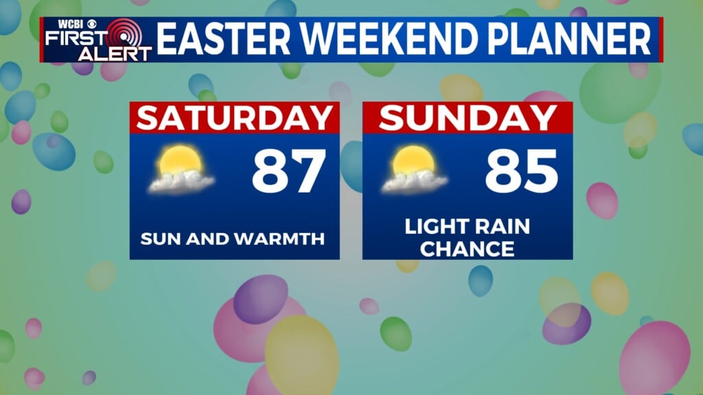
THU – SAT: Warming trend! Highs will top out in the 80s, reaching the middle and upper 80s Friday and Saturday afternoon.
SUN/MON: Sunday still looks to start dry, but a few showers and storms could develop into northern MS by the evening and overnight hours. While the best upper-air forcing looks to lift to the north of us, we could see a few locally strong to possibly severe storms in parts of the Mid-South late Sunday into Monday. Highs may return to the 70s by next Monday.