Windy Wednesday ahead of colder end to week
COLUMBUS, Mississippi (WCBI) – One last warm day is in store Wednesday before chilly air moves in Thursday and Friday.
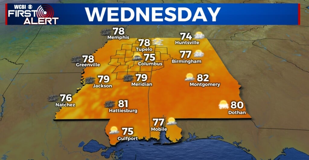
WEDNESDAY: Expect a warm, windy Wednesday with highs in the mid to upper 70s and southerly wind gusts up to 30-35 mph at times. A wind advisory is in effect for the entire region. A strong cold front this afternoon could trigger a few brief showers or storms between 4-8 PM, but widespread rain and storm coverage is not expected.

WEDNESDAY NIGHT: Behind the front, temperatures will drop quickly. Expect overnight lows in the lower 40s with westerly breezes up to 20 mph.
THU/FRI: Spring officially begins Thursday, and the calendar is having trouble keeping up with the changes! Highs will only reach the 50s Thursday afternoon despite a clearing sky. A frost and freeze is likely by Friday morning but Friday afternoon will bring highs back to the upper 60s.
WEEKEND: Saturday looks fantastic with highs in the 70s and plenty of sunshine. Clouds increase Sunday, and additional showers and storms are likely by Sunday evening. Some severe risk may accompany these as well, so stay tuned for further updates.