Sunny, warm Tuesday ahead
COLUMBUS, Mississippi (WCBI) – Beautiful, sunny weather highlights Tuesday and Wednesday’s weather. Storm potential increases Thursday and again late Friday into Saturday.
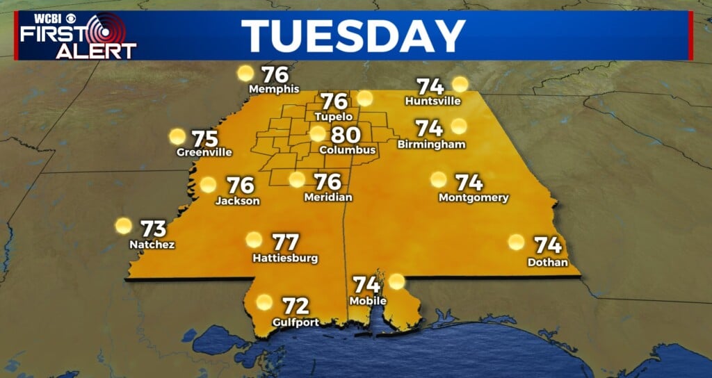
TUESDAY: Expect a fully sunny day with highs in the upper 70s to near 80 degrees by afternoon w/southwest winds 5-15 mph.
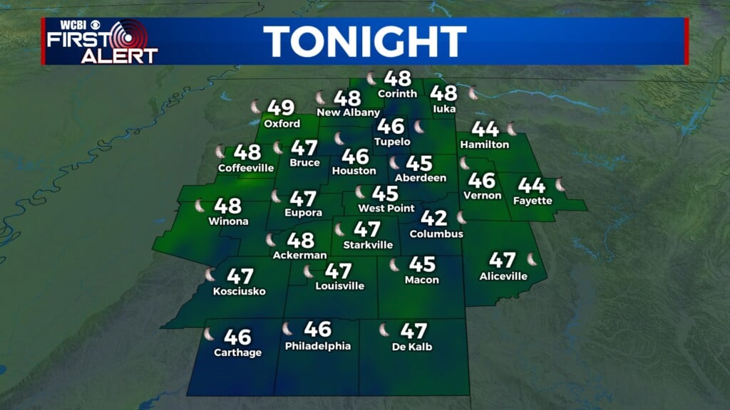
TUESDAY NIGHT: Mainly clear and cool as overnight lows drop into the lower 40s.
WED/THU: Most of Wednesday looks just fine w/plenty of sun and highs in the mid to upper 70s. Some rain and storms may arrive well after midnight Wednesday into Thursday, with low potential of a stronger storm or two. The main concern would be brief gusty winds or hail. This activity will gradually shift eastward into Alabama during the afternoon Thursday.
FRI/SAT: Friday looks relatively dry but very warm and breezy during the day. Highs will reach the upper 70s to low 80s w/south winds gusting to 25+ mph. As moisture recovers and upper-level energy increases, a rogue storm or two in the afternoon or early evening is possible w/severe potential. It still remains unclear if storms will actually form thanks to copious amounts of dry air in the mid-levels of the atmosphere. Still, storms in Arkansas may survive across the MS River late (after midnight), and these could also bring severe potential. Of more concern is Saturday – improving moisture, wind shear, and instability could prove quite problematic for the eastern part of MS into AL. Exact details still need to be pinned down, but elevated risks of all modes of severe weather are still plausible. All storms should exit the region by late Saturday.