Calm first half, building in storm potential later
COLUMBUS, Mississippi (WCBI) – The first half of our week will remain fairly calm, with plenty of sun and warmth. The second half brings quite a few chances for showers and storms.
MONDAY NIGHT: Overnight lows will fall into the 30s and low 40s, thanks to a clear sky across the Twin State Region.

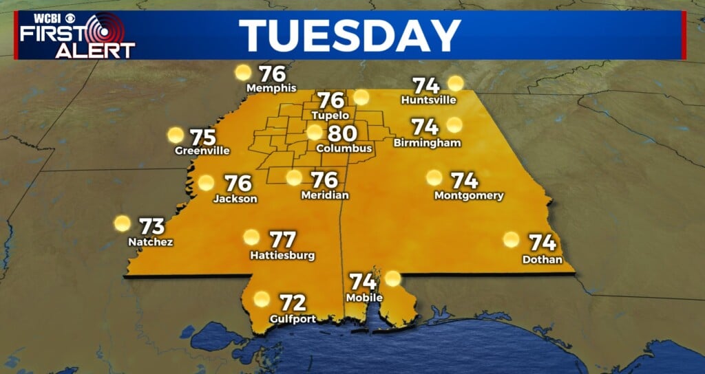
TUESDAY: Going to be such a nice day to get outside! Warm and sunny! Highs will reach into the middle to upper 70s. Another cool night, lows will drop into the lower 40s.
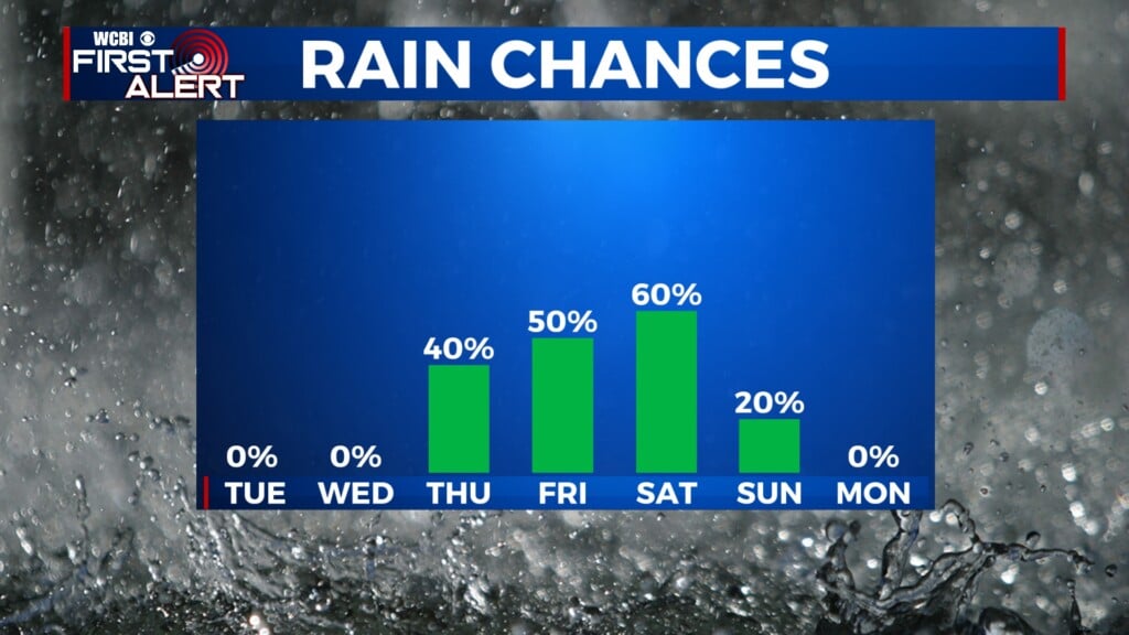
WED/THUR: Beginning Wednesday, conditions will be calm. Clouds will fill in throughout the day. Temperatures will again reach the upper 70s. A disturbance will bring the chance of showers and storms overnight Wednesday into early Thursday. Thursday will start with temps in the middle 50s and eventually work into the middle 70s. We’ll get a chance to quiet down Thursday afternoon into early Friday.

SEVERE THREAT FRIDAY EVENING & SATURDAY: Uncertainty for specifics is still high, but we could be in for multiple rounds of storms Friday night into Saturday. Severe potential will be elevated, as the Storm Prediction Center has already issued Levels 2/3 across northern MS and Alabama. Strong wind shear and improved moisture/instability give heightened concern for all modes of severe weather. Prepare now, just to be safe. We’ll keep you updated on more details throughout the week!