Gusty winds likely Tuesday, storm potential early Tuesday evening
COLUMBUS, Mississippi (WCBI) – A strong, dynamic system brings the risk of gusty winds and severe weather to the Southeast Tuesday. Gradually quieter weather filters in mid-week.
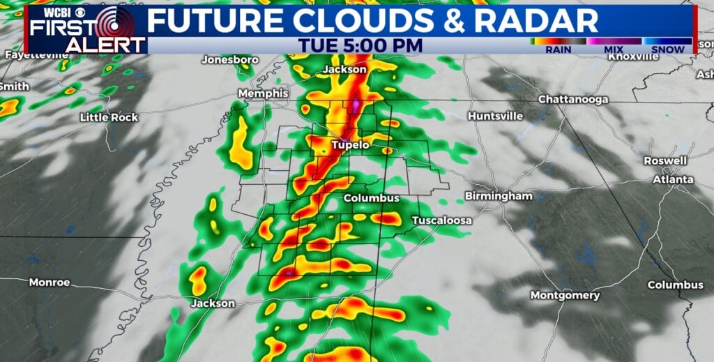
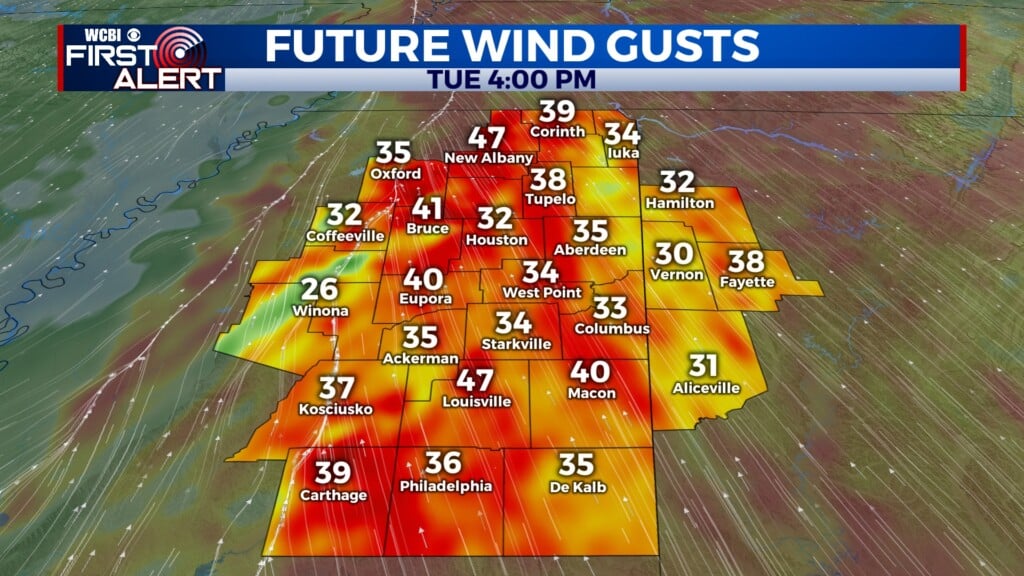
TUESDAY: Expect a mostly cloudy, warm, and windy day with highs in the low to mid 70s area-wide. Southeast winds will gust up to 40+ mph frequently through the day, making travel difficult for high profile vehicles. Showers and embedded storms will arrive after 3 PM and sweep quickly through the region, ending likely before 9 PM in west Alabama. Gusty to damaging wind gusts are possible along the line as it moves through, with potential for up to 60-70 mph gusts in bowing areas of the line. Thankfully, tornado potential still looks fairly minimal…though it is not zero. We’re still watching the general time frame of 4-8 PM for the most active weather.

TUESDAY NIGHT: Quick drying/clearing is expected behind the rain and storms, though clouds are likely to redevelop after midnight. Southwest breezes will also continue, gusting to 20-25 mph overnight.
WEDNESDAY: Expect a mostly cloudy sky with some sun at times as highs drop back into the 50s. West winds will gust up to 30+ mph.
THU/FRI: Thursday will bring the sunshine and chilly air back, but Friday brings milder air! The next chance for rain arrives Saturday.