Next round of rain and cool air
COLUMBUS, Mississippi (WCBI) – We made it through the warmest day of the week, just in time for the next cold front to come sweeping across the Deep South. Cool temperatures and chances for rain are going to be making an entrance.
WEDNESDAY NIGHT: The warmest day of the week made it into the middle 80s this afternoon. Temperatures tonight will follow that warmer trend, only falling into the lower 60s. Cloud coverage will be light and scattered across the sky.
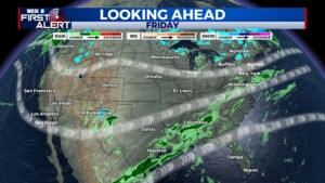
THURSDAY: Here it comes! A cold front will be working its way across northern Mississippi throughout the day. Temperatures will reach into the upper 70s before the colder air. The sky will be full of clouds. A chance for rain will start off light with a few scattered showers. The chance for rain will increase throughout the evening and overnight into Friday. Overnight low temperatures will fall into the middle 50s.
FRIDAY: Rain from overnight will continue throughout the morning. It will become lighter throughout the day, a bit more scattered. Temperatures are going to be cool, thanks to the cold air following the front. High temps will be in the middle 50s to lower 60s. May want to take a towel and a jacket to any high school football games! Low temps will drop into the lower 50s.


