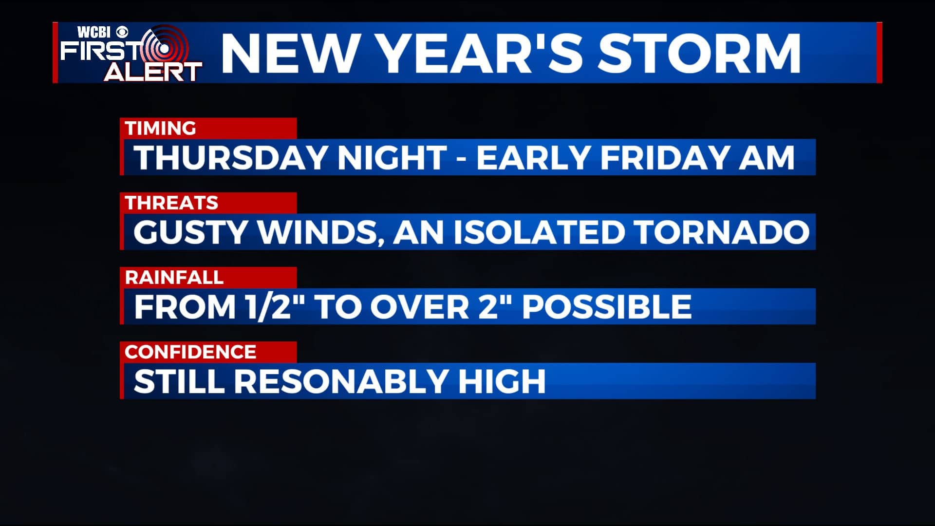
New Year’s Eve storm system remains on track
SUMMARY: All eyes are on the big system that will push through the region Thursday and Friday. Locally heavy rain and strong/severe storms with gusty winds and an isolated tornado or two are still possible Thursday night into Friday morning. Quiet weather builds in Friday afternoon and it’ll continue during the weekend.
TUESDAY NIGHT: Partly to mostly cloudy. Lows in the upper 40s. Winds SE 5-10 mph.
WEDNESDAY: Mostly cloudy with a 40% chance of rain showers. Highs in the mid 60s. Winds SE 10-20 mph.
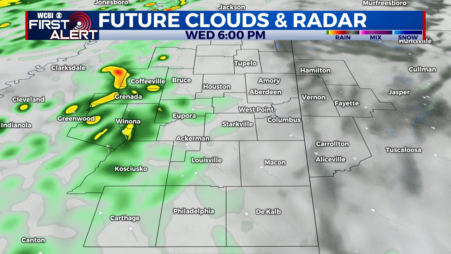
WEDNESDAY NIGHT: Mostly cloudy with areas of rain possible. Lows in the mid to upper 50s. Winds SE 5-15 mph.
THURSDAY: Mostly cloudy and breezy. Areas of rain during the day. Highs in the upper 60s. Winds SE 10-20 mph.
THURSDAY NIGHT: Rain and storms. Some storms could be severe with damaging wind gusts and perhaps an isolated tornado. Temperatures hold steady in the 60s. Breezy SSE winds 10-25 mph.
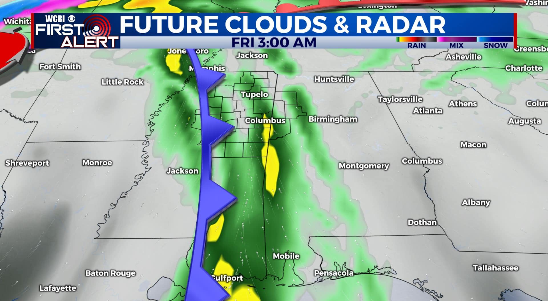
NEW YEAR’S DAY: Morning clouds, rain, and thunder. Sunshine returns during the afternoon. Breezy SW winds 10-25 mph. Highs in the 60s.
WEEKEND: Mostly sunny to partly cloudy. Cooler highs in the 40s and 50s with overnight lows in the 30s.
Follow @WCBIWEATHER on Facebook, Twitter, Instagram, and the WCBI News App


Leave a Reply