Wind, rain, and colder air on the way
SUMMARY: A strong cold front will push across the region Wednesday night. It will give us a good chance of rain, some thunder, and windy conditions before and after it passes. Temperatures plunge into the 30s and 40s for Christmas Eve and Christmas Day while overnight lows tumble back into the low 20s. Wind chill temperatures look to be the 20s and 10s Thursday and Thursday night.
TUESDAY NIGHT: Mainly clear to partly cloudy. Lows in the upper 30s to lower 40s. Winds SE 2-6 mph.
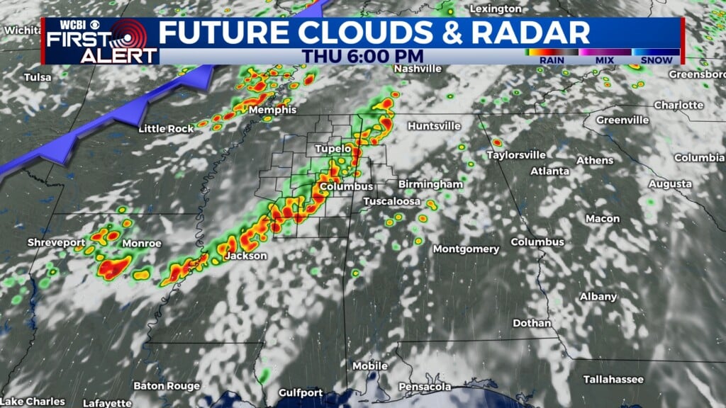
WEDNESDAY: Becoming mostly cloudy with afternoon showers developing. The heaviest rain will occur after sunset. Highs should top out in the low to mid 60s. Winds will be increasing from the SE between 10 and 25 mph. Some higher gusts are possible.
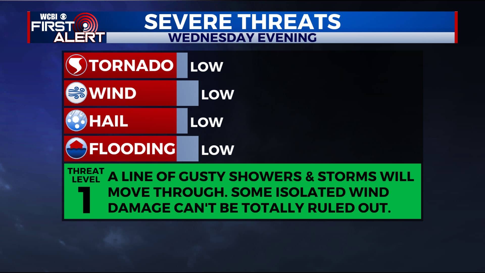
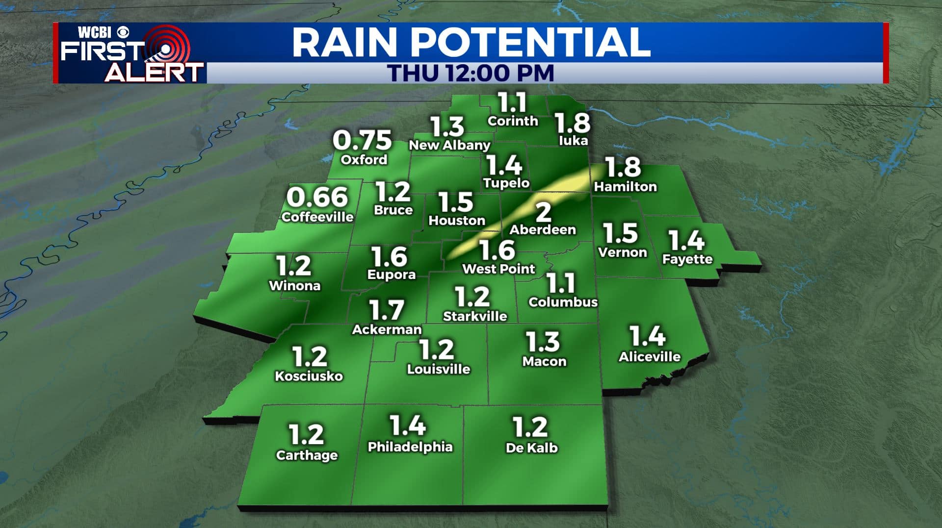
WEDNESDAY NIGHT: Widespread rain and perhaps even a few storms. There is a very low chance of some damaging wind gusts but the overall severe threat is not too great with this setup. Rainfall totals may add up between 1/2″ and 2″. Gusty winds can be expected all night. Lows in the mid 30s by sunrise.
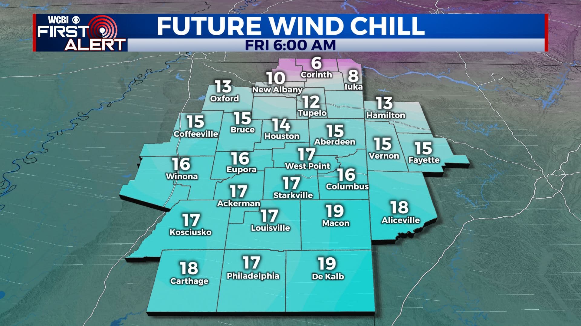
THURSDAY: Variably cloudy, blustery, and much colder. Afternoon temperatures struggling into the low 40s. Winds NW 10-25 mph with gusts over 30 possible. Wind chill values low 30s and 20s.
THURSDAY NIGHT: Partly cloudy and cold. Lows in the low 20s with some colder wind chill values in the 10s. Santa should have good visibility as he makes his way into our region this year.
CHRISTMAS DAY: Sunny and cold. Highs in the upper 30s to lower 40s.
FRIDAY NIGHT: Clear and cold. Lows in the low 20s.
SATURDAY: Abundant sunshine. Highs around 50.
SATURDAY NIGHT: Mostly clear. Lows near 30.
SUNDAY: Increasing clouds. Some late day and evening rain is possible. Highs in the mid to upper 50s.
Follow @WCBIWEATHER on Facebook, Twitter, Instagram, and the WCBI News App


Leave a Reply