Cool & cloudy Sunday, even colder by Christmas
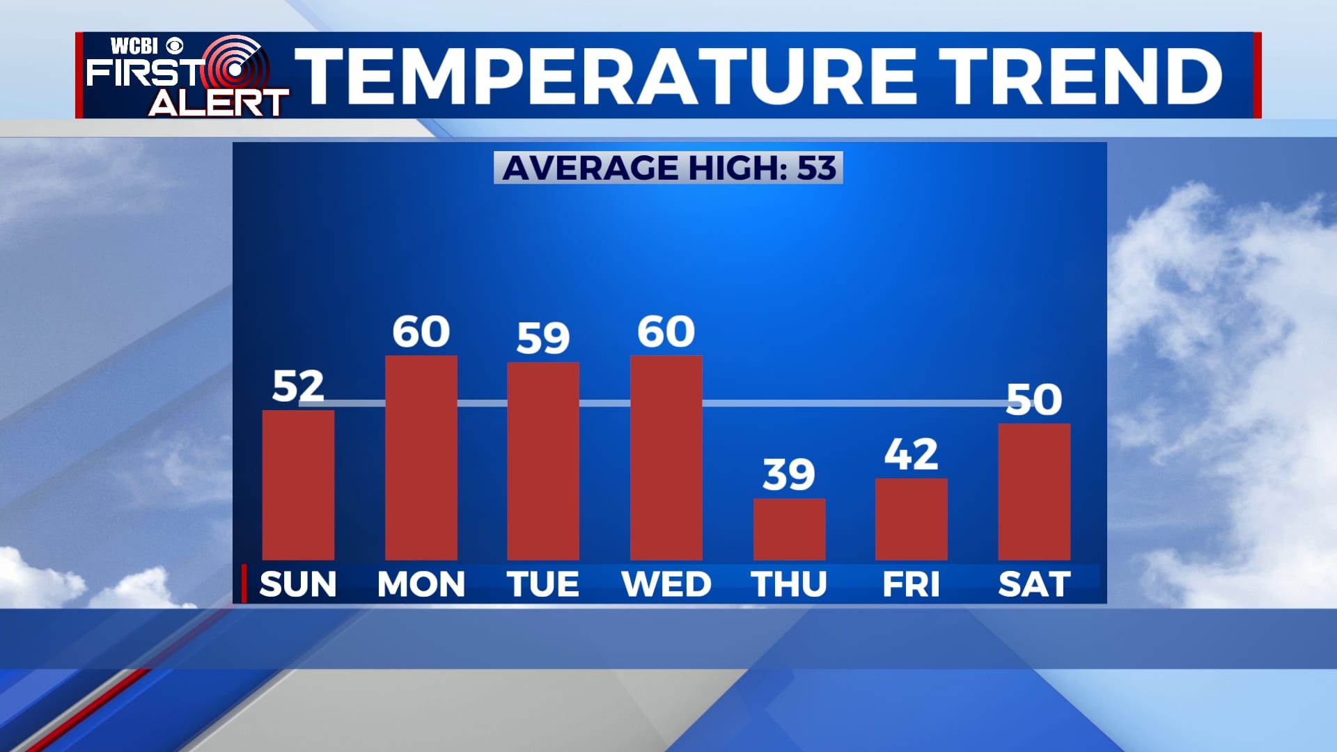
While we aren’t expecting a White Christmas in our area, the temperatures will certainly feel like winter. We’ll start the week off with highs near 60 but colder air will move in by the end of the week.
SATURDAY NIGHT: Rain showers will continue overnight but will slowly exit by sunrise. Temperatures will fall to the mid 40s with a light southeasterly wind.
SUNDAY: Clouds will linger through the day on Sunday, but most if not all of the day will be dry. Highs will be in the low 50s.
MONDAY-TUESDAY: Aside from some morning fog Monday, we’ll see a mix of sun and clouds to start the week off with highs near 60 each day. Temperatures will dip into the mid 30s each night.
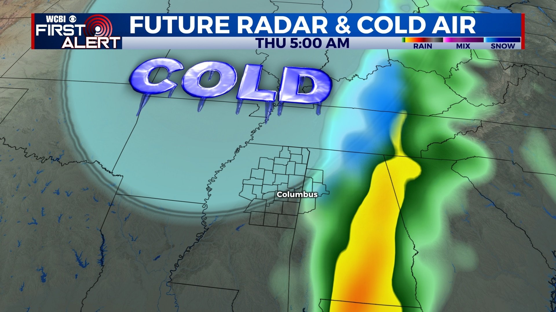
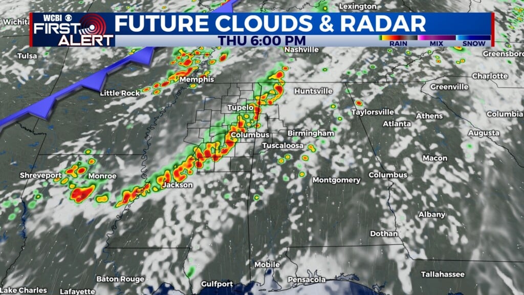
WEDNESDAY-THURSDAY: Clouds will build on Wednesday ahead of our next chance for rain which will be Wednesday evening and overnight. We could have a bit of thunder, but no major weather is expected. Much colder air will begin to filter in by Christmas Eve morning as the rain exits. Depending on how fast the cold air moves in, we could see a snowflake or two early Thursday morning. This remains a slim possibility and even if it does happen, we aren’t expecting enough to stick. Highs will be near 60 on Wednesday, but will only be in the 30s on Thursday. Winds will be breezy at times.
FRIDAY-SATURDAY: It looks like any precipitation will exit by Friday morning, leaving us dry and partly cloudy for Christmas Day. We’ll remain cold with highs in the 40s and morning lows near 20 in many locations. A few more clouds will move in by Saturday with highs back to near 50.
Follow WCBI Weather on Facebook, Twitter, and Instagram
Follow Meteorologist Trevor Birchett on Facebook and Twitter


Leave a Reply