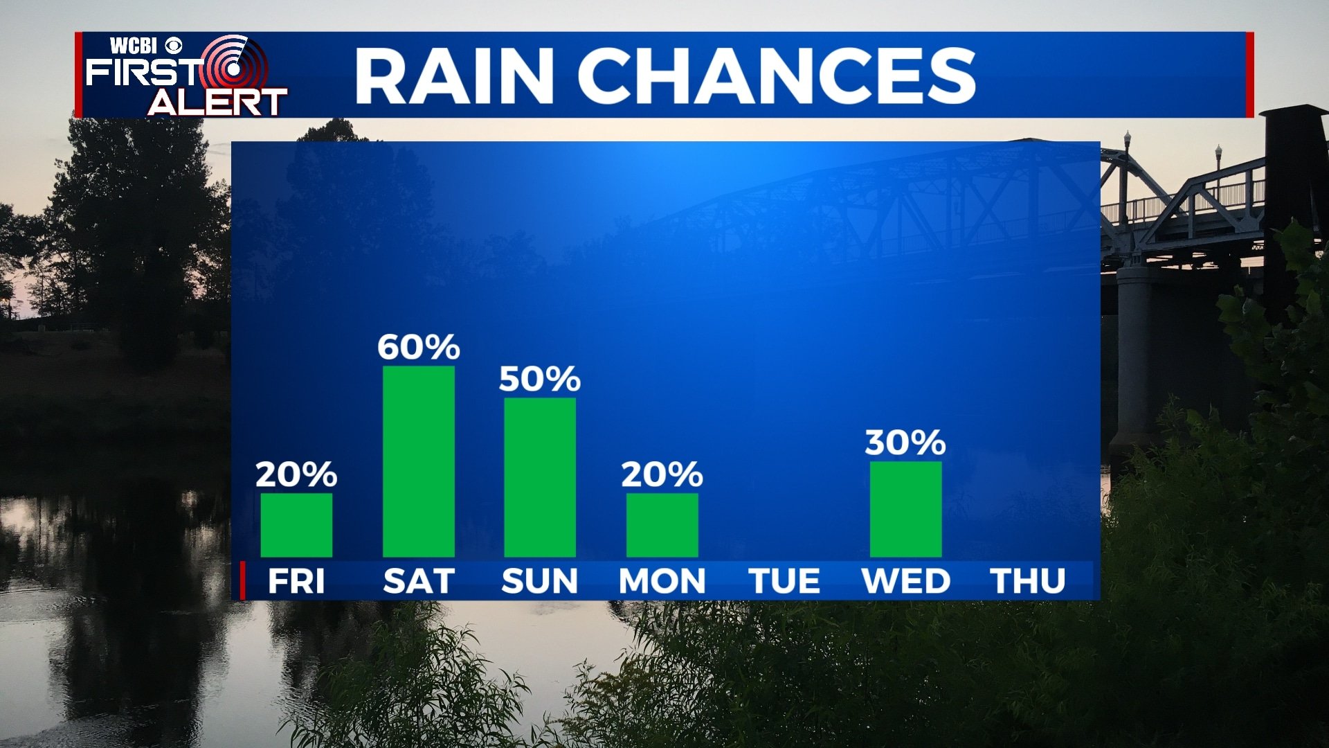
A few chances for rain this weekend
While we’re not expecting a complete washout this weekend, you will have to dodge some showers if you plan to be out. Fortunately, no severe weather is expected.
THURSDAY NIGHT: Skies will remain mostly clear for the most part tonight with a few clouds moving in early Friday morning. It’ll be another chilly night with lows in the upper 30s and a light southeasterly wind.
FRIDAY: Aside from a few peeks of sun in the morning, most of Friday will end up cloudy. An isolated shower is possible after 3 pm, but the majority of the rain will hold off until Saturday morning. Highs will be in the mid 60s with a southerly wind 5-10 mph.
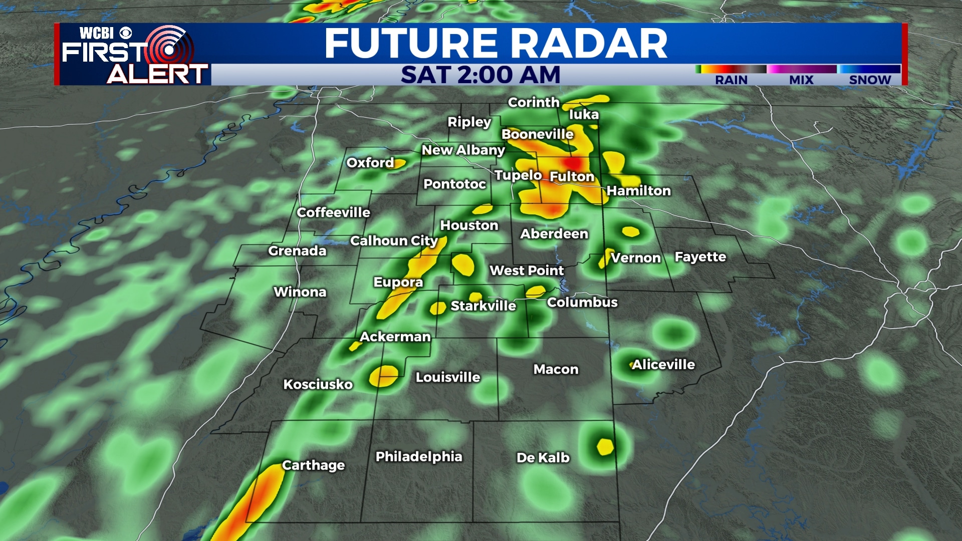
SATURDAY: Many of us will wake up to rain showers and perhaps a bit of thunder early Saturday morning. However, we don’t expect this system to produce severe weather. Rainfall amounts will be between 0.5″ and 1″ area wide. Rain will exit for the most part by lunchtime Saturday, leaving us dry for the rest of the afternoon. Highs will be in the mid 60s with temperatures dropping in the afternoon and evening.
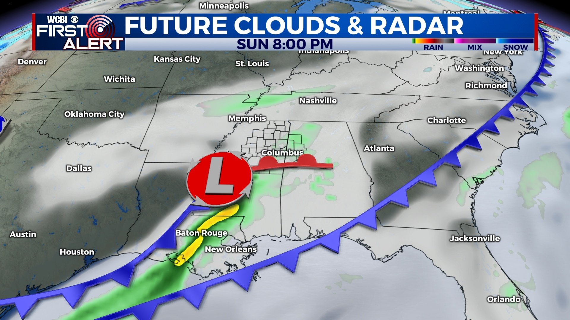
SUNDAY: Clouds will linger through the day on Sunday with another round of showers possible Sunday afternoon and evening. Temperatures will be cooler with highs in the 50s and lows in the 30s.
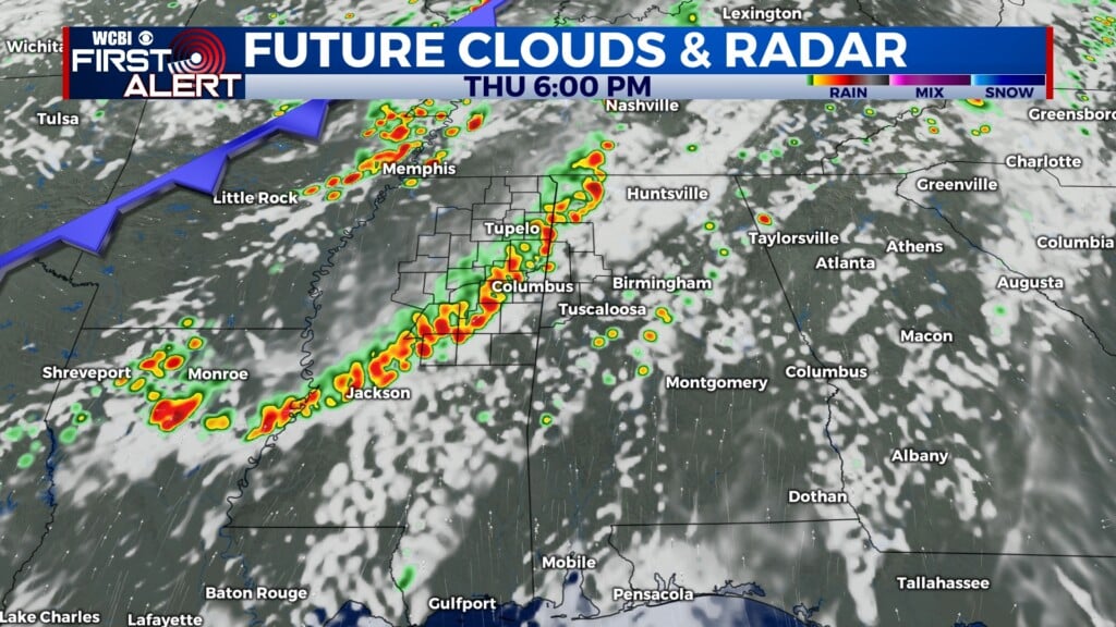
MONDAY-THURSDAY: Showers will linger through early morning Monday, but most of Monday will be dry with clouds slowly exiting by the evening. Tuesday looks dry and partly cloudy but more rain is possible through the day on Wednesday. Temperatures will remain cool next week with highs in the 40s and 50s and lows in the 20s and 30s.
Follow WCBI Weather on Facebook, Twitter, and Instagram
Follow Meteorologist Trevor Birchett on Facebook and Twitter


Leave a Reply