Cooler Friday followed by warmer Saturday
SUMMARY: More sunshine than clouds can be expected over the next week along with the return of cooler fall-like temperatures. Our only chance of showers will come on Sunday with another passing cold front. No major systems or severe weather is in the forecast anytime soon.
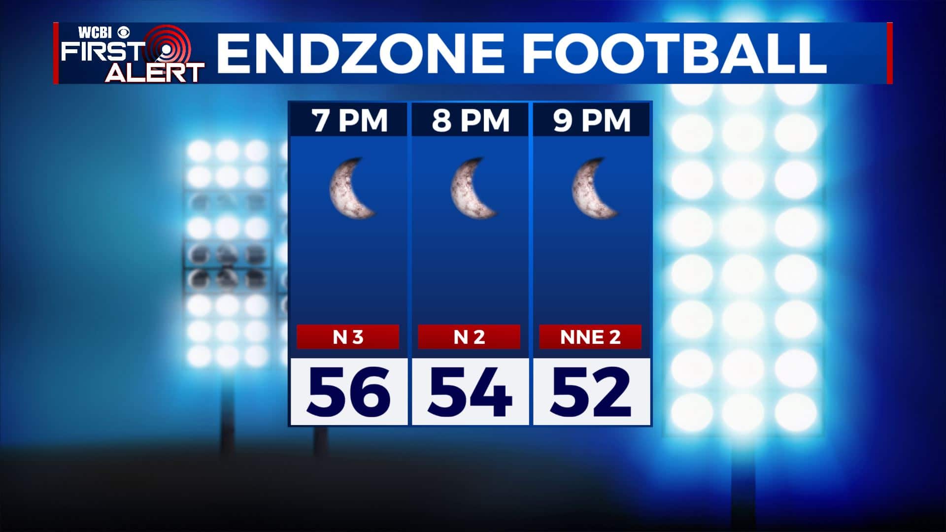
FRIDAY: We’re waking up to clouds early this Friday morning as a weak cold front is pushing through north Mississippi and west Alabama. It will be turning mostly sunny by the afternoon. Highs will only top out in the upper 60s. Winds a bit breezy coming from the NW at 5-15 mph. Going to be good weather for Friday night football, but keep those jackets handy as temperatures fall back into the 50s.
FRIDAY NIGHT: Mostly clear skies, cool and quiet. Overnight lows in the mid to low 40s.
SATURDAY: A mix of sun & clouds. Highs in the lower to mid 70s as our winds switch up to the SE 5-10 mph.
SATURDAY NIGHT: Increasing clouds with rain showers possible by sunrise Sunday morning. Overnight lows in the 50s.
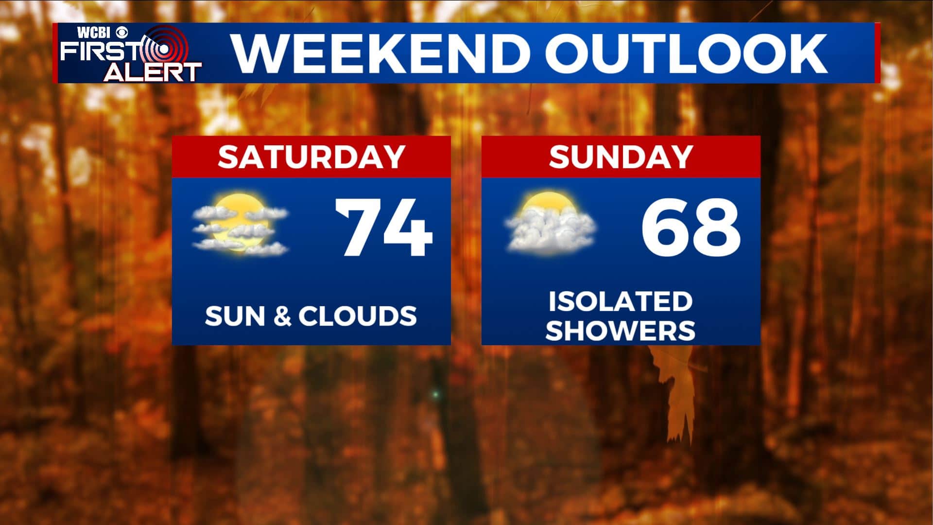
SUNDAY: Mostly cloudy some afternoon and evening showers are possible early Sunday with another cold front pushing through the region. Highs in the upper 60s.
SUNDAY NIGHT: Clear skies and chilly. Lows in the upper 30s.
EARLY NEXT WEEK: We’ll be dry, quiet and mostly sunny Monday into midweek. Temperatures will cool down once again with highs only in the mid to upper 60s. Chilly overnight lows in the 30s and 40s.
Stay connected with @WCBIWEATHER on Facebook, Twitter, Instagram, and the WCBI News App


Leave a Reply