Cold front pushing through for our Wednesday
SUMMARY: It’s a misty & rainy Wednesday as a cold front pushes through the region. The 70s are slated to remain in place through the upcoming weekend but some days and nights will be warmer than others. Another front could spark more showers Sunday and bring back in cooler fall air next week.
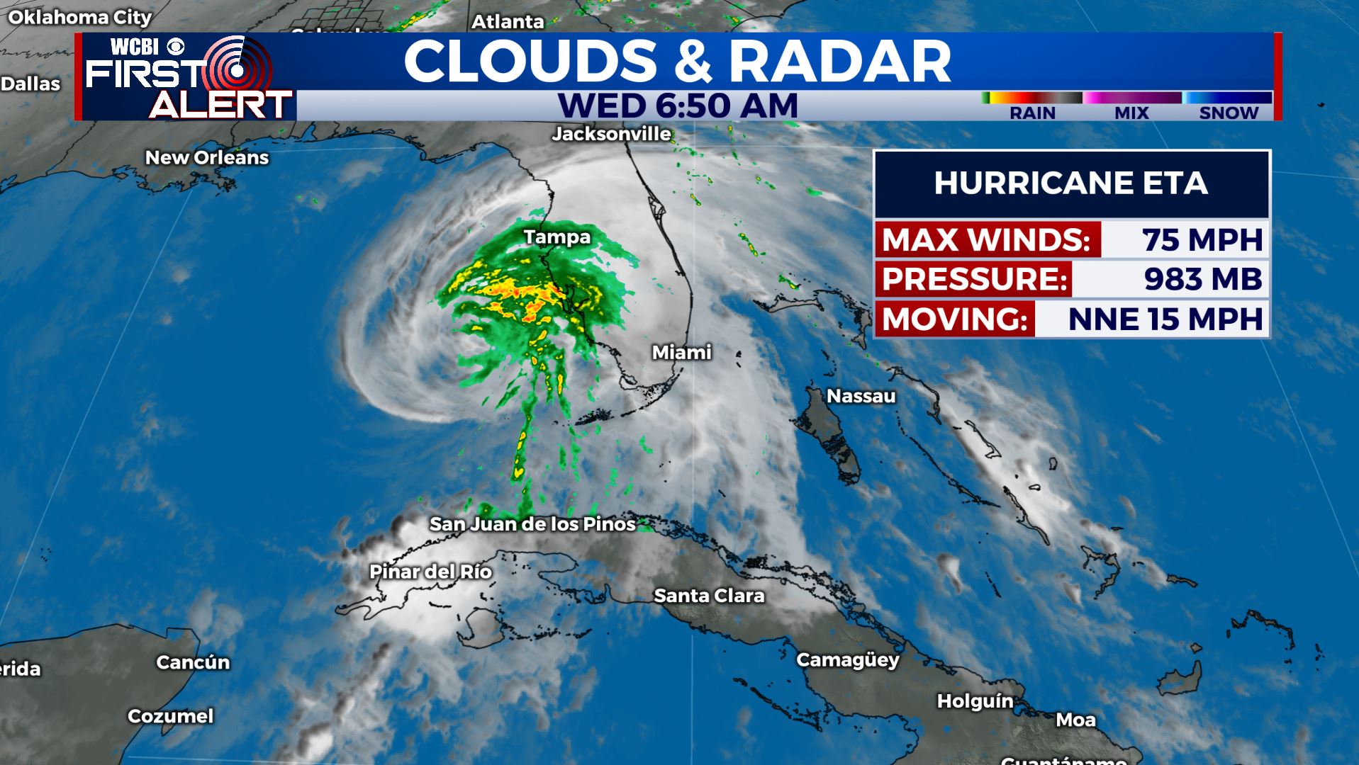
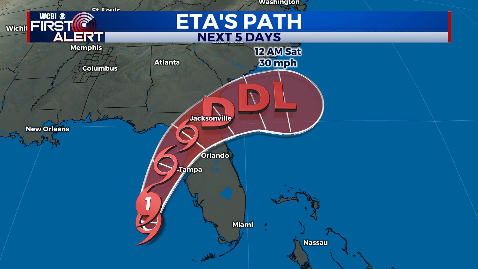
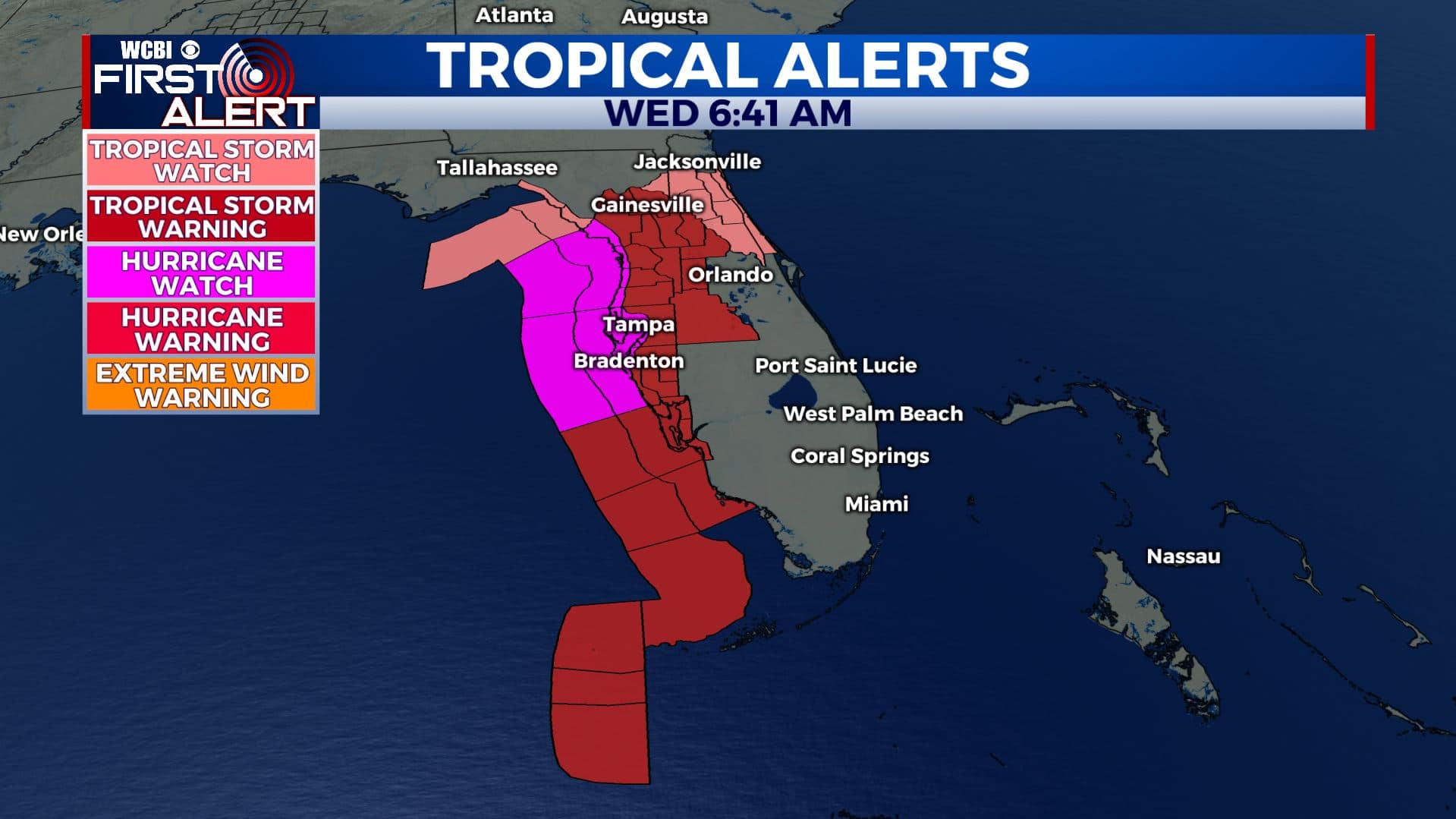
TROPICS: Our cold front that is pushing through the WCBI Viewing Area will also play a role in Eta‘s track as it makes a second Florida landfall over the next 24 hours. It’s now a Category 1 Hurricane again with winds at 75 mph. Tropical Storm Warnings and Hurricane Watches are in effect for Florida’s west coast. It’s possible that some of its moisture could make its way here but recent data suggest that may not be the case.
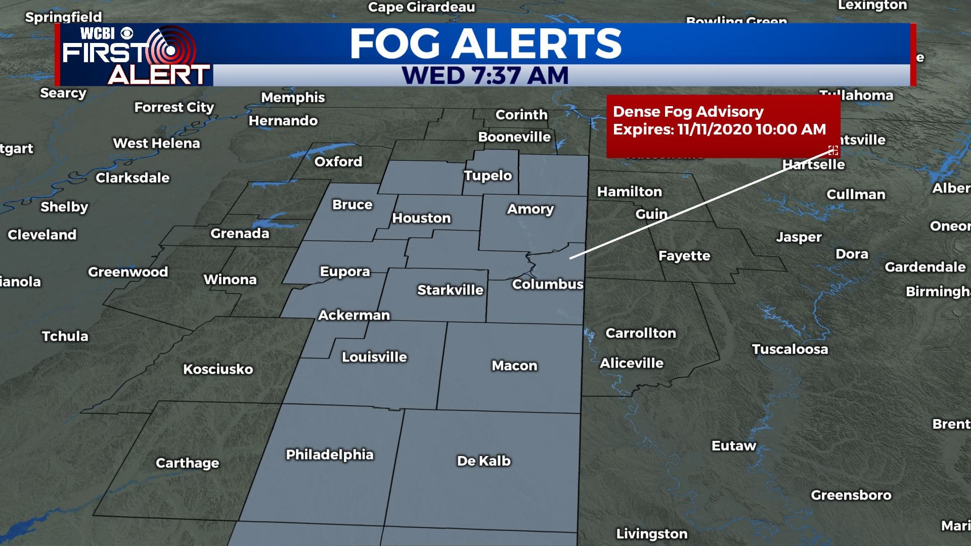
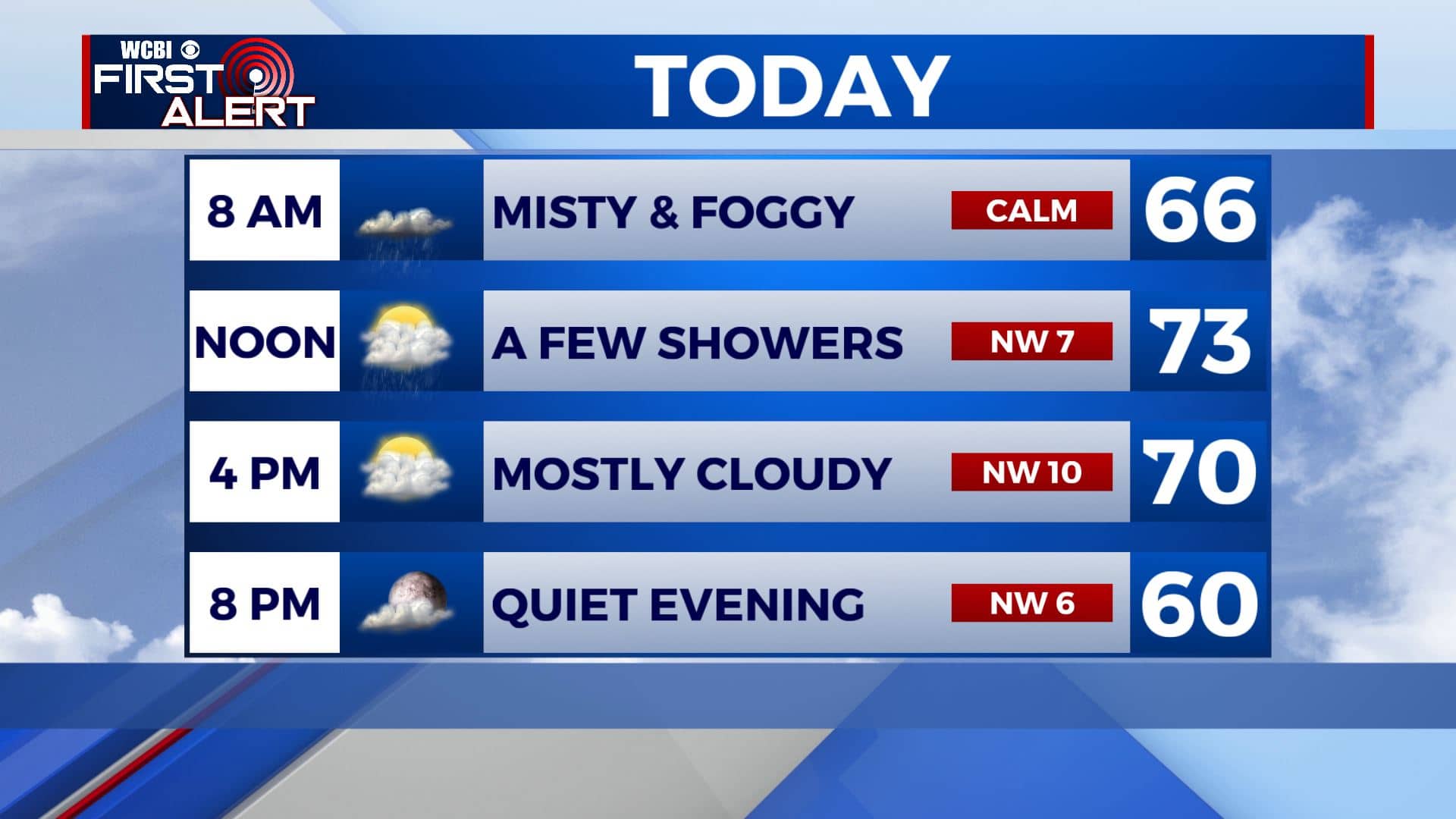
WEDNESDAY: A Dense Fog Advisory is now in effect from now through 10am. This does include the cities of Tupelo & Columbus. Visibility one quarter mile or less could cause hazardous driving conditions due to low visibility. Morning showers, fog and mist will give way to much better conditions by the afternoon and evening once the cold front pushes through north MS & west AL and skies clear up. Highs will be mild ahead of the front in the lower to mid 70s then dropping to the 60s as a NW wind kicks in behind it.
WEDNESDAY NIGHT: Partly cloudy and cooler. Lows in the upper 40s to lower 50s.
THURSDAY-FRIDAY: We’ll see a mix of sun & clouds as we end the workweek. High temperatures in the lower to mid 70s. Overnight lows will be cooler in the mid 40s to near 50 degrees.
WEEKEND: Look for well above normal temperatures in the 70s. Saturday is going to be dry with a mix of sun and clouds but some afternoon and evening showers are possible Sunday with an approaching cold front.
MONDAY-TUESDAY: Any rain we receive will exit by Sunday night, leaving us dry and mostly sunny by Monday into Tuesday. Temperatures will cool down once again with highs only in the upper 60s.
Stay connected with @WCBIWEATHER on Facebook, Twitter, Instagram, and the WCBI News App


Leave a Reply