A warm & decent Friday & weekend ahead
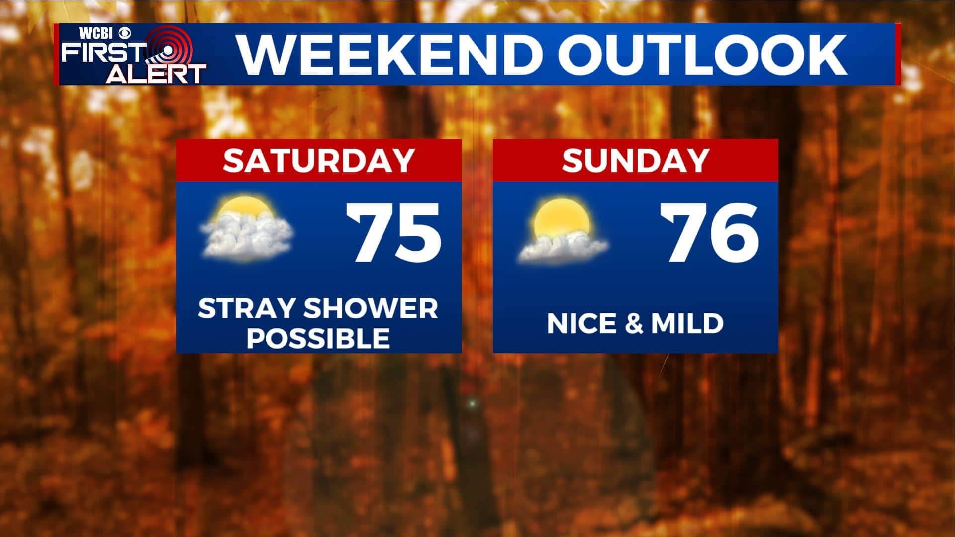
SUMMARY: The weekend is almost upon us. Mild fall air is slated to continue into next week. Rain chances will remain low but a stray shower can’t be ruled out on Saturday. Higher odds will wait until the middle to end of next week.
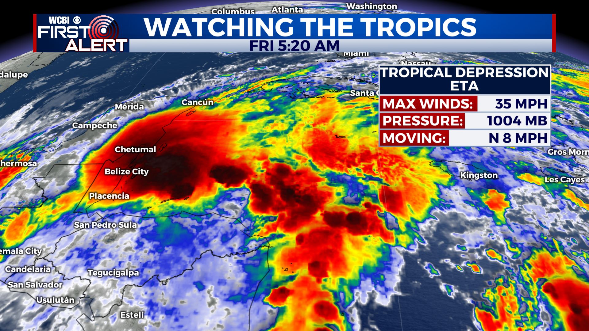
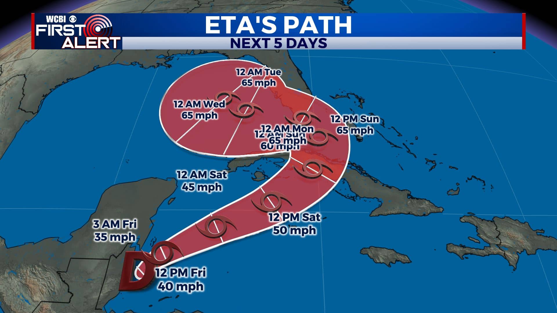
TROPICS: We’re continuing to watch Eta this morning as it’s now over the Caribbean & moving towards Cuba. Should strengthen back to a Tropical Storm this weekend and bring rain & gusty winds to South Florida early next week. We’ll see what this storm will do as it gets into the Gulf!
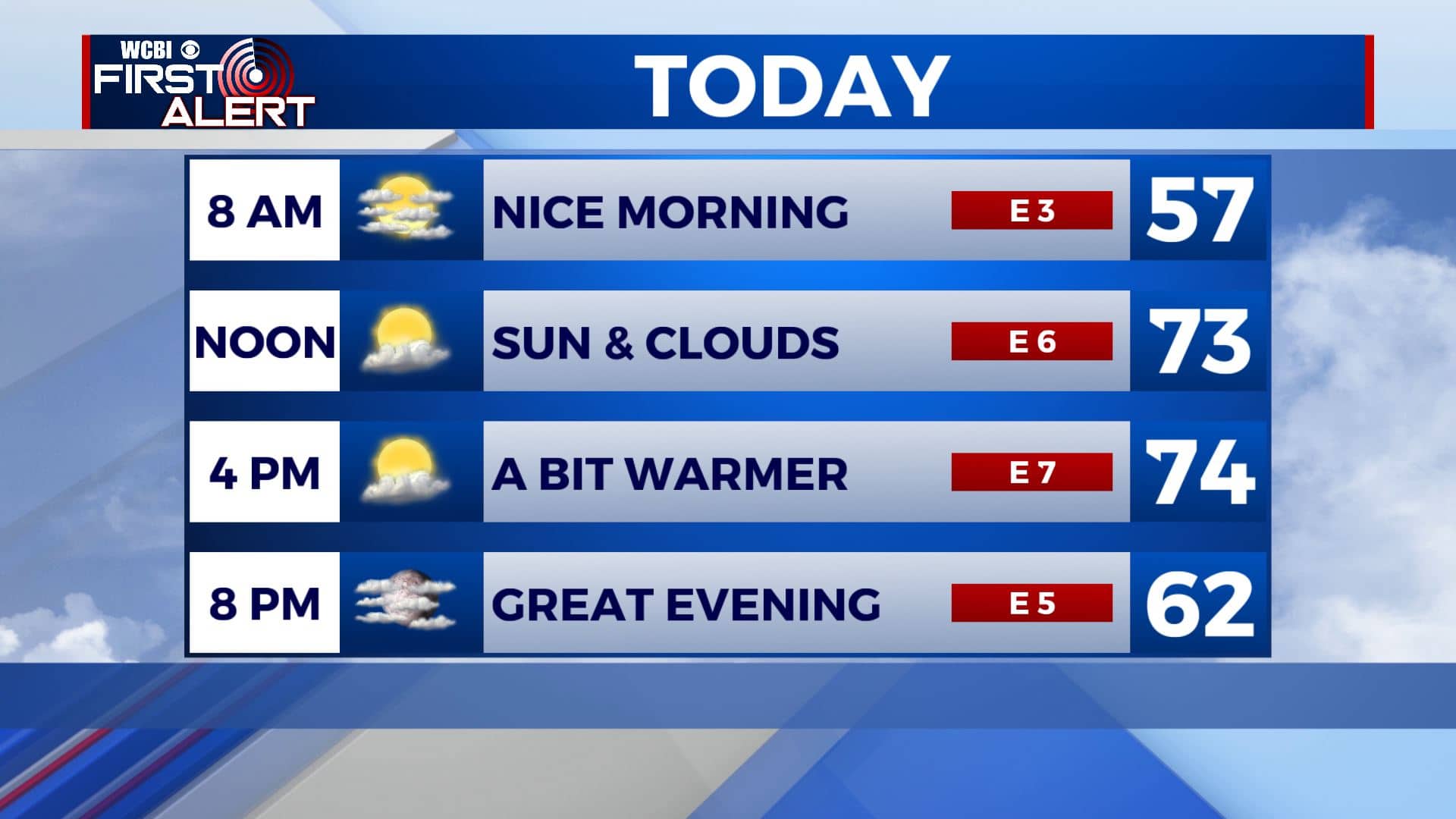
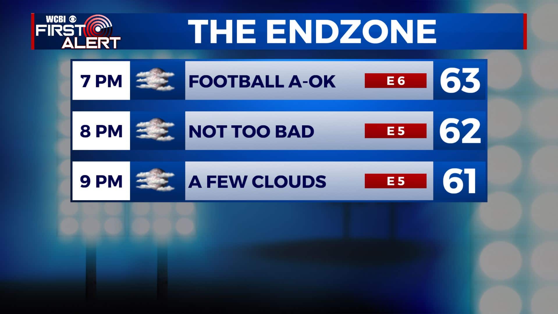
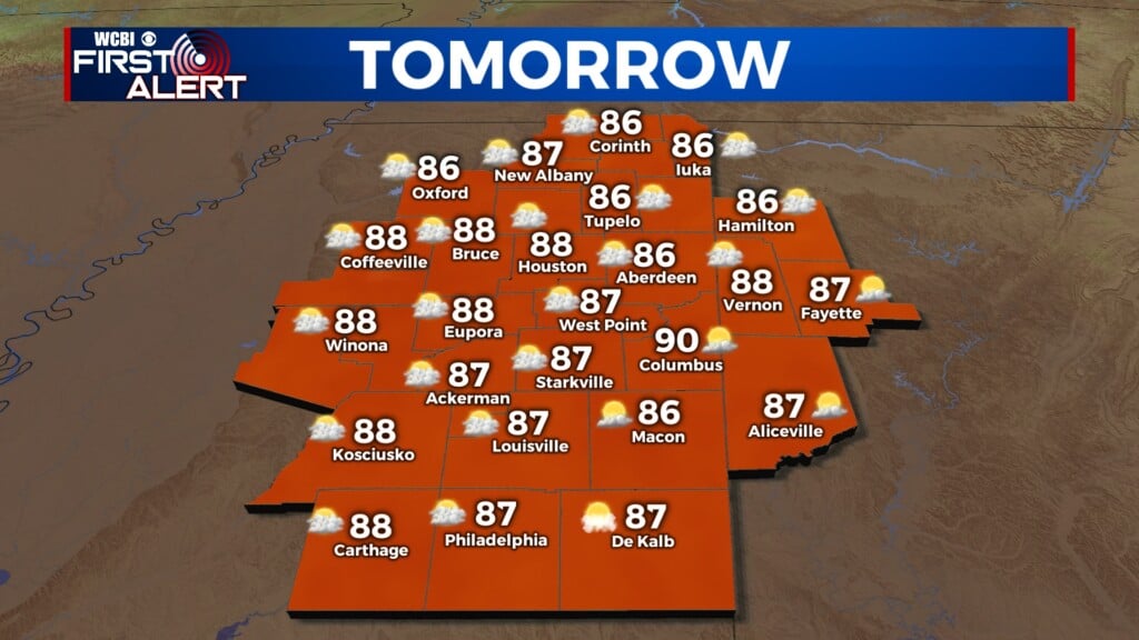
FRIDAY: Expect a decent end to the workweek for your Friday as we’ll have sunshine & a few clouds. High temperatures continue to warm up into the mid 70s. Evening temperatures in the 60s making for a nice night for high school football. You’re welcome!
FRIDAY NIGHT: A few clouds. Overnight lows in the 50s.
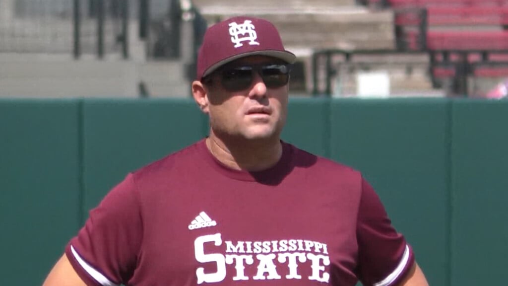
SATURDAY: Partly to mostly cloudy skies. Just a very slight chance of a stray shower as tropical moisture from the Gulf tries to make it up here. Highs remain mild in the mid 70s. Conditions should be pretty good for the MSU game in Starkville during the afternoon. Overnight lows around 60 Saturday night.
SUNDAY: Looking mostly dry with a mix of sun & clouds. Overall, we’re not expecting much to ruin any outdoor plans. Temperatures continue to warm up into the mid to upper 70s for highs
MONDAY-TUESDAY: A mix of sun & clouds and mild. Highs in the upper 70s with overnight lows in the 50s. A chance of a few showers by Tuesday night.
WEDNESDAY – THURSDAY: A mix of sun & clouds with a chance of showers as our next cold front pushes through. We’ll also need to see if any moisture from Eta can get here. Highs stay in the 70s with lows in the low 60s.
Stay connected with @WCBIWEATHER on Facebook, Twitter, Instagram, and the WCBI News App


Leave a Reply