Temperatures continue to warm up & the weather stays dry
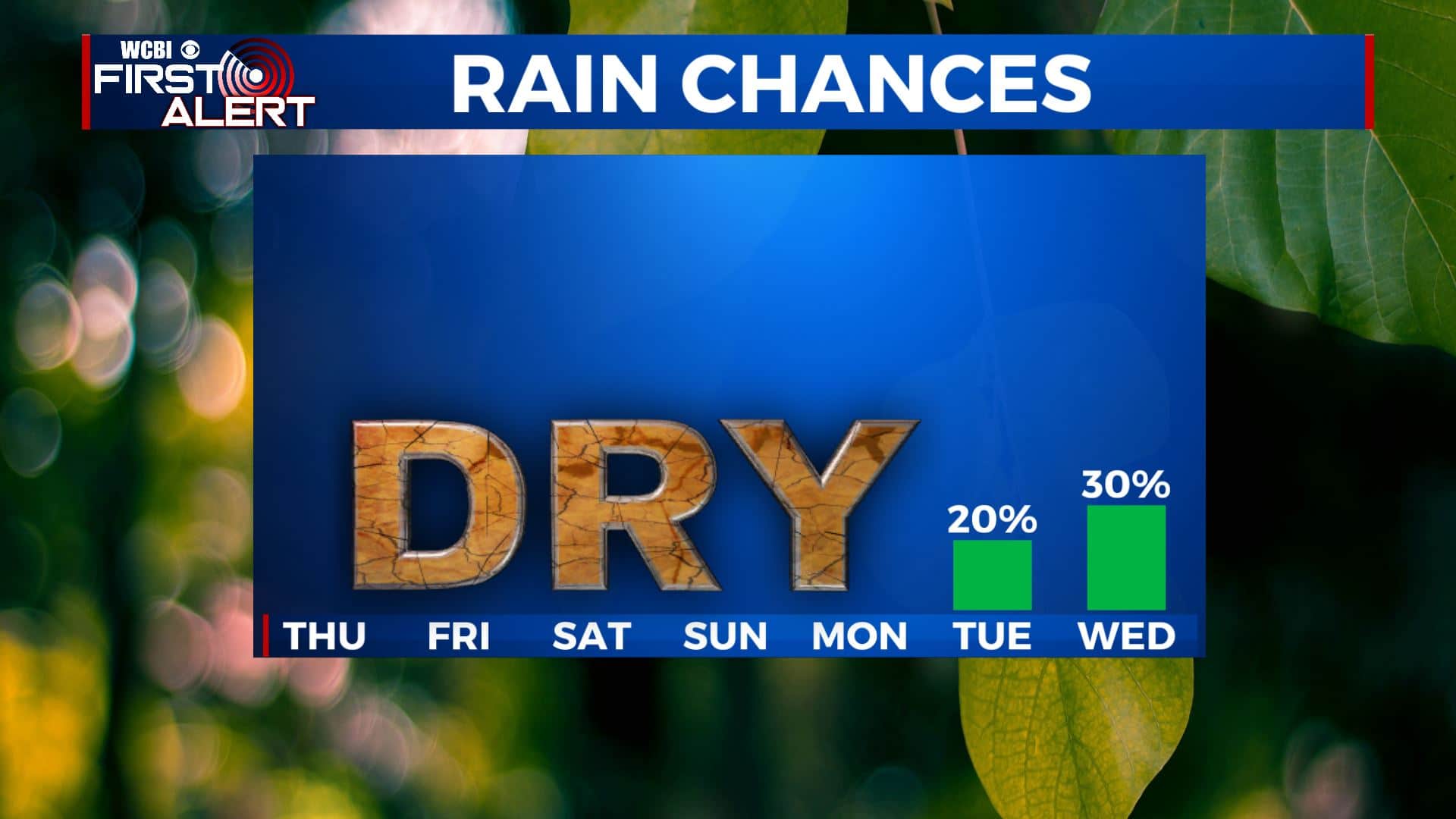
SUMMARY: Clouds will be moving into the region and mixing in with the sunshine heading into the weekend. The quiet weather pattern is here to stay through early next week. Look for seasonably mild air to continue at least through next Tuesday. Some rain is possible by midweek as our next cold front pushes into the region.
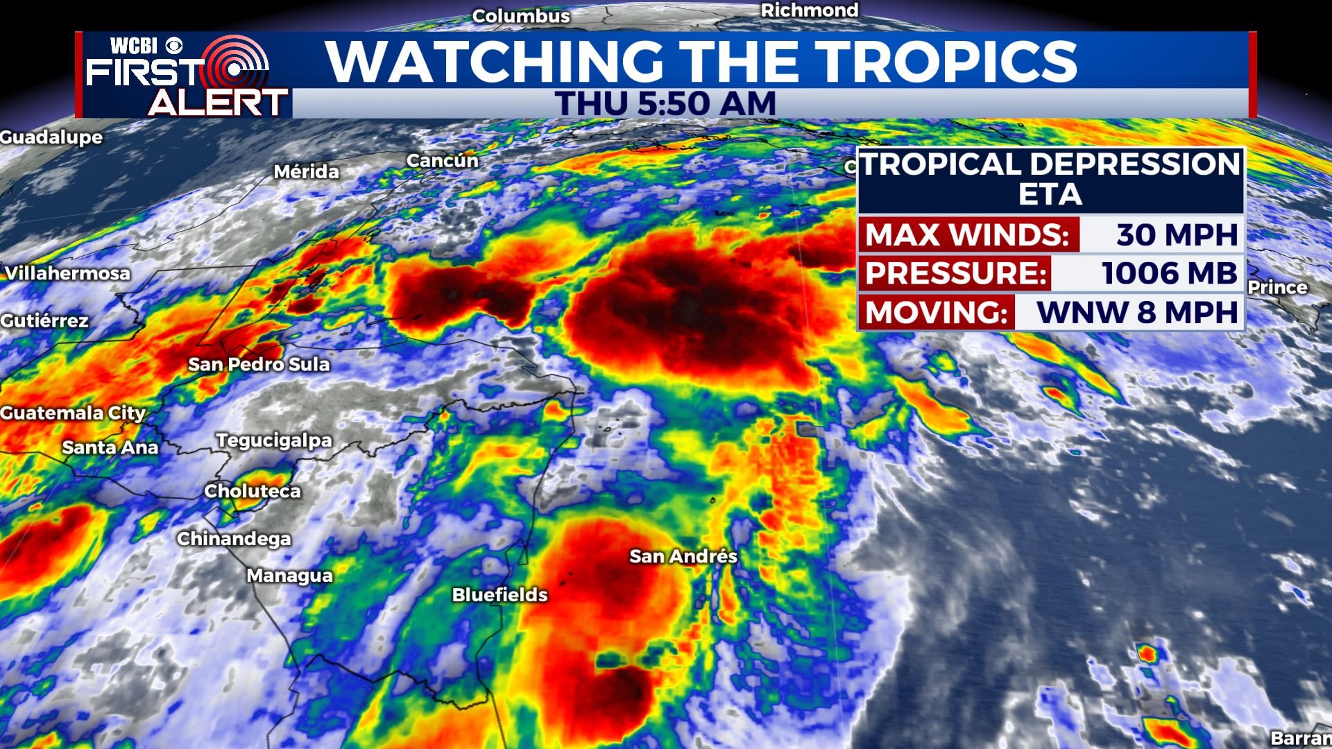
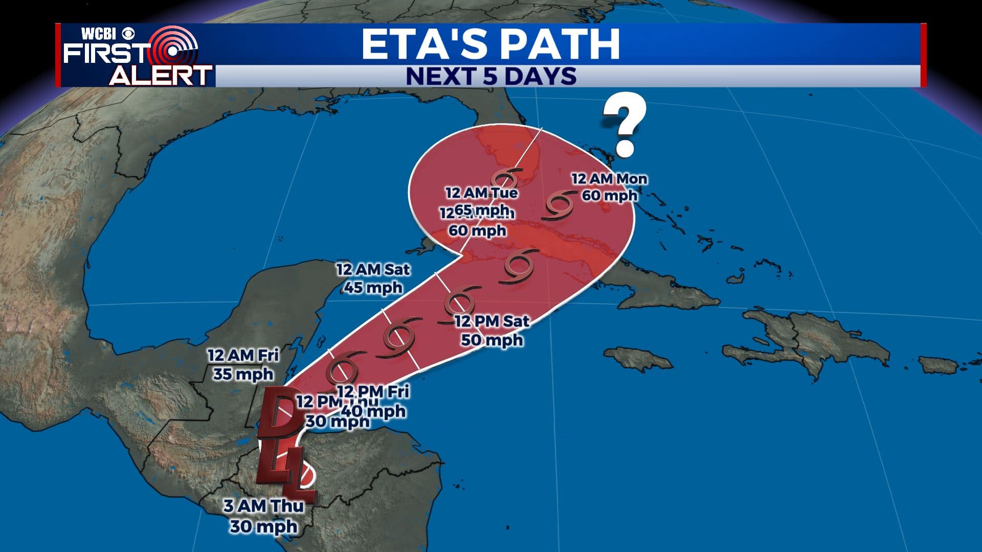
TROPICS: Eta is a Tropical Depression this Thursday morning. Still forecast to move back into the Caribbean this weekend & strengthen back into a strong Tropical Storm. Will probably bring some effects to Cuban and South Florida early next week. We’ll continue to watch it. The latest data suggest it will not be a factor in our region but we’ll keep watching.
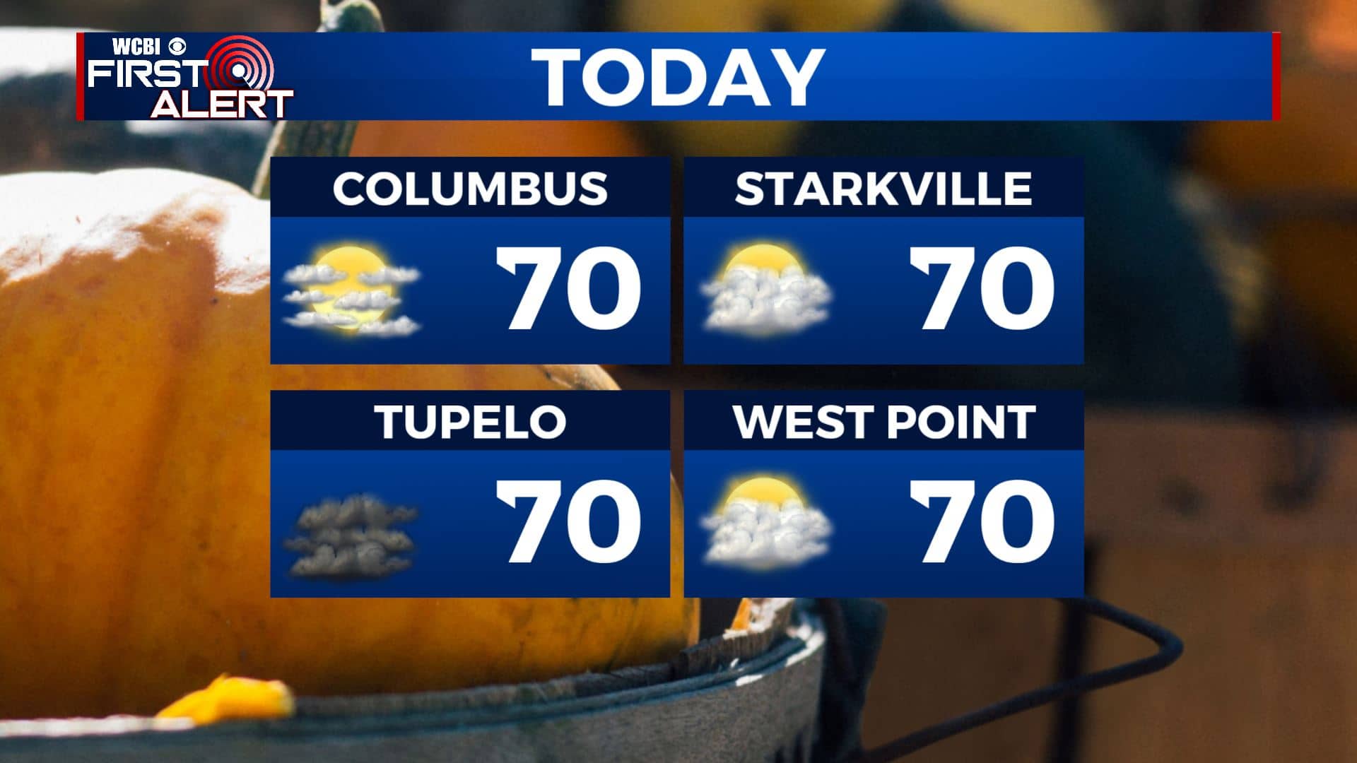
THURSDAY: We’re waking up to clouds moving in this Thursday morning, we’ll have a mix of sun & clouds throughout the day. A light SE wind will allow temperatures to stay seasonably mild in the upper 60s to near 70 degrees for highs.
THURSDAY NIGHT: Mostly clear skies. Overnight lows in the upper 40s.
FRIDAY: Mostly sunny skies as we end the workweek. Looking great for those Friday night high school football games. High temperatures continue to warm up into the mid 70s.
WEEKEND: The weekend looks mostly dry with a mix of sun & clouds both Saturday & Sunday. Overall, we’re not expecting much to ruin any outdoor plans. Temperatures continue to warm up into the mid to upper 70s for highs.
EARLY NEXT WEEK: A mix of sun & clouds and mild. Highs in the 70s with lows in the 50s. A chance of a few showers by Tuesday.
Stay connected with @WCBIWEATHER on Facebook, Twitter, Instagram, and the WCBI News App


Leave a Reply