First freeze of fall likely in some areas tonight
A cold front that passed through the area Sunday morning will bring in much colder air to start off the week. Temperatures will be near or just below freezing in many spots Monday morning, but temperatures will slowly warm through the week. Rain chances remain slim to none.
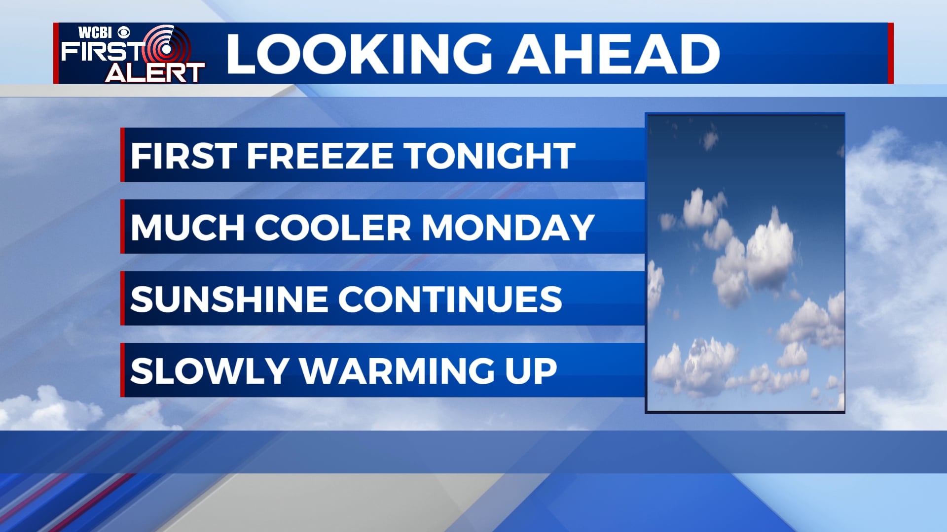
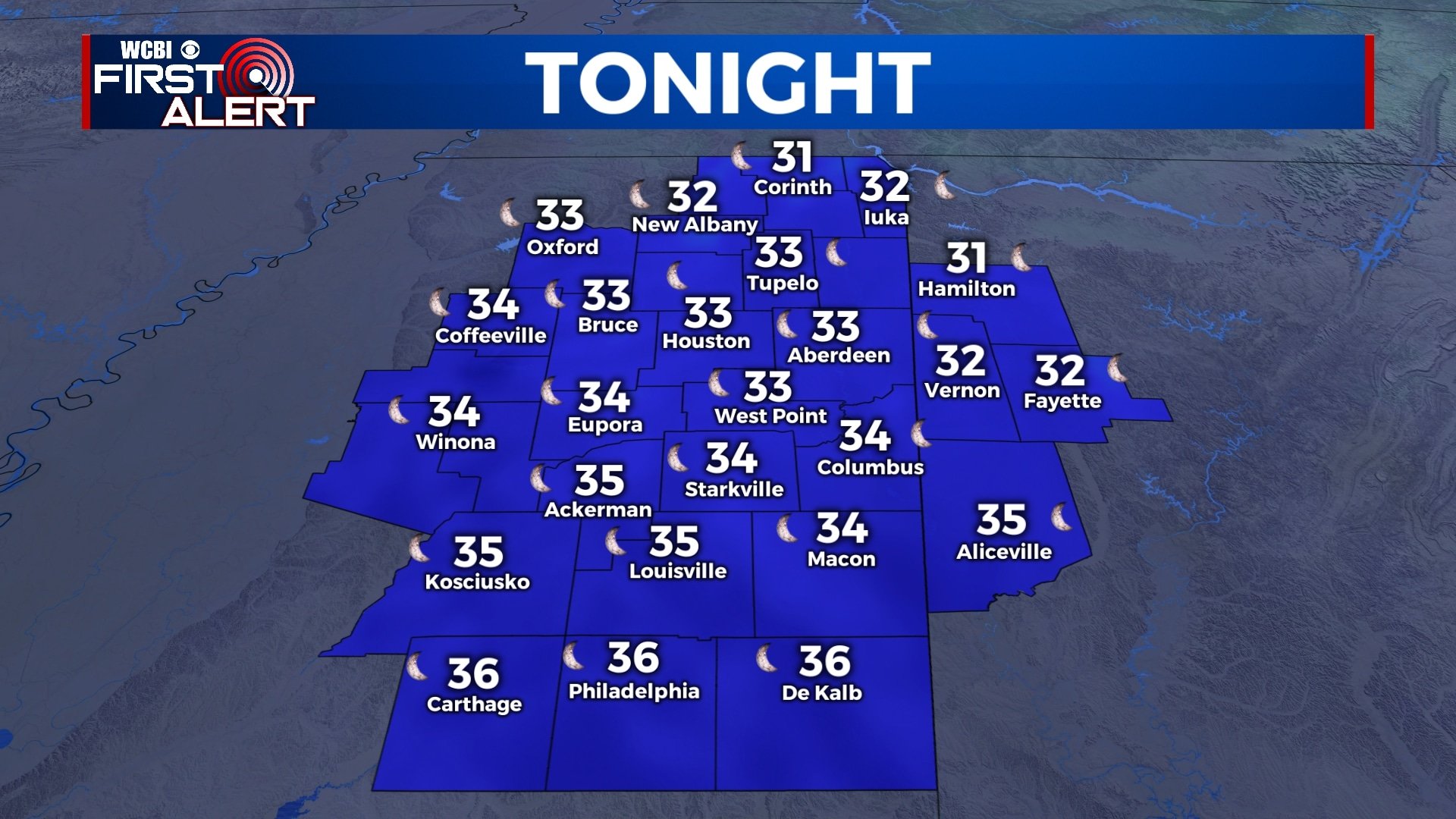
SUNDAY NIGHT: Skies will remain mostly clear overnight, allowing our temperatures to drop quickly. Lows will be in the mid 30s within the city, but temperatures will likely fall to below freezing north of Highway 82 and in outlying areas. Northerly winds will continue at 5 to 10 mph.
MONDAY: Monday will start off on a cold note, and we’ll remain chilly through the day. Highs will only be in the mid 50s across the area with plenty of sunshine.
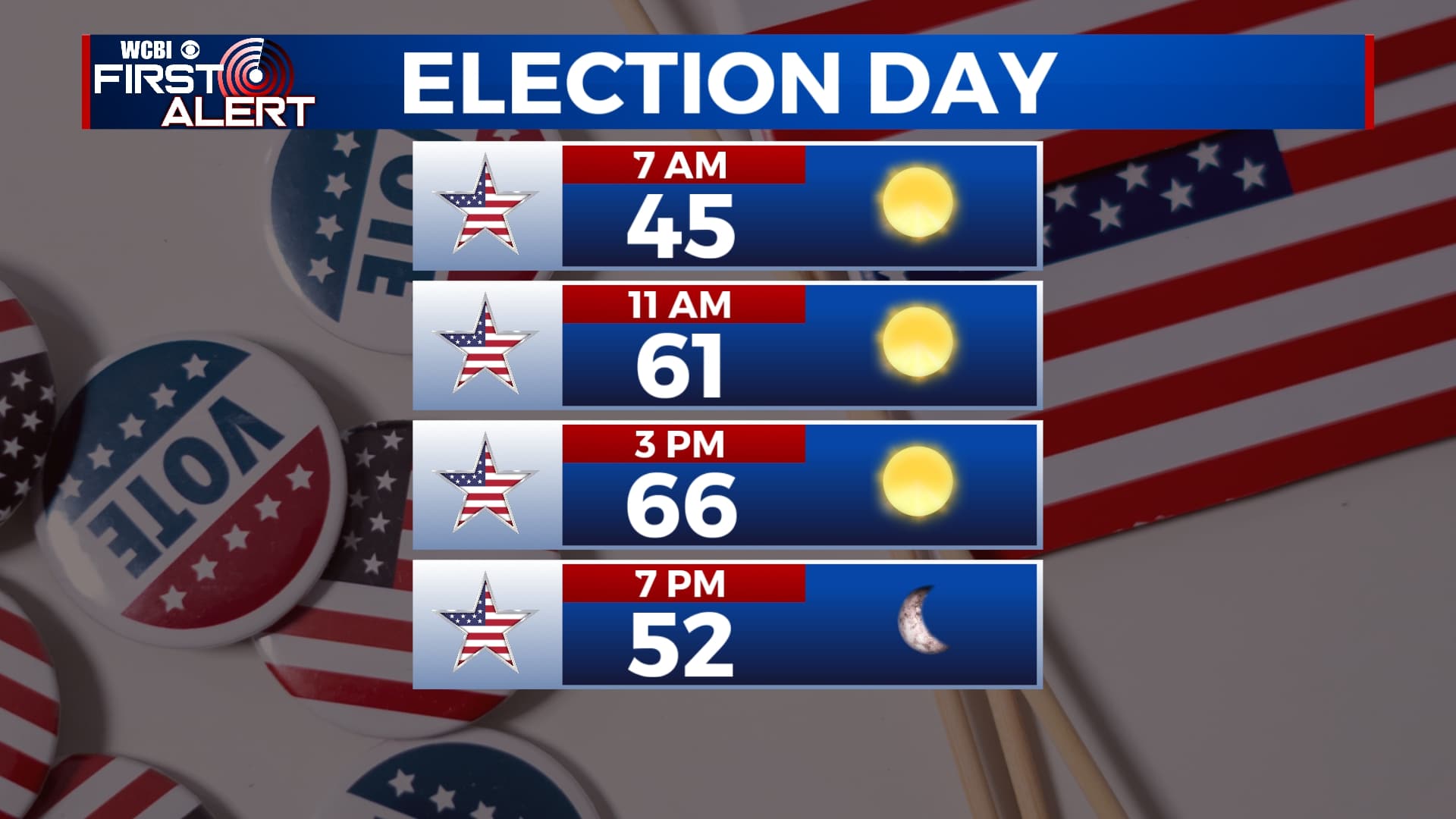
TUESDAY: Nice weather will continue for Election Day with blue skies, sunshine, and chilly temperatures. We’ll start off in the low to mid 30s in the morning, but afternoon highs will be back into the mid 60s.
WEDNESDAY-FRIDAY: Temperatures will slowly increase for the second half of the week with highs in the low to mid 70s. However, morning lows will still be chilly with temperatures starting off in the 40s. Skies will remain mostly sunny on Wednesday, with a mix of sun and clouds for Thursday and Friday.
SATURDAY-SUNDAY: While the weekend looks mostly dry, a sprinkle or shower is possible in a few locations. Overall, we’re not expecting enough rain to ruin any outdoor plans. We’ll remain under a mix of sunshine and clouds with afternoon highs in the mid 70s.
Follow WCBI Weather on Facebook, Twitter, and Instagram
Follow Meteorologist Trevor Birchett on Facebook and Twitter


Leave a Reply