Zeta Passes Tonight, Lots of Sun Coming
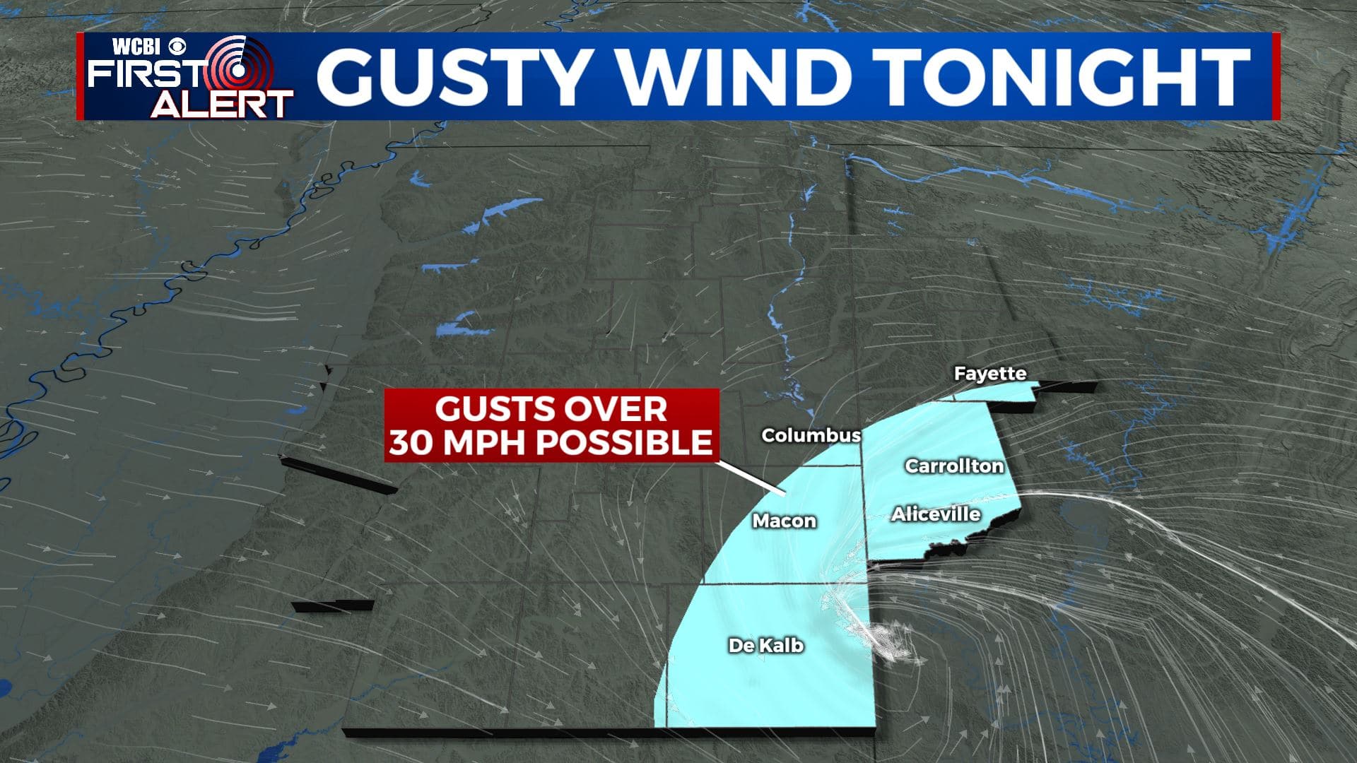
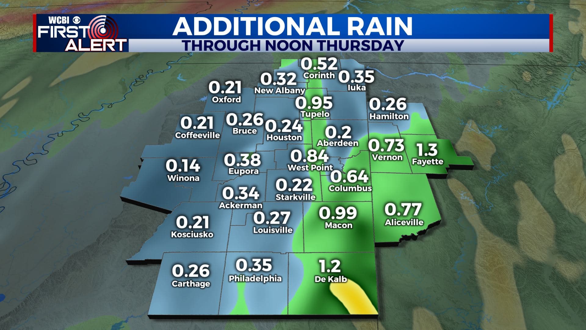
HURRICANE ZETA: The remnants of Zeta will swirl through the region tonight. The center of the system should track right along the I-20/59 corridor putting our area on the less active side. We don’t envision too many local impacts but some gusts over 30 mph are possible east and south of Columbus from about 10 p.m. through 2 a.m. This is also the same area where an additional 1-2″ of rain could fall. Lighter winds and rain amounts can be expected elsewhere.
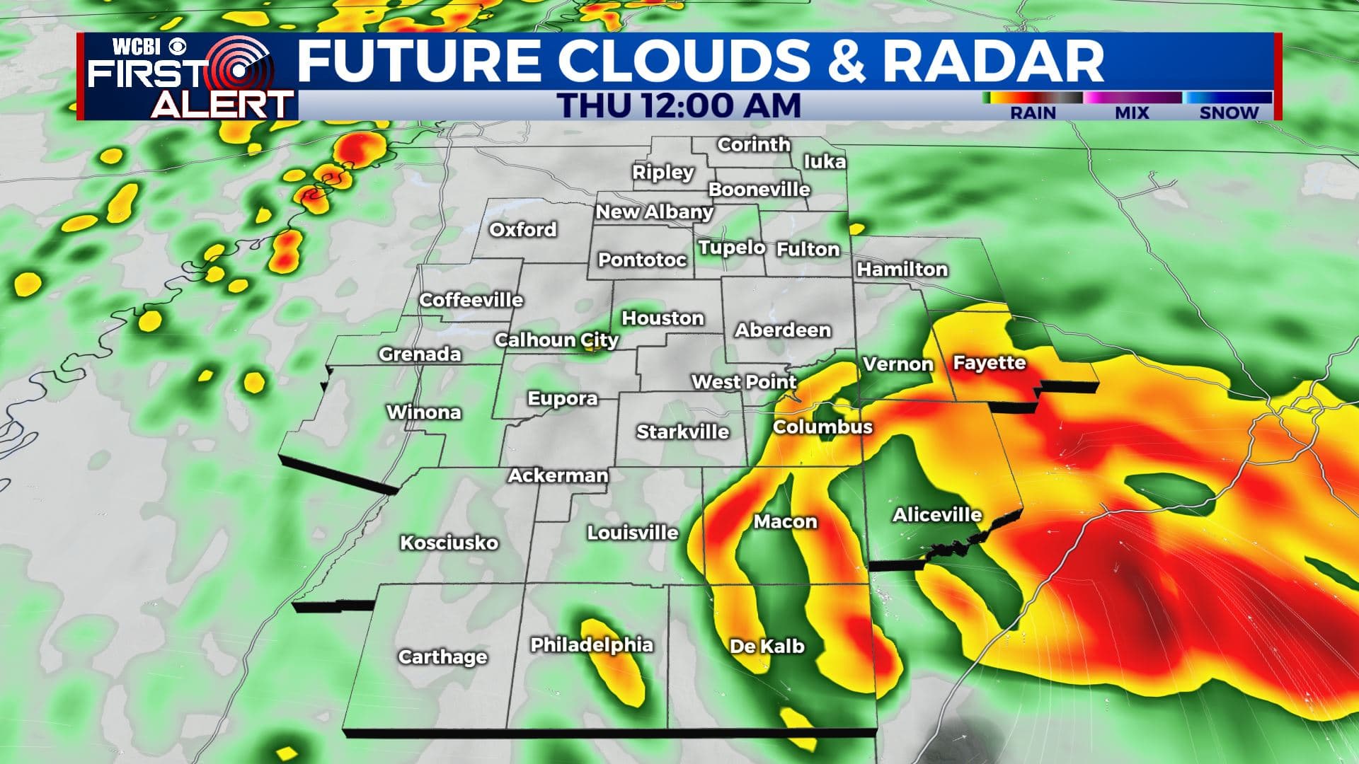
TONIGHT: Areas of rain and wind. The heaviest rain and strongest wind will generally be east and south of Columbus. Evening temperatures will hold steady in the 70s but they’ll cool into the mid 60s by sunrise. Winds 10-20 with gusts over 30 mph in the southeast.
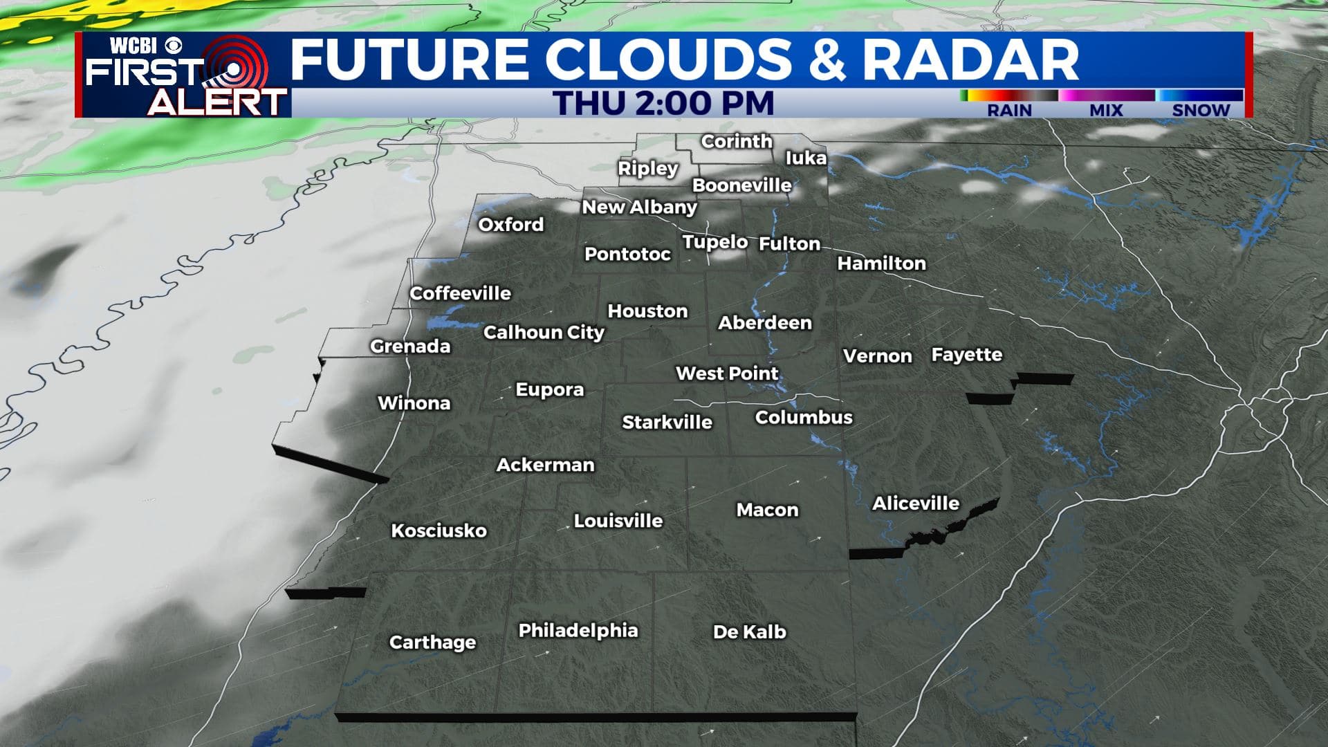
THURSDAY: Morning clouds and lingering showers. A fair amount of sun will briefly take over by early afternoon. Cooler temperatures in the 60s and 50s with breezy SW winds 10-25 mph.
THURSDAY NIGHT: Mostly cloudy. Cooler lows in the upper 40s.
FRIDAY: Gradual clearing and cooler. Highs only in the low 60s.
FRIDAY NIGHT: Clear, cool, and quiet. Lows in the low 40s.
HALLOWEEN: No tricks, just treats. Highs around 70 under mostly sunny skies. Early evening temperatures around 60 can be expected for those little ghosts and goblins that may venture out. Lows around 50 Saturday night.
SUNDAY: Mostly sunny. Highs in the upper 60s. Cooler lows in the mid 30s Sunday night.
MONDAY: Sunny & cool. Highs in the upper 50s. Lows in the mid 30s Monday night.
ELECTION DAY: Sunny. Highs in the mid 60s.
Stay connected with @WCBIWEATHER on Facebook, Twitter, Instagram, and the WCBI News App


Leave a Reply