Beautiful Weather Continues This Week
Most everyone will stay dry and sunny through the Labor Day weekend, but a sprinkle can’t be ruled out. We’ll stay hot, humid, and sunny through the middle of the week before temperatures and humidity drop once again.
SATURDAY NIGHT: Mostly clear and calm, lows in the mid to upper 60s. Light winds out of the east.
SUNDAY: Another warm and sunny day as temperatures climb to the low 90s by the afternoon. A quick sprinkle can’t be ruled out, but even that is unlikely. Humidity will start to slowly creep back up, so heat index values could be in the mid 90s by 3pm.
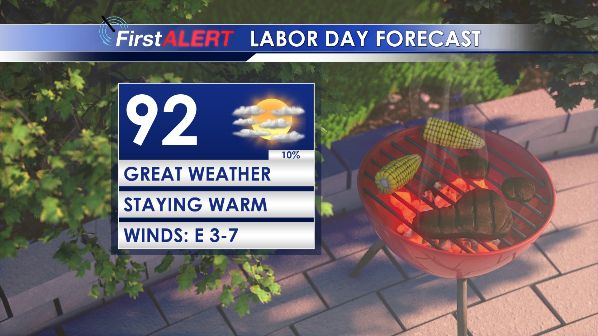
MONDAY: Labor Day will be another warm day with highs in the low 90s. Weather looks great for your cookout or for a dip in the pool as we will see plenty of sun through the day. Grab the sunscreen and enjoy the holiday!
TUESDAY-WEDNESDAY: Warm and muggy weather continues into the middle of the week with highs reaching the mid 90s. We’ll stay dry with plenty of sun.
THURSDAY-SATURDAY: Possibly some of the best weather of the summer will come into our area by the end of the week. Lots of sun and no chances for rain. Highs will be near 90, but humidity will be much lower. This will make for crisp mornings and relatively comfortable afternoons.
TROPICS: Hurricane Dorian has strengthened to a high end Category 4 storm with winds of 150mph as it approaches Florida. At this point, the storm is expected to curve northward and spare Florida a direct impact. Regardless, Dorian will still bring flooding rain, storm surge, and possible wind damage to much of Florida and possibly areas along the East Coast. No impacts to weather in our area are expected.
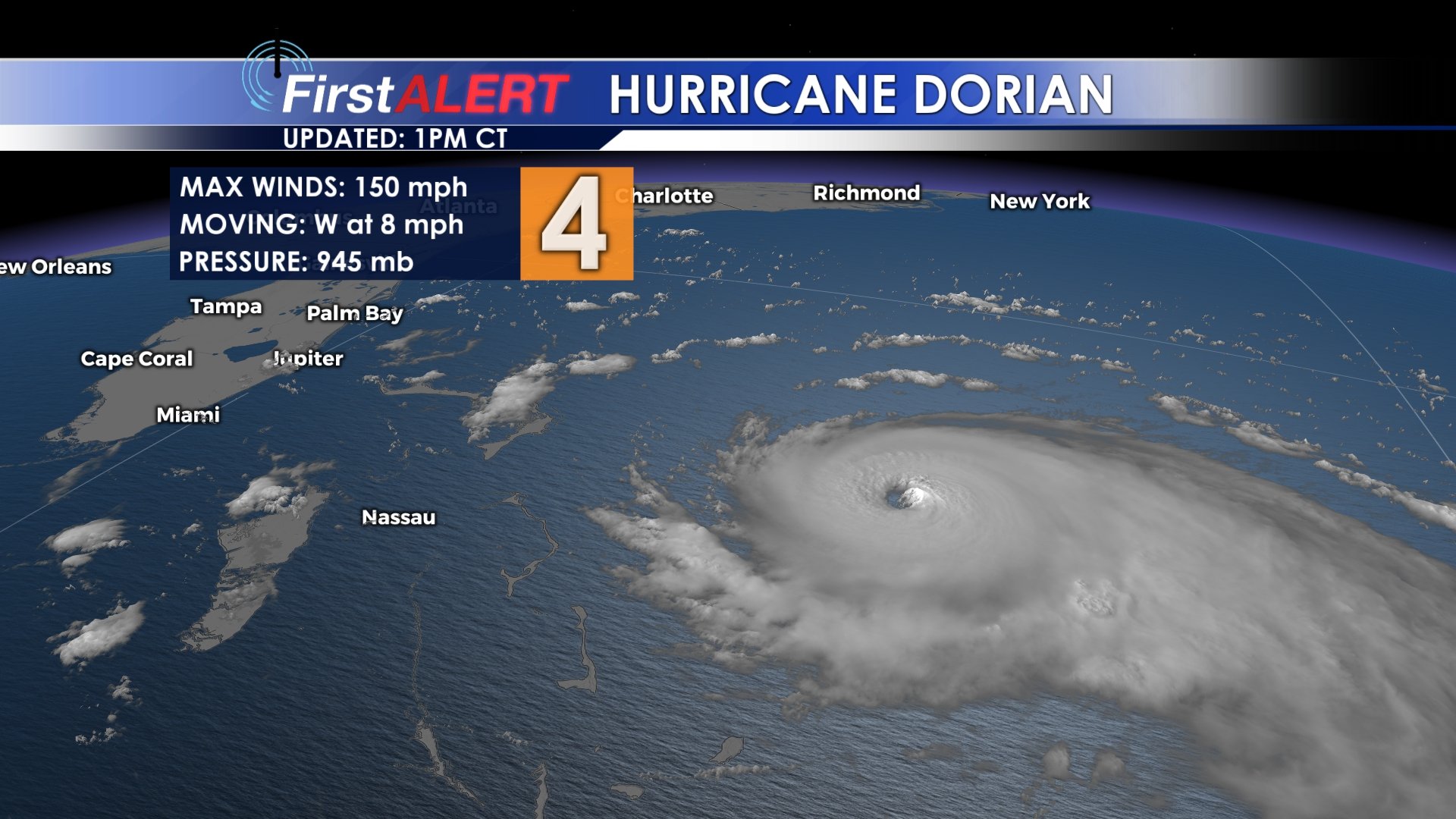
Hurricane Dorian churns in the Atlantic Ocean (2:30pm 8/31)
Follow @WCBIWEATHER on Facebook, Twitter, and Instagram


Leave a Reply