A few isolated showers possible for Tuesday
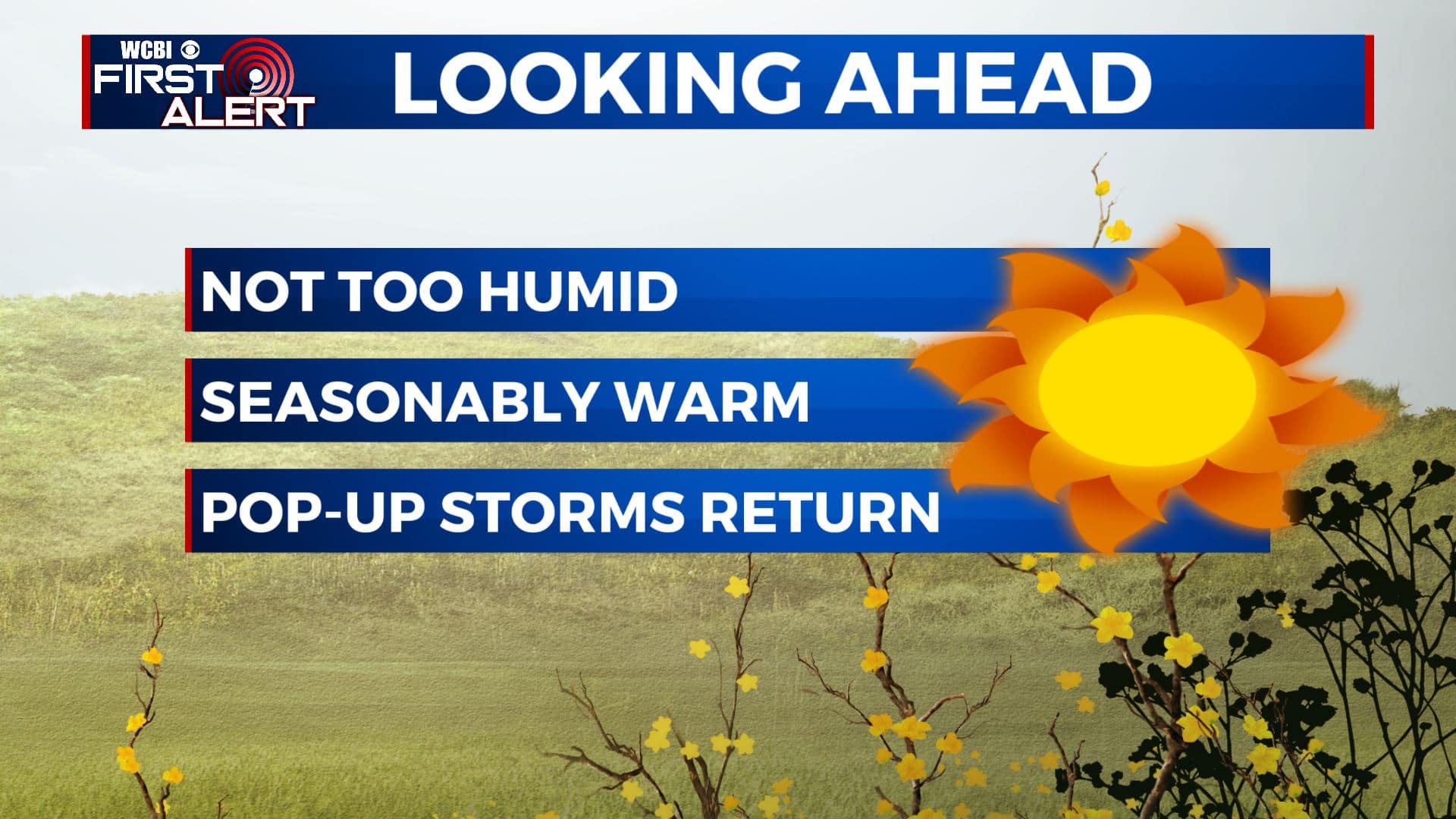
SUMMARY: Conditions will remain seasonably warm over the coming week but it won’t be as bad as it otherwise could be for mid August. A few isolated showers & storms are possible Tuesday with a weak disturbance pushing through. Additional showers and storms are likely later in the week and weekend as humidity levels increase once again.
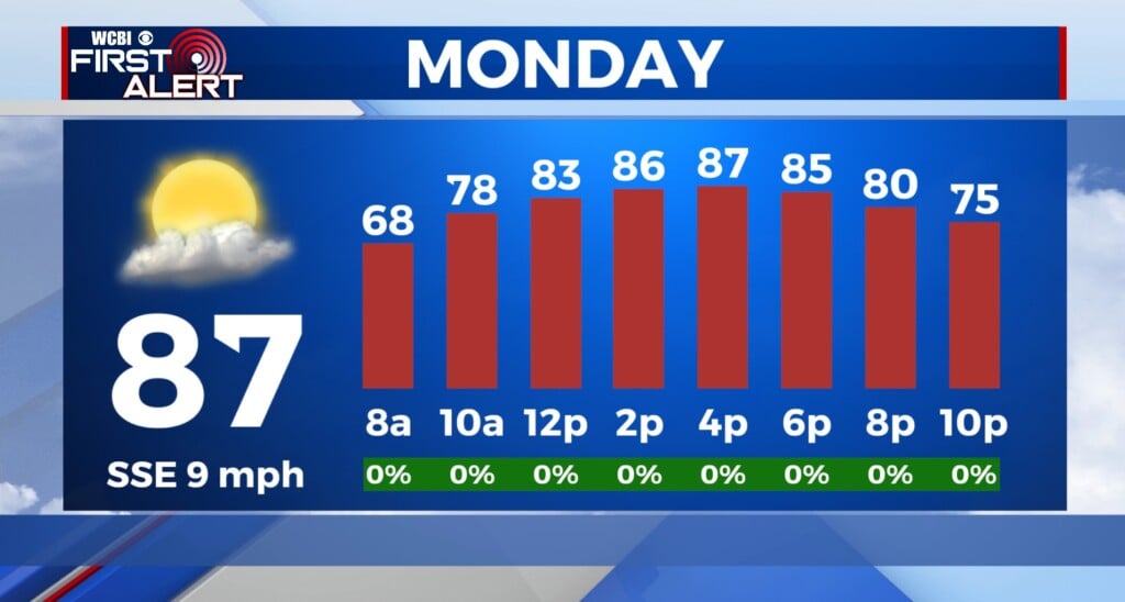
TUESDAY: It’s a nice and comfortable start to our Tuesday as we’re waking up to temperatures in the 60s to near 70. High temperatures will be very warm again today in the lower 90s but humidity values will still be on the low end. A weak disturbance will be passing through north MS and west AL this afternoon. We could see a stray shower or storm, but overall I’m expecting us to stay mostly dry with a mix of sun & clouds. NW light winds.
TUESDAY NIGHT: Mostly clear and quiet. Lows in the mid 60s.
WEDNESDAY: While we’re not expecting any major rain Wednesday, we will have a chance of scattered shower or storm in the afternoon hours. Most of us will stay dry with a mix of sun and clouds. Afternoon highs will be in the upper 80s. Overnight lows in the 60s.
THURSDAY-SUNDAY: Daily chances for pop-up showers and storms make a comeback for the second half of the week and into the weekend. Chances will be scattered, but anyone could see a brief downpour once we get past Thursday. Highs will be in the lower 90s, but the humidity will be making a comeback. Overnight lows will remain in the upper 60s.
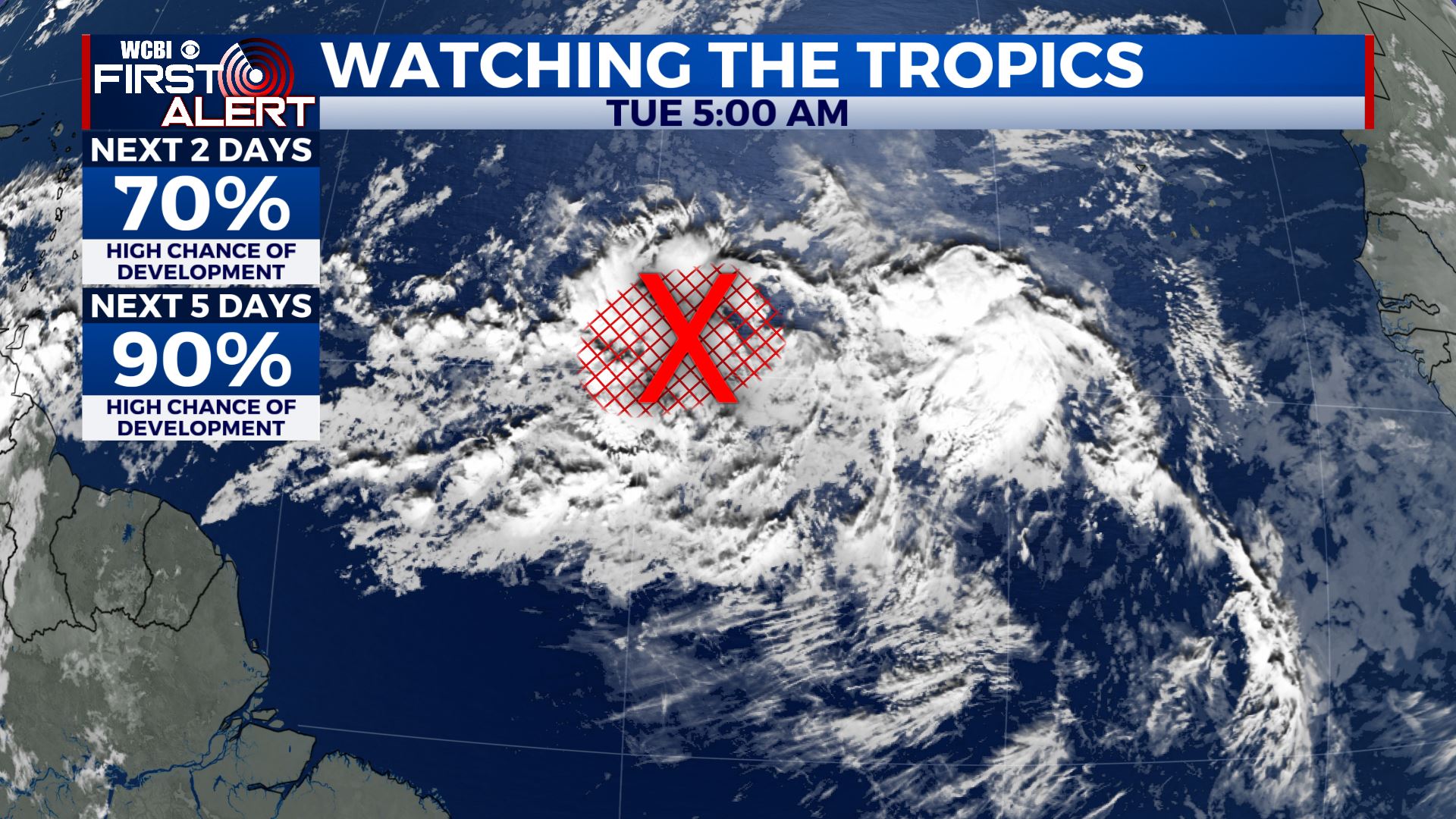
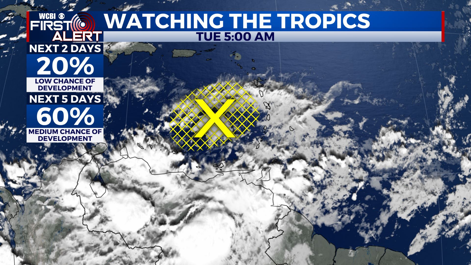
TROPICS: There are two items of interest that need to be watched closely. One is approaching the Caribbean Sea and another one is out in the open Atlantic. Both features are drifting back to the west and could develop over the next few days.
Stay connected with @WCBIWEATHER on Facebook, Twitter, Instagram, and the WCBI News App


Leave a Reply