A sunny & less humid start to the new workweek
SUMMARY: If you have been wanting a break from the summer heat…you’re in luck as we kick off the new week. A cold front pushed through Sunday, leaving us much drier and a little more comfortable. Temperatures will still be warm, but the air will be noticeably less humid. Pop-up rain & storms chances will return to the forecast by mid to late week.
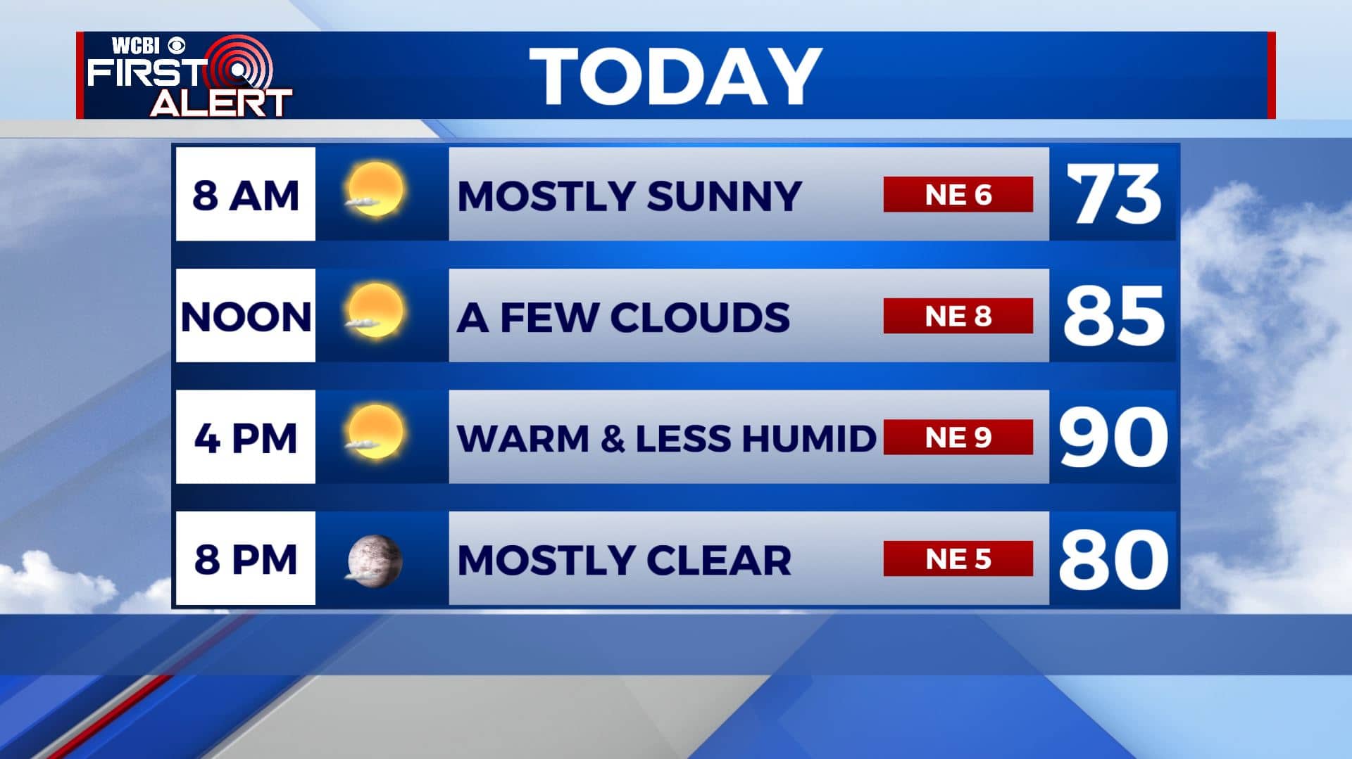
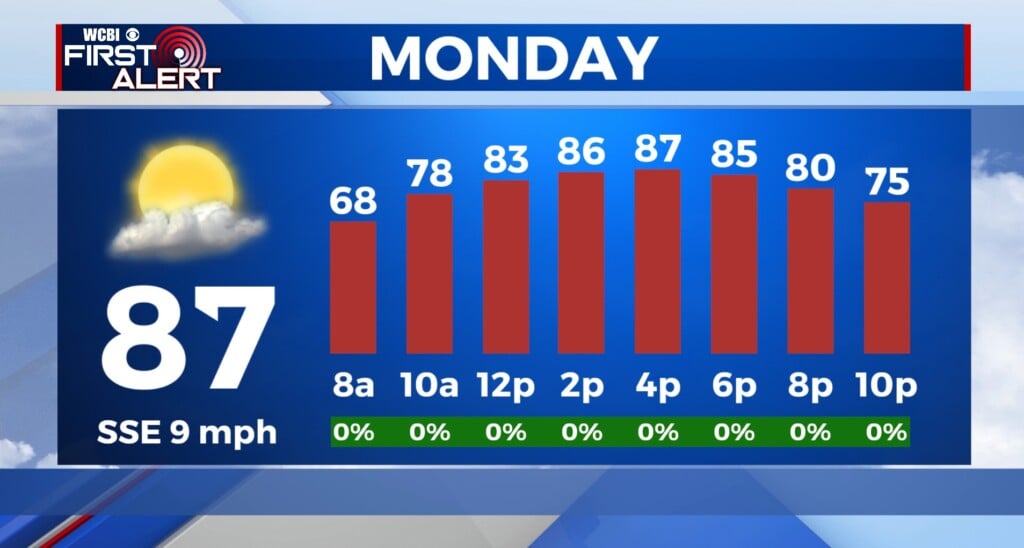
MONDAY: We’ll have mostly sunny skies for your Monday. Temperatures still warm in the upper 80s to lower 90s. But lower humidity levels will make things feel just a bit more comfortable. Enjoy! NE 5-10 mph.
MONDAY NIGHT: Mostly clear skies and quiet. A cool and nice night ahead with overnight lows in the 60s.
TUESDAY: A few more clouds will move in for your Tuesday. But we’ll stay dry and see the sunshine. Temperatures will remain in the lower 90s for highs but low humidity levels will still allow for conditions to remain tolerable to be outside. Overnight lows in the 60s.
WEDNESDAY: While we’re not expecting any major rain Wednesday, we will have a chance of a very isolated shower or storm in the afternoon hours. Most of us will stay dry with a mix of sun and clouds. Afternoon highs will be in the upper 80s. Overnight lows in the 60s.
THURSDAY-SUNDAY: Daily chances for pop-up showers and storms make a comeback for the second half of the week and into the weekend. Chances will be scattered, but anyone could see a brief downpour once we get past Thursday. Highs will be in the lower 90s, but the humidity will be making a comeback. Overnight lows will remain in the upper 60s.
Stay connected with @WCBIWEATHER on Facebook, Twitter, Instagram, and the WCBI News App


Leave a Reply