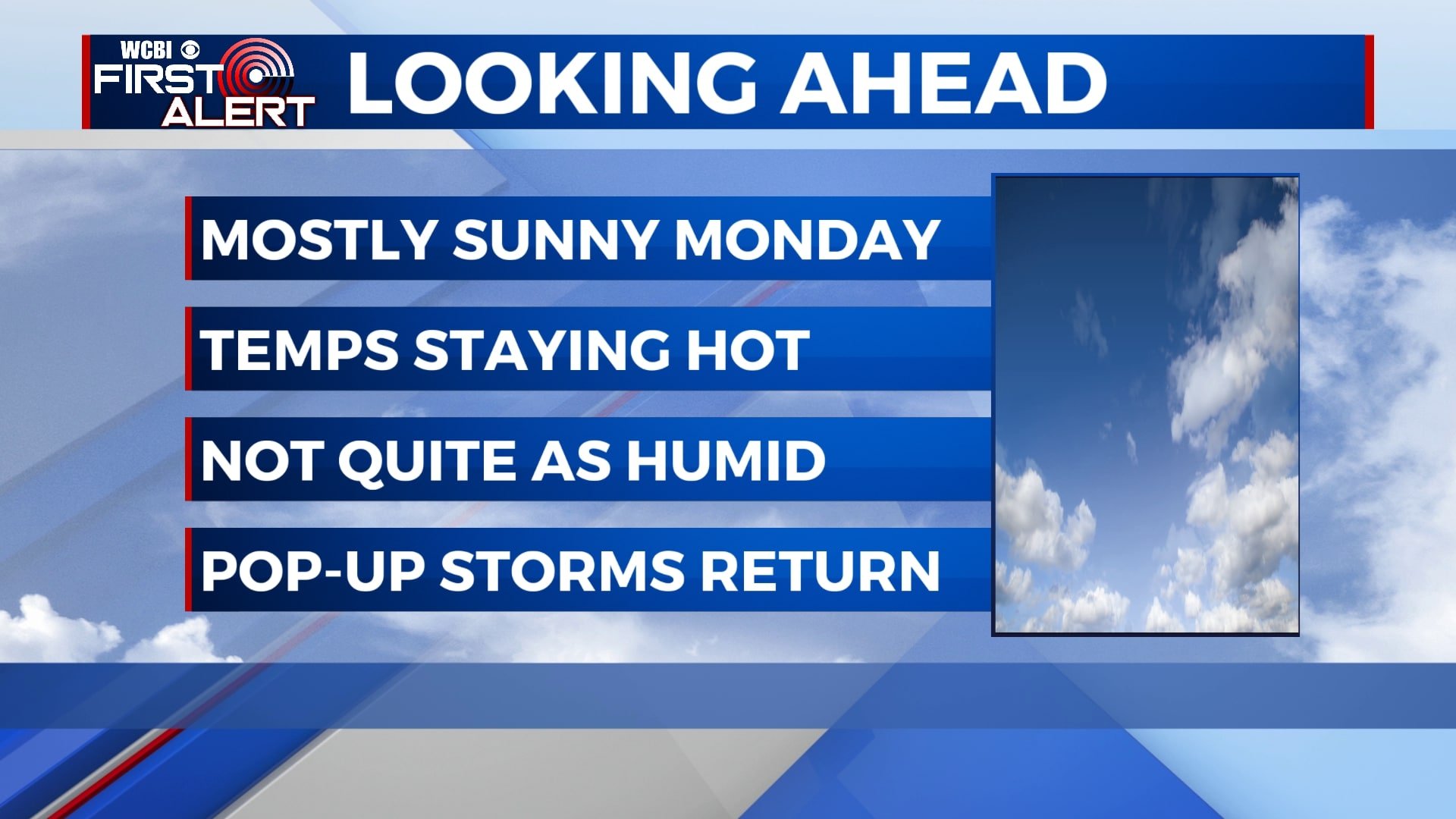
A brief break from humidity and rain chances
A cold front will clear the area tonight, leaving us much drier and a little more comfortable to start the week. Temperatures will still be hot, but the air will be noticeably less muggy. Rain chances return to the forecast by the middle of the week with pop-up storms possible each afternoon.
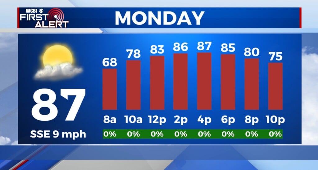
SUNDAY NIGHT: Clouds will exit the area, leaving us mostly clear by sunrise. Lows will be in the mid 60s with a light northerly wind.
MONDAY: Monday will be the best day of the week as skies remain mostly sunny and temperatures rise into the low 90s. It will still be hot, but lower humidity will make things feel just a bit more comfortable.
TUESDAY-WEDNESDAY: While we’re not expecting any major rain on Tuesday or Wednesday, we will include a 20% chance of a very isolated shower or storm in the afternoon hours. Most of us will stay dry with a mix of sun and clouds. Afternoon highs will be in the low 90s.
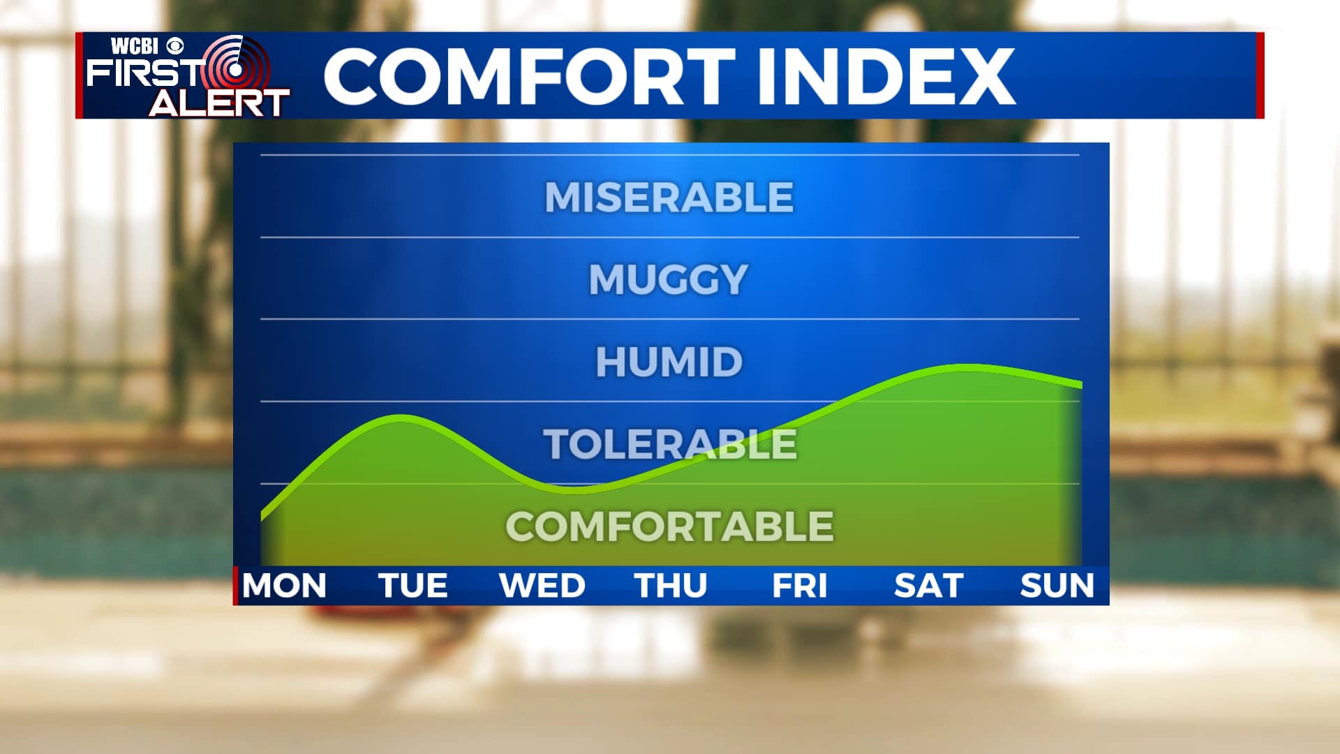
THURSDAY-SUNDAY: Daily chances for pop-up showers and storms make a comeback for the second half of the week and the weekend. Rain chances will still be relatively low at 30%, but anyone could see a brief downpour once we get past Thursday. Highs will be in the low 90s as humidity slowly ticks back up. Morning lows will remain in the upper 60s.


Leave a Reply