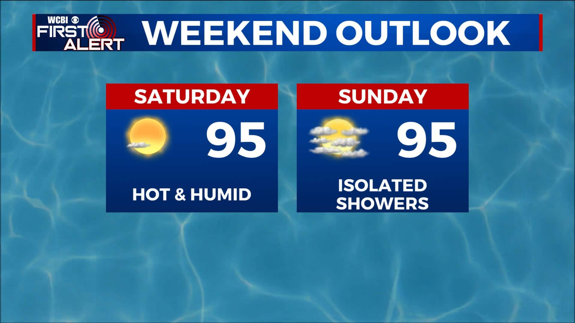
The summer heat and humidity returns this weekend
SUMMARY: We’re going to end the workweek on a warm and sunny note and carry it over into the weekend. The summer heat and humidity ramps back up starting Saturday and that will lead to the return of afternoon showers and storms into next week.
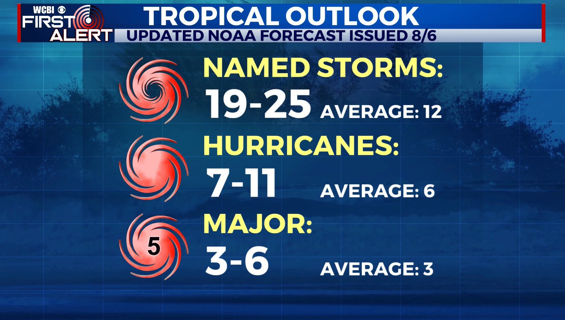
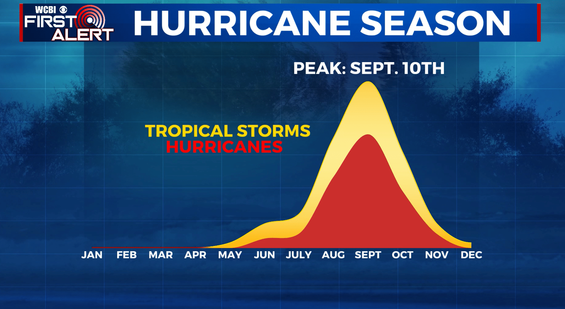
TROPICS: Thankfully the tropics are quiet again after Isaias, but NOAA updated their 2020 Atlantic Hurricane Season Outlook and now calls for: 19-25 named storms, of which 7-11 could become hurricanes, including 3-6 major hurricanes. The peak of Hurricane Season is September 10 so we’re starting to get into the more active part of the season or Cape Verde season.
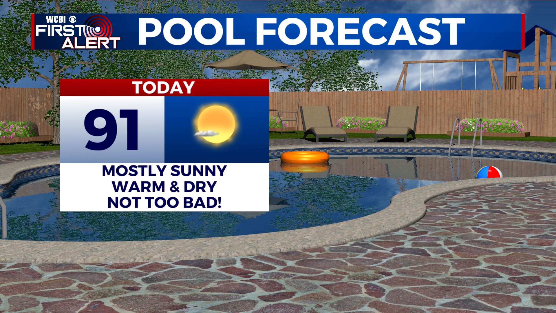
FRIDAY: Mostly sunny, warm, and dry. Highs in the lower to mid 90s. Light northerly winds.
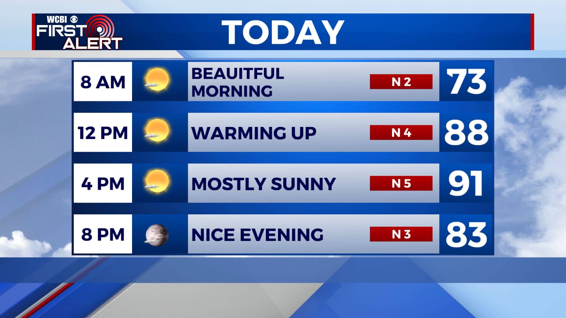
FRIDAY NIGHT: Mostly clear skies and quiet. Overnight lows in the upper 60s.
SATURDAY: Mostly sunny and getting hot. Highs in the mid 90s. Humidity starts to rise back up to the muggy levels and that will lead to heat indices in the upper 90s to near 100 at times.
SATURDAY NIGHT: Mostly clear skies and mild with overnight lows near 70.
SUNDAY: Staying hot and humid with a mix of sun and clouds. High temperatures in the mid 90s with heat indices in the 100s. Just a slight chance for a few afternoon and early evening showers and storms.
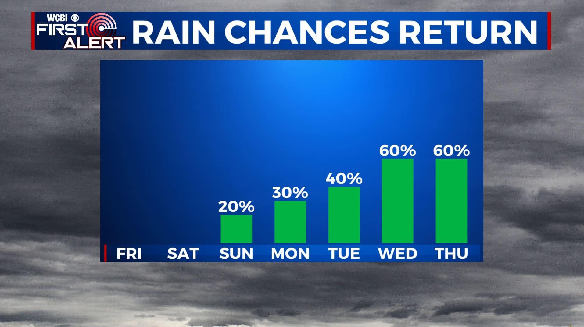
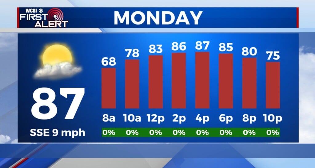
NEXT WEEK: Our typical summer weather returns to the Deep South. Expect those daily afternoon pop-up storm chances. Staying hot and humid with highs in the 90s and muggy overnight lows in the 70s.
Stay connected with @WCBIWEATHER on Facebook, Twitter, Instagram, and the WCBI News App


Leave a Reply