Scattered afternoon summer storm chances returns
SUMMARY: The ongoing July summer heat and humidity will be producing more daily chances for scattered showers and storms. These will be mainly during the peak heating of the day in the afternoon. High temperatures look to remain in the 90s with heat indices around 100-105°.
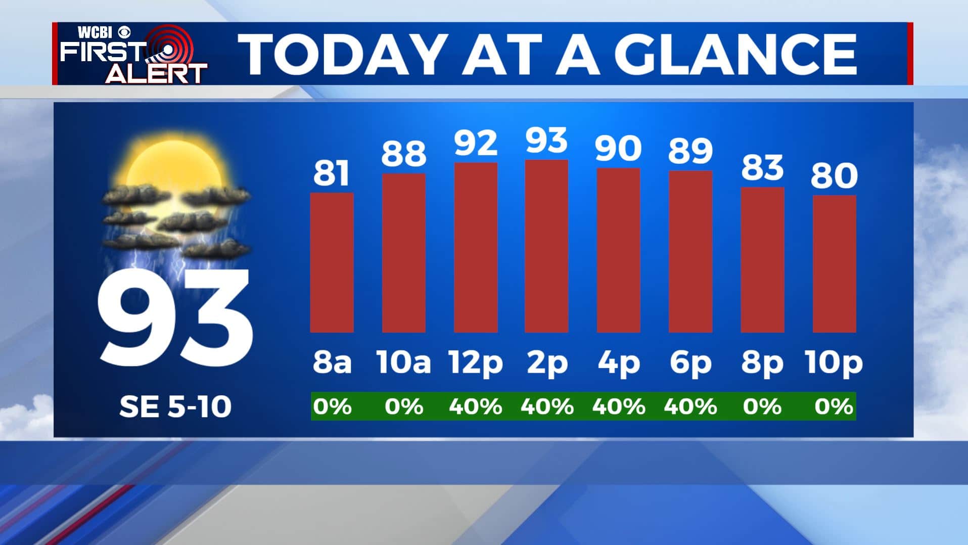
TUESDAY: We’re once again hitting the repeat button for your Tuesday. Highs will be in the mid 90s with heat index values close to 100-105 in the afternoon. You can expect a mix of sunshine and clouds through the day with the chance some summertime pop-up showers and storms. SE winds 5-10 mph.
TUESDAY NIGHT: Partly cloudy skies. Staying warm & muggy with overnight lows in the mid 70s.
WEDNESDAY-FRIDAY: Hot and humid weather will continue for the remainder of the week with temperatures climbing into the mid 90s each afternoon. Chances for afternoon pop-up storms will be there, but still not everyone will see rain each day. If you’re lucky enough to see a quick downpour, it will help to cool you down a few degrees.
WEEKEND-MONDAY: As of now, the weekend into early next week is looking dry for the most part aside from a few afternoon pop-up scattered showers or storms. High temperatures will remain hot with highs in the mid 90s and overnight lows in the mid 70s.
Stay connected with @WCBIWEATHER on Facebook, Twitter, Instagram, and the WCBI News App


Leave a Reply