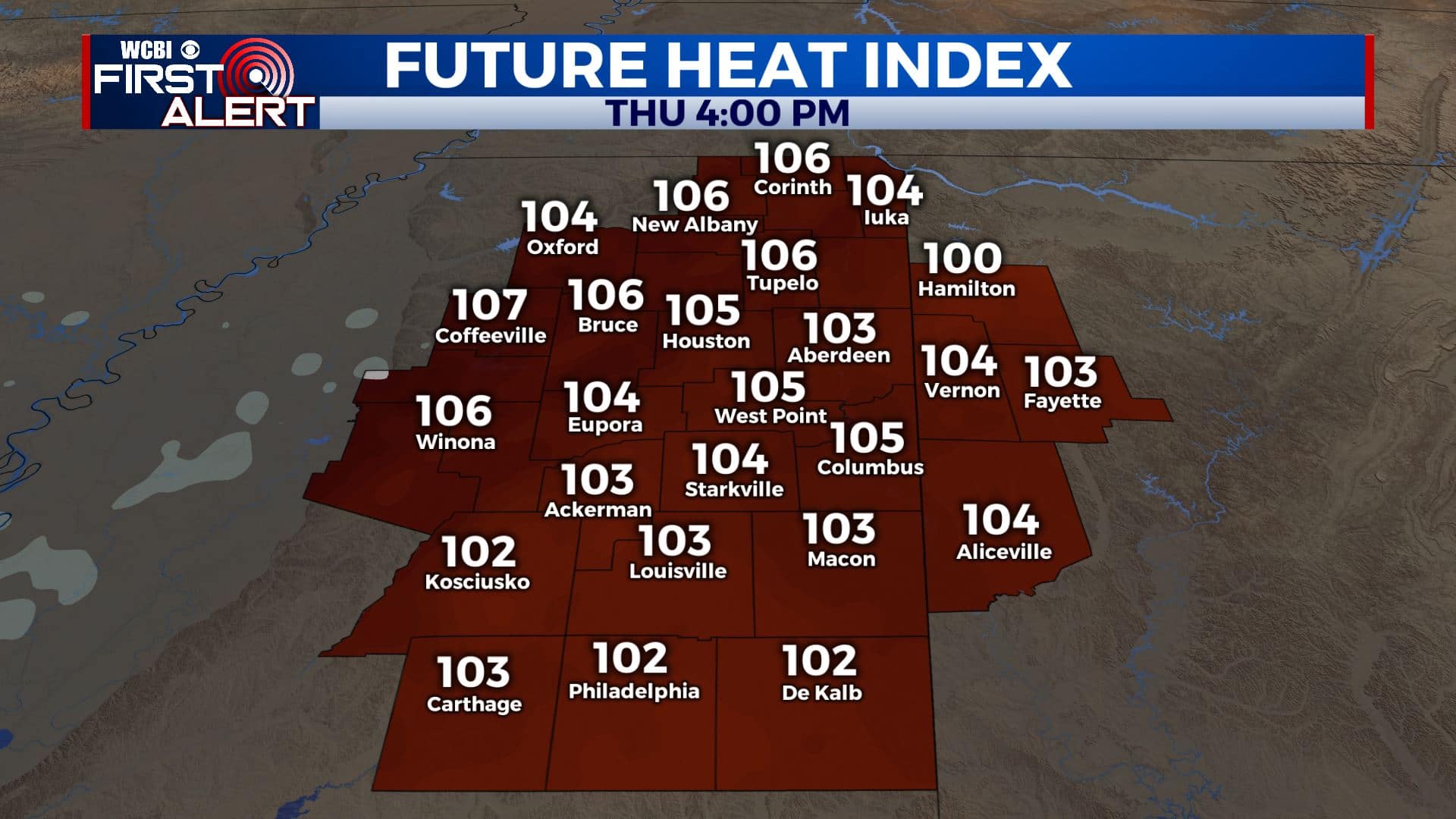
Heat Advisory in effect once again for Thursday
SUMMARY: A Heat Advisory is in effect from 11 a.m. to 7 p.m. Thursday as another hot & humid day is on tap for us. Heat index values could get up to 110 degrees or more. You’ll need to take the proper precautions to stay cool & hydrated. Highs each day into next week will be in the mid 90s with heat indices as high as 110. Spotty scattered storms will remain possible each day so hope for a short lived cool down if one can manage to find your location.
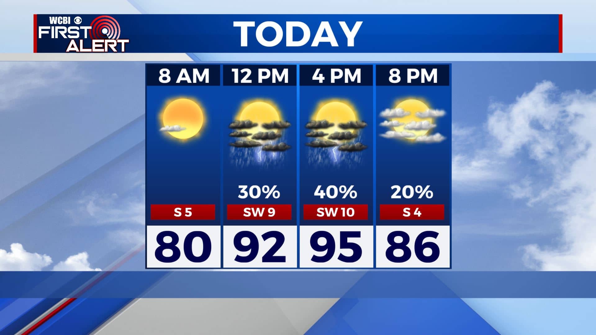
THURSDAY: We’re basically hitting the repeat button for our Thursday. Highs will once again climb into the mid 90s. Heat indices between 105-110. We’ll also have the chance of pop-up scattered storms late morning through early evening with a mix of sun & clouds. SSW winds 5-10 mph.
THURSDAY NIGHT: A few clouds overnight. Staying warm and muggy with lows in the mid 70s.
FRIDAY: Once again a partly sunny, hot and humid day as we end the workweek. Highs remain in the mid 90s with heat indices between 100 and 110. A scattered chance of pop-up storms during the peak heating of the day.
WEEKEND: Staying partly sunny, hot and humid. Daily rain and storm chances but looking to be very isolated. Highs still in the mid 90s with heat indices between 100 and 110. Overnight lows in the mid 70s.
EARLY NEXT WEEK: More summer heat and more humid conditions. Rain and storm chances appears it will become higher by Tuesday and Wednesday. If that does happen daytime highs may only be in the lower 90s. Overnight lows stay in the 70s.
Stay connected with @WCBIWEATHER on Facebook, Twitter, Instagram, and the WCBI News App


Leave a Reply