Staying very hot & humid
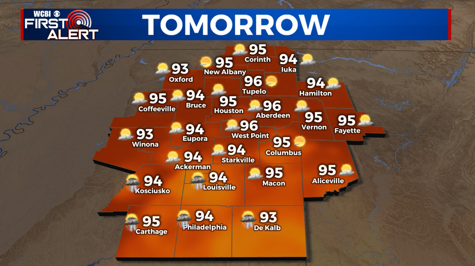
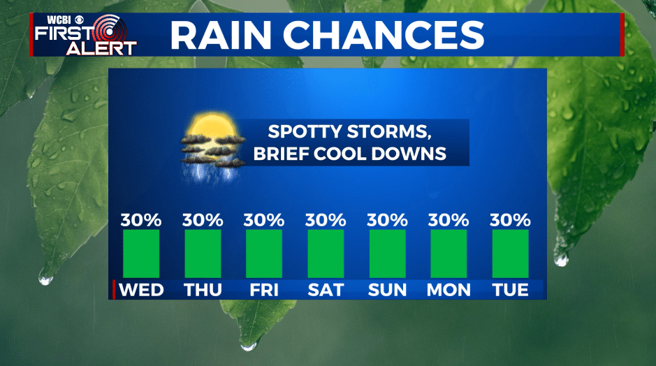
SUMMARY: Hot and humid July weather is now entrenched and it’s going nowhere for a while. Highs each day over the next week look to be in the mid 90s with heat indices between 100 and 110. Some spotty showers and storms are possible each day but not everyone will get in on the action. The Atlantic remains quiet so there are no tropical troubles for our region at this time.
TUESDAY NIGHT: Mainly clear and quiet. Lows in the low 70s with calm wind.
WEDNESDAY: Partly cloudy and hot. Highs in the mid 90s with heat indices 100-105 or higher. There is a 30% chance of a few pop-up showers and storms during the afternoon and early evening.
WEDNESDAY NIGHT: Turning partly cloudy. Muggy lows in the mid 70s. Light wind.
THURSDAY-MONDAY: Continued hot and humid. Highs generally in the mid 90s with overnight lows in the mid 70s. A daily 20-30% chance of pop up showers and storms primarily during the heating of the day. Heat indices may range from 100 to 110 during peak heating.
Follow @WCBIWEATHER on Facebook, Twitter, Instagram, and the WCBI News App


Leave a Reply