Setting up to be the hottest year of 2020 so far this week
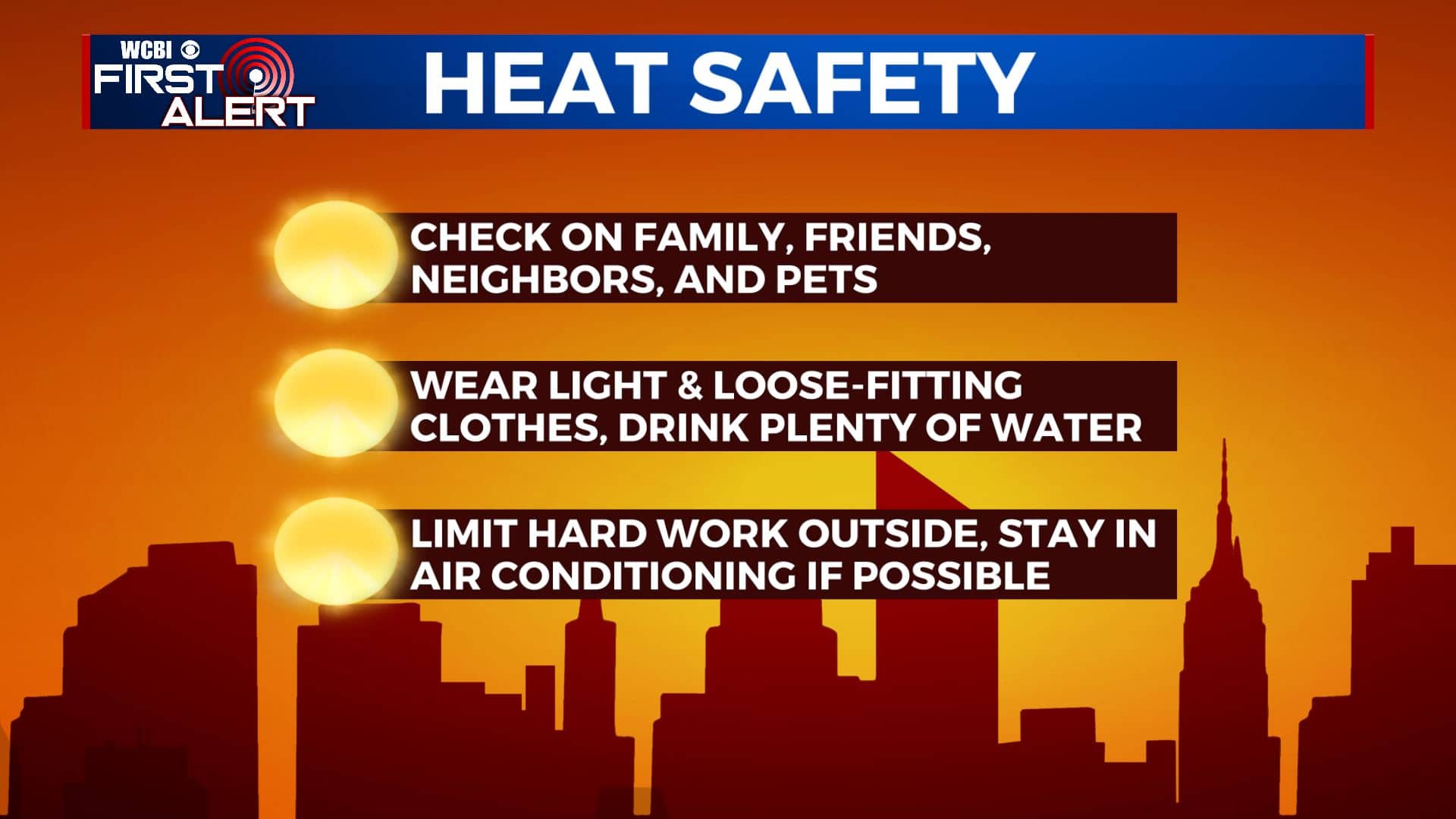
SUMMARY: The hot & humid summer weather will continue this week as high temperatures go up to the mid 90s. The heat index will make it feel like 100 to near 110 degrees out there as times. Stay cool & hydrated! While rain chances are minimal, scattered pop-up showers or storms can’t be ruled out mid to late week.
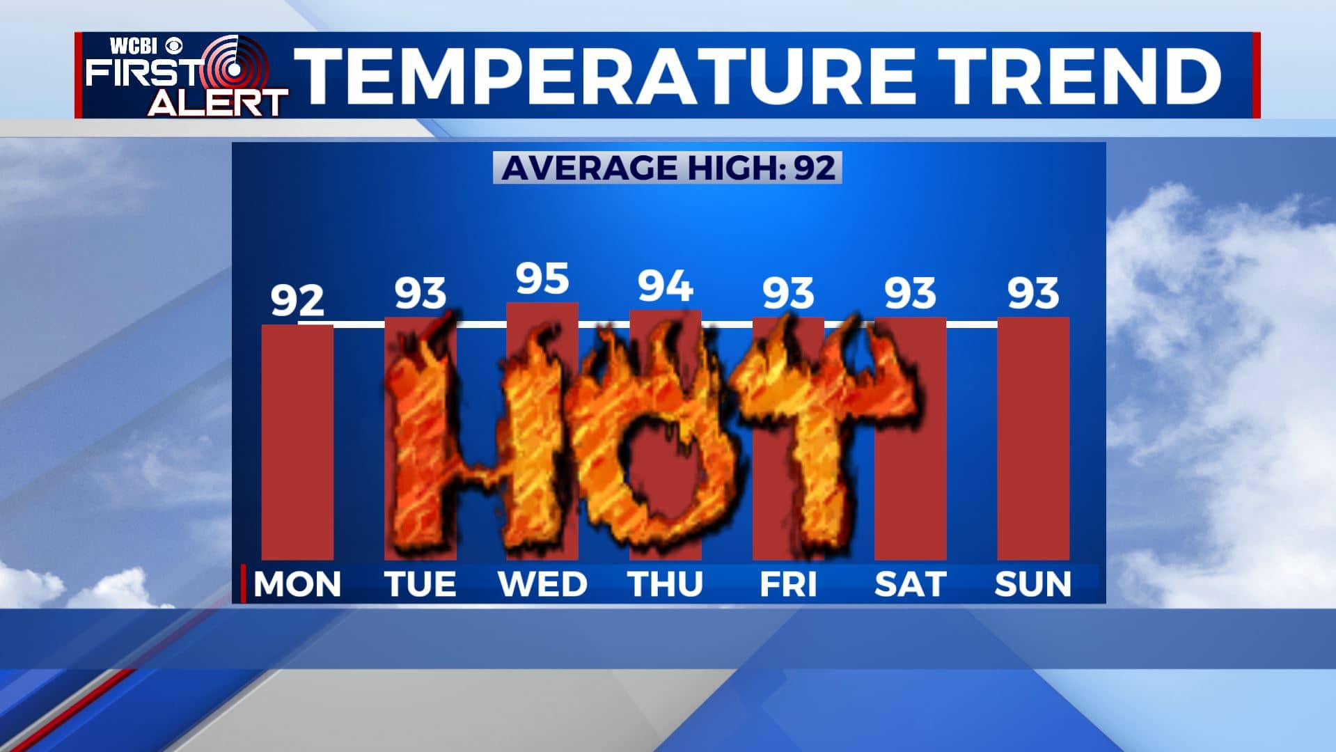
MONDAY-TUESDAY: The summer heat will build on Monday and Tuesday with highs in the lower 90s. Mostly sunny skies. Heat index values will approach 100 at times.
WEDNESDAY-THURSDAY: We’ll bump rain chances up to an isolated chance on Wednesday then bit scattered on Thursday. Not everyone will see a shower or storm. That will allow temperatures to rise to the mid 90s. With higher humidity levels, heat index values will approach 105-110. Morning lows will be in the low to mid 70s.
FRIDAY-SUNDAY: Rain & storms chances will be on the scattered end still the end of the week into the weekend, but a stray shower or storm is still possible. We’ll remain hot and humid with highs in the lower to mid 90s. With heat index values approaching 110 in the afternoon. You’ll need to take extra precautions if you plan to be outside for an extended period of time.
Stay connected with @WCBIWEATHER on Facebook, Twitter, Instagram, and the WCBI News App


Leave a Reply