A quiet start to the new week but active weather will return
SUMMARY: After a stormy & rainy Sunday, we’ll start off the new week on a sunny & quiet note. We’re watching systems that could impact the area Wednesday night into Thursday morning and again on Friday and Saturday. Stay tuned!
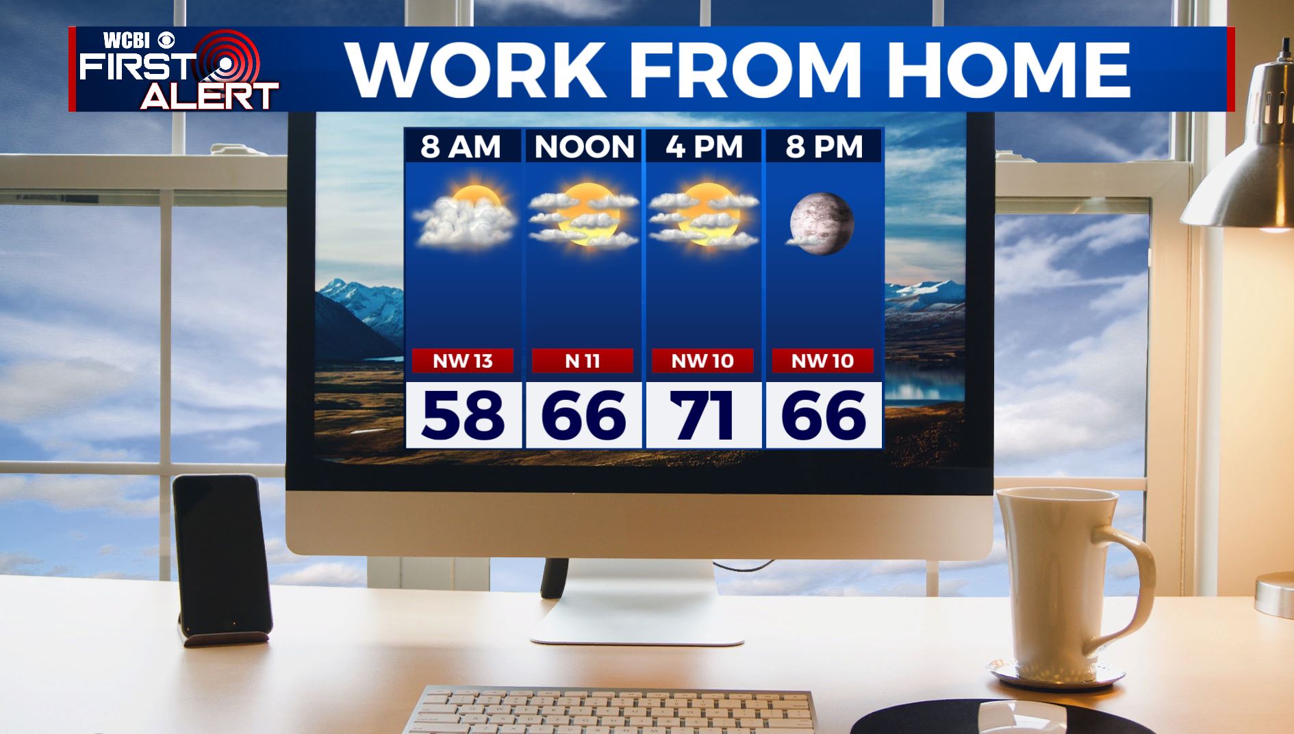
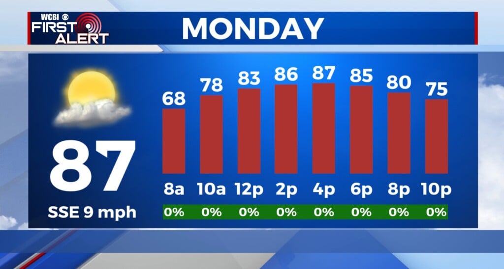
MONDAY: We are waking up to cloudy & drier conditions this Monday morning after a rainy & stormy Sunday. Clouds will break up by the afternoon, leaving us with some peeks of sunshine with highs in the lower 70s.
MONDAY NIGHT: Mostly clear skies with overnight lows in the 50s.
TUESDAY: Tuesday looks to be sunny and clear for the most part. Highs will be in the mid 70s with overnight lows in the 50s.
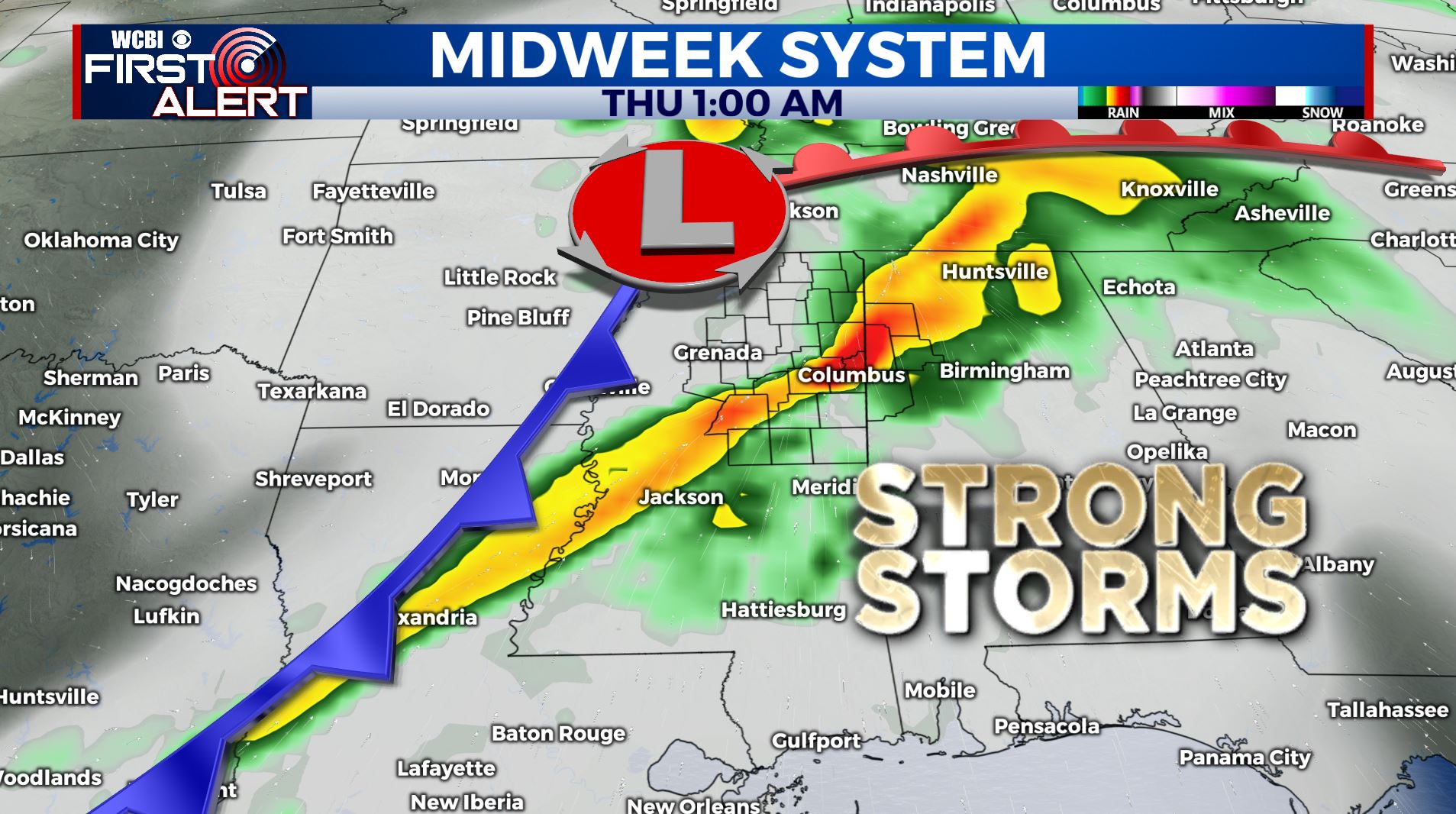
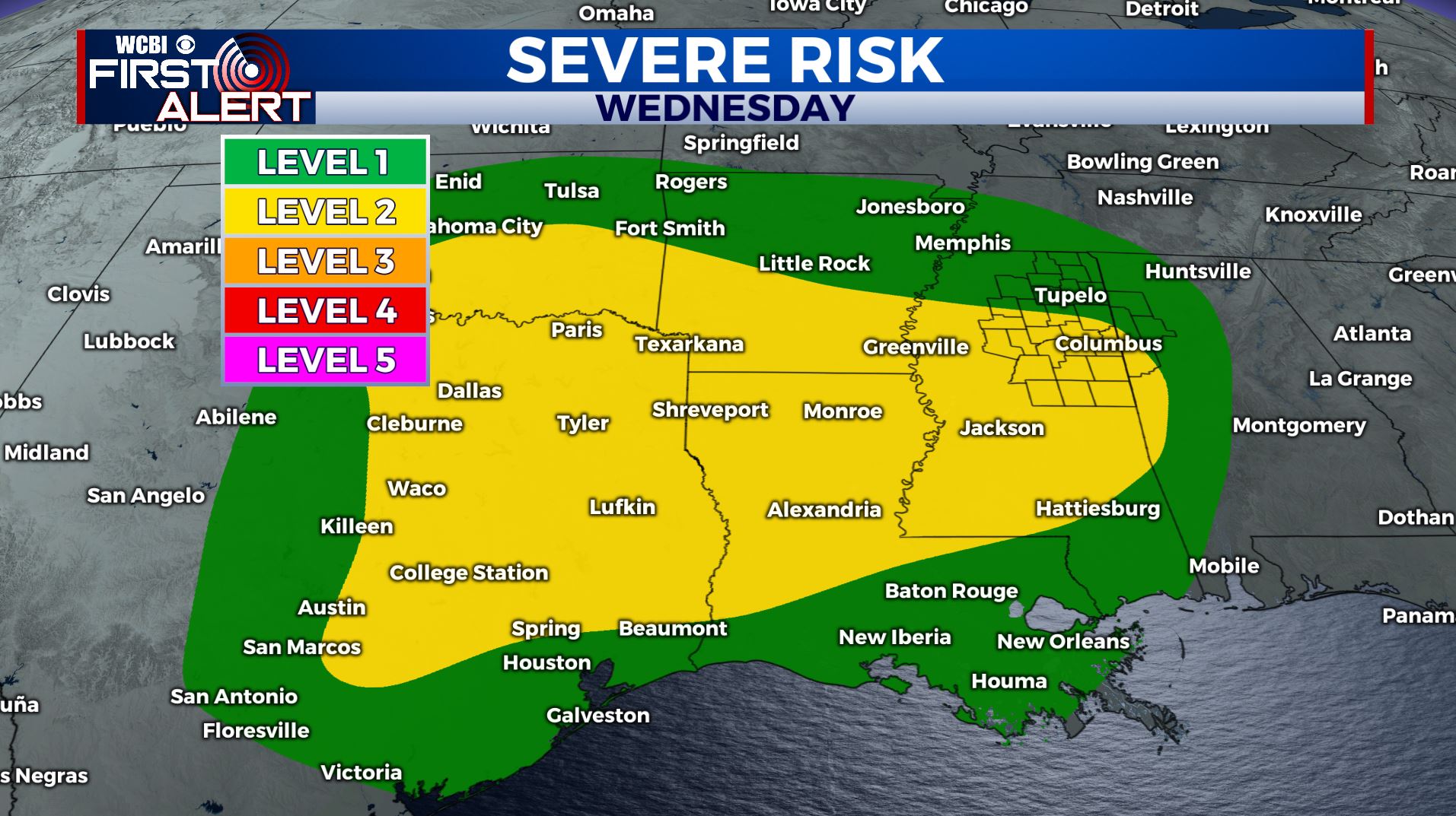
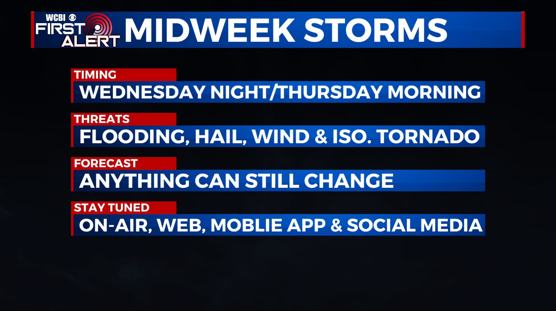
WEDNESDAY-THURSDAY: We’re going to continue to watch the return of an active weather pattern heading into midweek as another storm system will approach the Deep South. At this point, it looks like storms will develop late in the day on Wednesday and move across the area overnight into early Thursday morning. Temperatures will top out in the mid 70s in the afternoon. As of now, we’re under a Level 1-2 Risk for strong to severe storms with large hail, damaging winds and heavy rain. An isolated tornado can’t be ruled out. We’ll keep you updated!
FRIDAY: We’ll be dry with some peeks of sunshine to start of Friday, but rain and storms will build into the area by the evening. Highs in the mid to upper 70s.
SATURDAY-SUNDAY: Some rain and storms could linger into the day on Saturday, but will exit the area by Saturday evening. It looks like most of Sunday will be dry, but we’ll have to continue to monitor to fine-tune timing details. Highs cooler in the upper 60s to lower 70s.
Stay connected with @WCBIWEATHER on Facebook, Twitter, Instagram, and the WCBI News App


Leave a Reply