Warmer temperatures and more rain chances this week
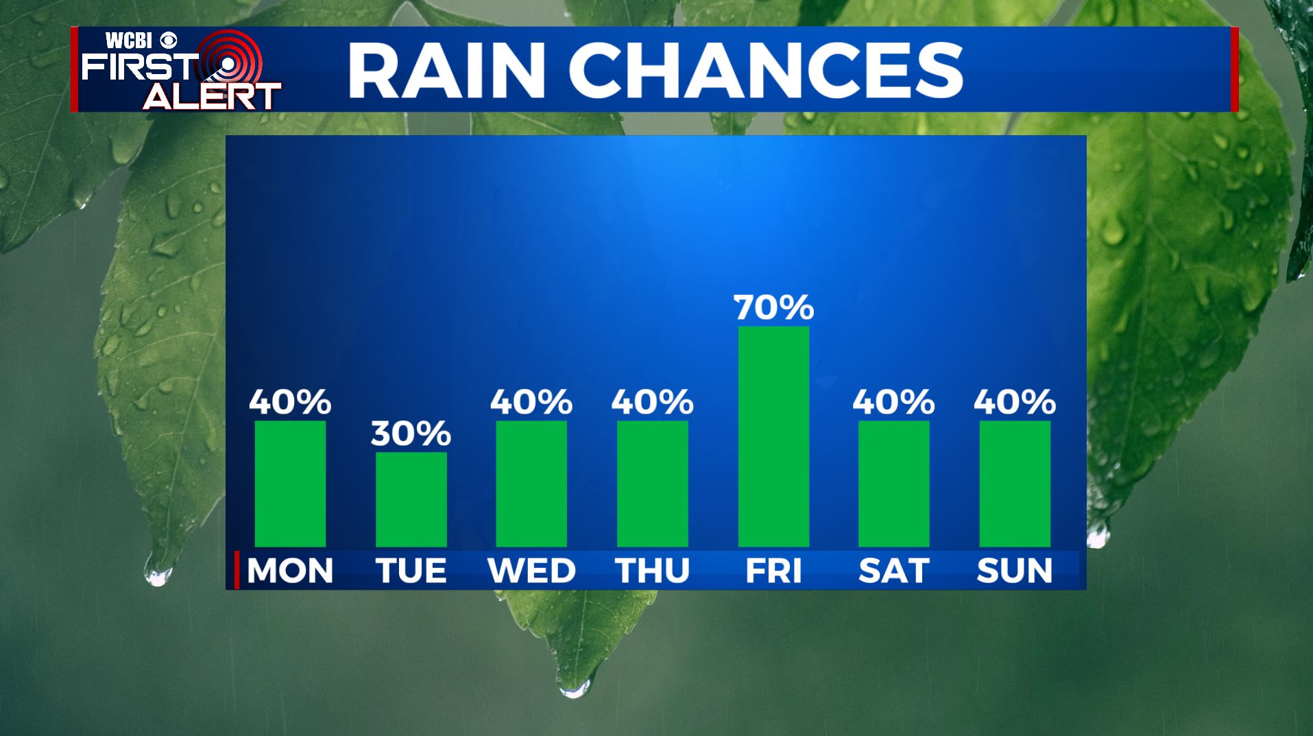
SUMMARY: Our unsettled weather pattern will continue for the next week with chances for showers and storms each day. As of right now, the best chances for widespread rain and storm activity look to be late Thursday into Friday. Temperatures will remain above average with highs in the lower 80s by Thursday. Rainfall amounts could be as high as 3″ in spots.
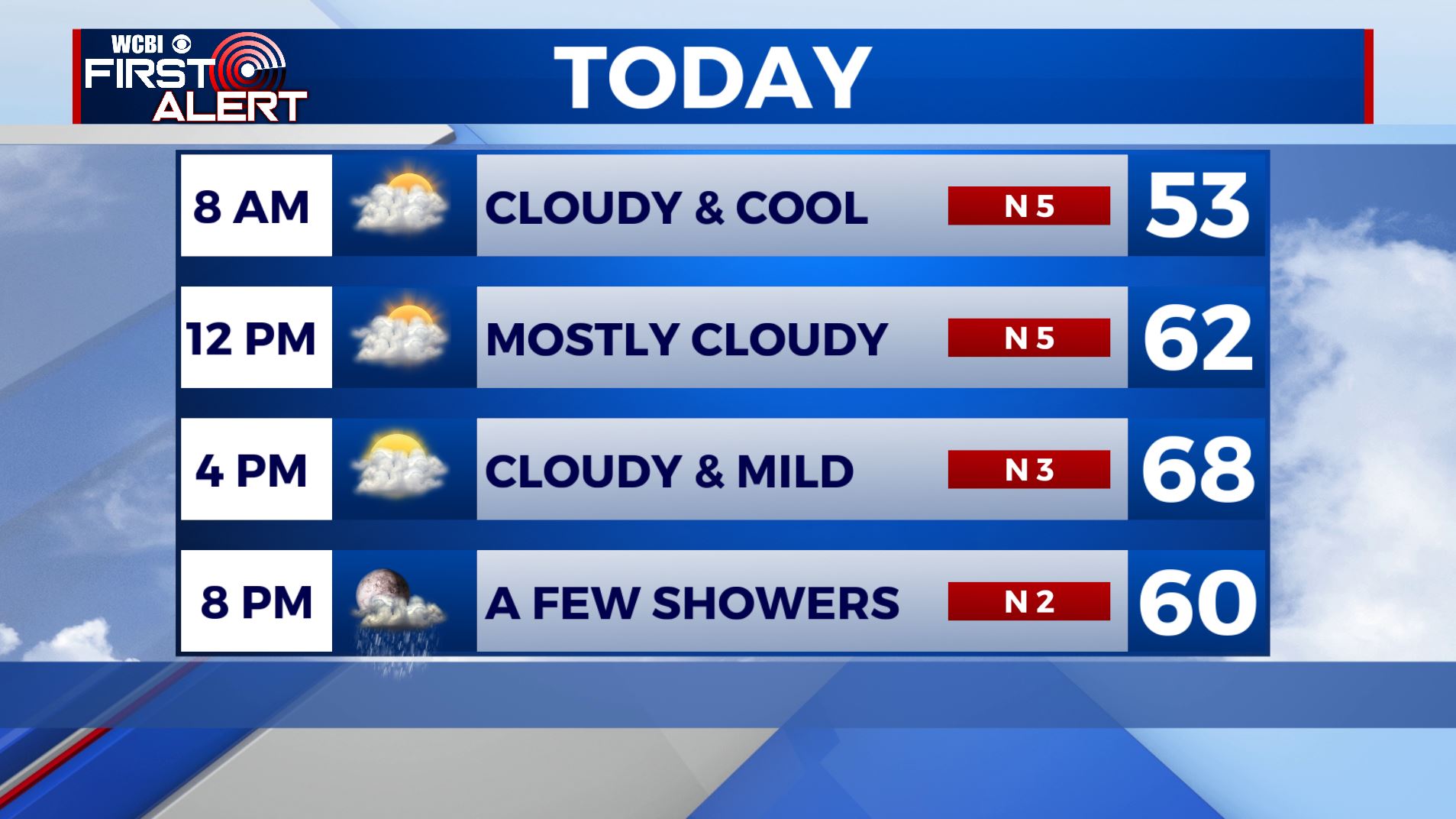
MONDAY: We are waking up to cloudy but mostly dry conditions in the 40s to lower 50s. We’ll see mostly cloudy skies through the afternoon. Temperatures in the upper 60s for highs.
MONDAY NIGHT: Scattered light rain showers move in during the evening into the overnight hours. Overnight lows in the mid 50s.
TUESDAY-WEDNESDAY: We’re expecting several rounds of showers and storms through the week with temperatures climbing into the middle to upper 70s. Each day won’t be a total washout, but still keep the umbrella handy.
THURSDAY-FRIDAY: There will be better chances for showers and some rumbles of thunder late week. Highs very warm in the middle 70s to lower 80s.
THE WEEKEND: Yet another batch of scattered showers and storms will continue through the weekend. Highs will be cooler with temperatures in the upper 50s to lower 60s both Saturday and Sunday. Morning lows will be in the 40s on Saturday and Sunday mornings.
Stay connected with @WCBIWEATHER on Facebook, Twitter, Instagram, and the WCBI News App


Leave a Reply